Good Forest Service gravel roads permeate the Black Hills. A typical passenger car can handle the Primary roads and many good Secondary Roads. A bit more vehicle clearance and driver judgment opens up most of the remaining Secondary Roads, absent weather issues. All these roads are well mapped and are great fun for a day ride on a gravel bike. See, The Good, The Bad & The Ugly.
The Black Hills also feature a practically unlimited assortment of Low Standard Roads, numbered motorized use trails, unnumbered often abandoned two-track, unnamed trails, and other backcountry pathways. The design, construction, and maintenance of these "roads" are all over the map. There's no way to know what's really there without getting out there.
The BackBone Grande seeks out those little known and less traveled roads to create a unique experience for bikepackers, while still following some Primary and Secondary Roads for re-supply and to access landmarks such as Wind Cave National Park, Custer State Park, Crazy Horse Memorial, Mt. Rushmore, Mickelson Trail, Spearfish Canyon, and Roughlock Falls. Perhaps nothing shows this better than the journey between the village of Rochford and the college/mountain bike town of Spearfish.
 |
| Abandoned Old Baldy Road swings through a lost canyon. (image by Paul Brasby) |
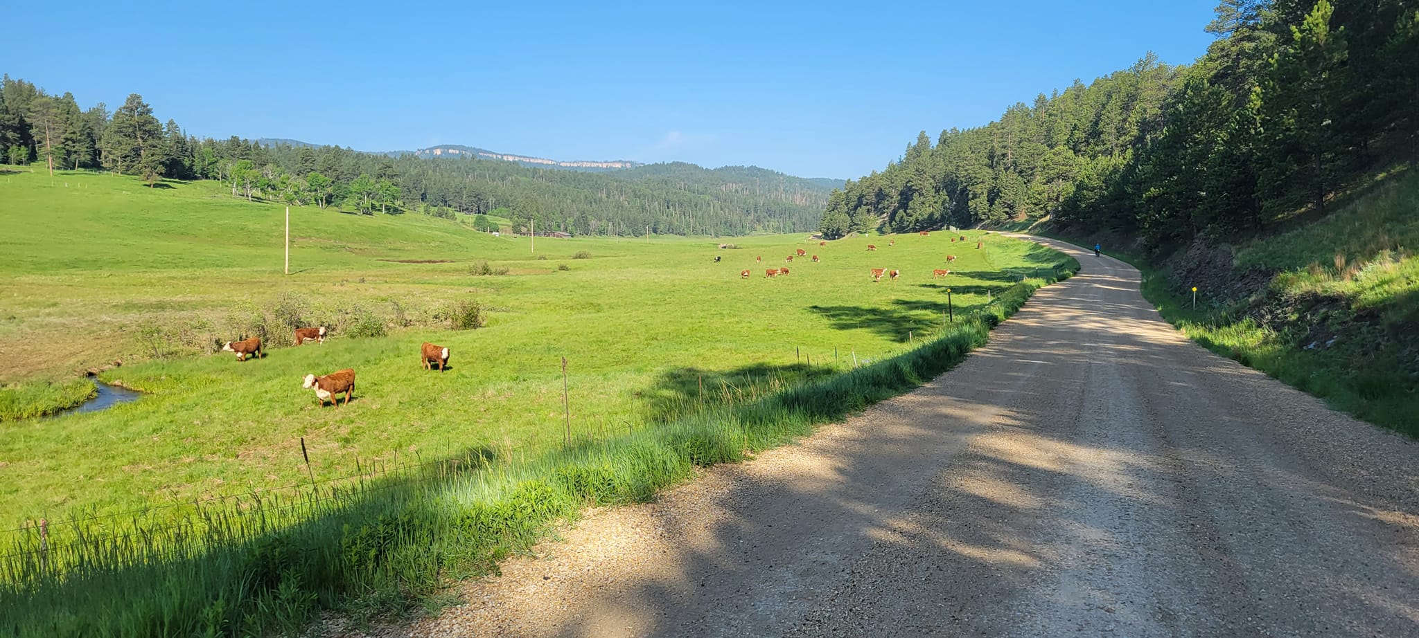
We start our Day 5 of the BackBone Grande from a campsite near Rochford, where mornings always seem cold. A gentle 8 mile climb up bucolic South Rapid Creek Road (USFS Primary 231) leads to picturesque USFS Black Fox Campground, a popular site for a variety of outdoor enthusiasts. Then we roll up Black Fox Camp Road (USFS Secondary 233), another all-time favorite of mine. See, Five Favorite Black Hills Gravel Roads. With cool temperatures, no wind and clear skies, we smooth roll these early morning miles and soak in the quiet Black Hills vibe.
After that nice warmup, we eagerly turn onto Low Standard Road 189 to start in earnest our venture onto less developed roads. Road 189 starts little different from Black Fox Camp Road, but earns its lower designation as it climbs. Yearning for more, we continue onto Low Standard Road 631.2 for about 4 miles of even more ruts and rocks, with more up than down. It's all rideable, but can be messy. We skirt some mud and water filled pot holes, although nothing like the quagmire when I rode it a few weeks ago.
 |
| South Rapid Creek Road (USFS Primary 231) out of Rochford. (image by Paul Brasby) |
 |
| Spinning up skinny Black Fox Camp Road (USFS Secondary Road 233). |
Road 631.2 abruptly ends at South Rapid Creek Road (USFS Primary Road 231). So, we turn onto that good gravel road for a couple of fast miles to connect with Long Draw Road (USFS Secondary Road 209). Rolling for about 8 miles over a series of long downs and a few ups, we regain a little rhythm here on the solid surface and moderate grades.
Then we ride onto Hanna Road (USFS Primary Road 196) to very nice USFS Hanna Campground, which sure looks to be a promising destination for a touring cyclist. We stop to check out the walk-in tent area, water, toilets, and picnic tables along rushing Spearfish Creek. It looks great, but we're not nearly ready to stop for the day.
From the campground, Hanna Road drops a couple of more miles to Cheyenne Crossing for food, re-supply, and cabins, if desired. As some clouds gather, we take a late lunch break at the busy cafe.
 |
| Paul about to grunt up a pitch on USFS Low Standard Road 631.2. |
 |
| More Low Standard Road goodness on 631.2. |
From Cheyenne Crossing, the BackBone Grande drops down paved U.S. Highway 14A, aka Spearfish Canyon Scenic Byway, renown for the striking canyon walls towering over raging Spearfish Creek. Although the road is paved without much shoulder, we comfortably drop down the 5 quick miles to Savoy, another town abandoned but for a cafe and a resort. Traffic picks up here, so stay alert.
At Savoy, we turn onto Roughlock Falls Road (USFS Secondary 222) to start climbing again. But it's only a couple of gentle miles to Roughlock Falls and this canyon is stunning, as well. Roughlock Falls is a very popular destination for tourists and locals, with trails, boardwalks, interpretive signs, picnic tables, bathrooms, and ample parking space. We stop, too.
Up the canyon a few more miles lies USFS Rod & Gun Campground and, a couple of miles further, USFS Timon Campground. Although both were full, the friendly campground host allows us to carve out some unused space at Timon to pitch our tents. We decide to stay there despite our relatively short day and the abundance of disperse camping opportunities ahead. After all, we're touring the BackBone Grande, essentially as a final recon ride. We have maps to study, pictures to take, things to consider. No rush.
 |
| Coasting down Spearfish Canyon Scenic Byway (U.S. Highway 14A). (image by Paul Brasby) |
 |
| Bright sun battles dark clouds on Roughlock Falls Road (USFS Secondary Road 222). (image by Paul Brasby) |
Day 6 breaks open bright and early, with hardly a cloud in sight. We gratefully stow our rain jackets and spin up the remaining few miles on Roughlock Falls Road. The gradient minds its manners, the notoriously rough surface doesn't materialize, and the canyon walls continue to reveal their splendor. What a way to start the day.
Spinning up Tinton Road (USFS Primary Road 134) for about half a mile, we eagerly turn onto School House Gulch Road (USFS Secondary 222). This solid gravel road circles west, turns north through a large area of private land surrounding the ghost town of Tinton, and then runs east back to Tinton Road. However, we don't take that entire loop.
 |
| Roughlock Falls Road (USFS Secondary 222). (image by Paul Brasby) |
After just a couple of miles on School House Gulch Road, we reach a barely marked right hand turn onto Pettigrew Gulch Road, an unnumbered public road. Over the next mile or so, it passes a few homes and, just before it ends at a private residence, the route turns 90 degrees left (west) to drop to a gate. Through that gate awaits 2 miles of discovery deep in Black Hills National Forest.
This abandoned two-track, sometimes single track, and occasionally hard-to-follow track is closed to motorized vehicles and appears to be an old road that eventually simply turns into Old Baldy Road (USFS Low Standard Road 633.1). Here, however, it's a rolling, overgrown path through meadows and trees, with creek and gate crossings to negotiate. The surprising bonus is a small, but striking canyon with sheer rock walls looming over a rushing creek. Truly a hidden gem.
 |
| Abandoned road eventually turns into Old Baldy Road (USFS Low Standard 633.1) (image by Paul Brasby) |
 |
| I'm not lost, but I'm not sure about that guy behind me. (image by Paul Brasby) |
 |
| An old wooden bridge complements the barely recognizable trail. (image by Paul Brasby) |
 |
| The old road bed is visible as Paul enters a small canyon. |
After just a couple of miles, that short, sweet abandoned "road" turns into Old Baldy Road for a bumpy ride that ends at School House Gulch Road, several miles to the north from where we left it. We do little but cross that Secondary Road and hop right back on another unnumbered, abandoned two-track. This one starts by quietly following Beaver Creek along a grass covered hillside.
These little two-tracks are great fun and the miles pass far too quickly, even when moving slowly along the rough, untended surface. We ride out of trees and into meadows, and vice versa, relishing the tranquility. After just a mile or so, however, the two-track announces the end of this polite, mellow jaunt by swerving 90 degrees to plow straight up the hillside to a ridge line. That's a bit of a jolt, but we grind up that mile long pitch and celebrate in some shade at the top.
 |
| Unnamed, unnumbered two-track following Beaver Creek. (image by Paul Brasby) |
 |
| Climbing out of the Beaver Creek valley. (image by Paul Brasby) |
 |
| Paul leaves Beaver Creek behind to seek the next ridge line. |
We land on unnamed USFS Low Standard Road 130, a curiously well built and maintained Low Standard Road that follows a ridge line for several miles and then simply dead-ends. A number of less developed roads and tracks spin off Road 130, so perhaps it was built long ago for some logging activity. In any event, we enjoy a mostly downhill 4 mile spin on this solid road that rides much more like a Secondary Road. With all the aspen trees, this stretch is sure to be pure gold in the fall.
Of course, when we leave Road 130, it's onto a yet another unnamed, unnumbered two-track. This is a bit more rocky and rutted, but again it's mostly downhill to Higgins Gulch Road (USFS Secondary Road 214).
 |
| Rolling through aspen groves down a ridge line on USFS Low Standard Road 130. (image by Paul Brasby) |
 |
| Dropping down a final two-track to Higgins Gulch Road. (image by Paul Brasby) |
Miles flow smoothly and quickly down Higgins Gulch Road. Far too soon, we bottom out on the west side of Spearfish. We ride by two bike shops, breweries, restaurants, fast food places, C-stores, grocery stores, and more. After a re-supply and lunch stop, we even ride right through downtown, past Spearfish City Park, and right into the Spearfish City Campground.
It's yet another short day when we decide to stay in the very nice city campground. We pitch our tents right next to Spearfish Creek and actually order pizza that is delivered to the campground. How's that for living large in the big city?
The Black Hills now are behind us, along with all those amazing Low Standard and lower roads. Tomorrow we launch into the Northern Prairie for the final 150 miles or so to the North Dakota border. Maybe we'll find more friends in low places.
I think you have the perfect terrain and roads there in the Black Hills for bikepacking adventures. Looks amazing!! Thanks for posting.
ReplyDeleteTony from MN