Search This Blog

Tuesday, January 25, 2022

The Great Divide - Camp Host Extraordinaire

Oh, ho, ho, it's magic, you know
Never believe it's not so
It's magic, you know
Never believe it's not so

Magic, David Paton & William Lyall (1974)

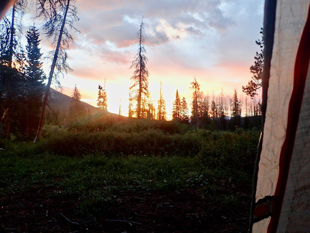
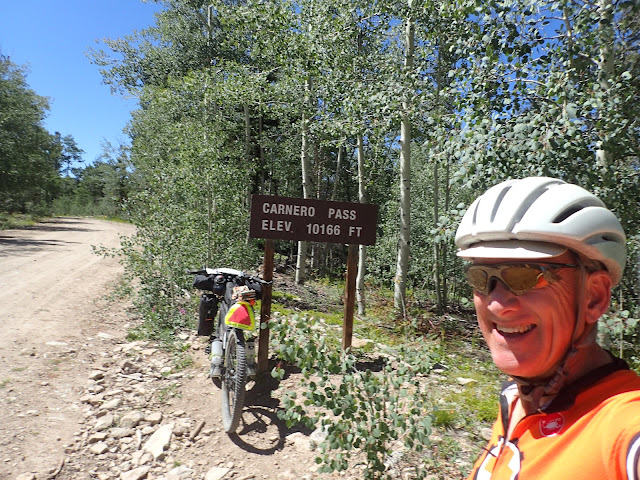
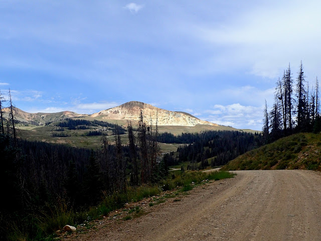
USFS Hopewell Lake campground in Carson National Forest, New Mexico.
I wish I had a picture of Dawn, the awesome Camp Host, to post here.


Trail Magic is real. And appears in the most unexpected places.
 
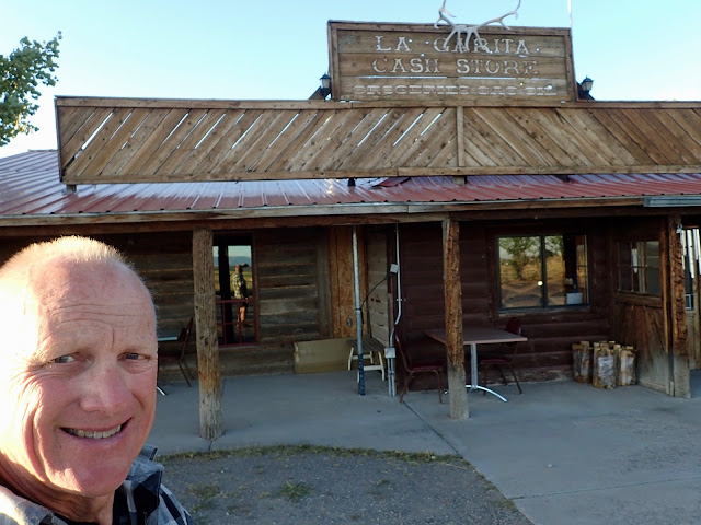
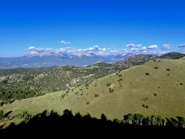
In the four days since leaving the La Garita Cash Store, I've crossed over the Continental Divide several times and climbed four high mountain passes, namely Indiana Pass (11,910'), Elwood Pass (11,631'), Stunner Pass (10,541'), and La Manga Pass (10,234'). Like much of the Great Divide Mountain Bike Route, this stretch of southern Colorado and northern New Mexico is pretty much all up or down.

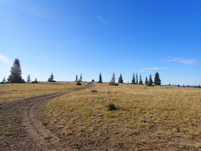
As I work my way south, the country becomes less and less developed, with fewer ranches and smaller towns, if any. The roads generally grow rougher, both less used and less maintained. I encounter fewer locals and practically no tourists. The last North Bound Great Divide cyclist or CDT through hiker I saw was hundreds of miles ago in Wyoming. This ride continues to get more and more out there.

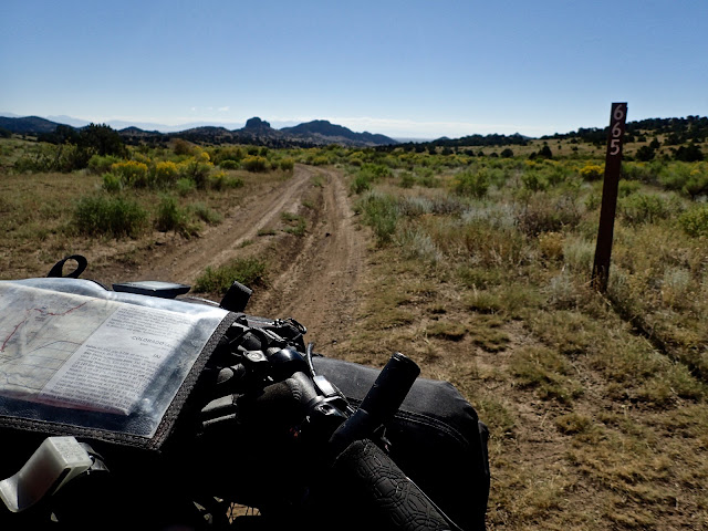
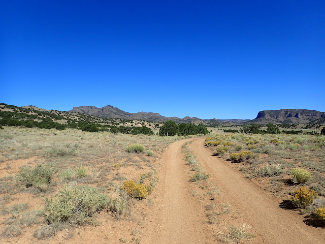
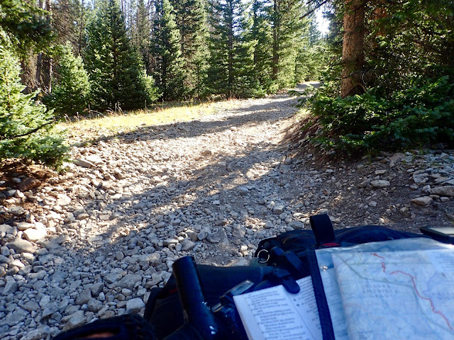
Southwest of La Garita, USFS Low Standard Road 665 delivers miles of amazing two track.

There's not so much as a fence post along this unnumbered road.

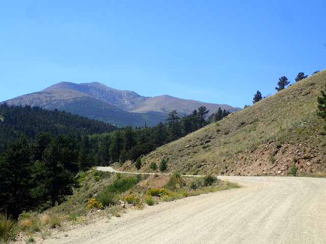
Not surprisingly, the ride up Indiana Pass from Del Norte is a grind, but the road surface is hard packed and fast. Although advertised as the pass with the most elevation gain and the highest elevation, I did not find it particularly difficult. Just long. After the sustained climb ends, the road runs along a lumpy ridge for another 10 miles, with almost as much climbing as descending. With no obvious summit and no marker of any kind, the top's exact location is not apparent. It's all a bit anti-climatic, although fabulous scenery and big views abound.

Dropping down the other side toward the seasonal town of Platoro, colorful mountainsides reveal concentrations of heavy metals exposed by natural forces and mining that wash into surrounding surface water. Even if filtered, the water here is too contaminated to drink. So, I pull into the Gold Pan General Store for water and whatever food they may have. Turns out, the Gold Pan offers a well stocked store, a good cafe, and a cabin for Great Divide cyclists only. I decide to support all of the above.

Leaving Platoro heading for Horca, I descend along the Conejos River on a bluebird sky morning. A pickup draws near from the rear, but slows on approach. The passenger asks, "Do you know a cyclist named Andi?" Yes. Then she asks, "Are you Craig?" Yes. She smiles and says, "Andi has your camera. I saw it on the road a few miles back and stopped to pick it up. I was thinking about what to do, when two cyclists rode up. I asked them if they knew whose camera this was. Andi said that it was yours and that she'd see you again and get it back to you." You must be kidding. Trail Magic. Out here.

Climbing Indiana Pass (11,910'), the highest elevation of the entire Great Divide route.

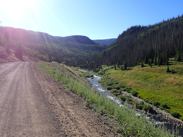
Trout fishing draws many to the Conejos River, evidenced by the washboarded road.

Approaching the New Mexico border after La Manga Pass, I find dozens of cars parked along the road, with people scattered all over the mountainside. Some sitting, some standing, most looking down a valley, many peering through binoculars. I'm thinking there must be an unusual wild animal happening, like a large elk herd moving or a couple of big horn sheep battling. So, I stop to look. Seeing nothing unusual, I ask.

It's nothing I expected. These people are train aficionados, breathlessly awaiting the arrival of a wood burning steam locomotive brought in for the 50th anniversary celebration of the historic Cumbres and Toltec Scenic Railroad. They're like kids waiting for Santa at a Thanksgiving Day parade. And, right here on the Great Divide route, that railroad track crosses barely graveled USFS Secondary Road 117. 

I enjoy talking with several of these folks, all with a passion for these trains, especially in this Wild, Wild West setting. It's a whole different world for this cyclist. Then one train guy spots my loaded bike and excitedly tells me of his friend who rode the Great Divide a few years ago. He says he knows what lies ahead and insists on filling all my water bottles. Cool.

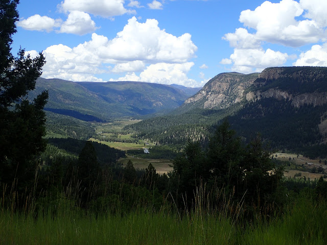
Looking back into the San Juan Wilderness Area on the climb up La Manga Pass.

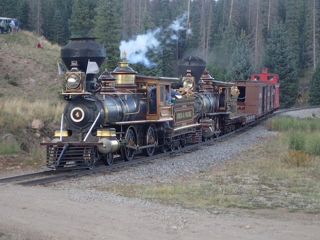
Wood burning steam locomotive on the Cumbres and Toltec Scenic Railroad.

Just a few miles into New Mexico, USFS Low Standard Road 87 launches up an elevator shaft littered with large, irregular shaped rocks, randomly dumped onto a shifty, dusty base. The ACA cue sheet says, "Start steep rocky uphill, may need to walk." Right. My journal says, "Impossible to ride, very difficult to walk." That pitch is a beast. I'd pay to watch someone ride it, even with fresh legs on an unloaded, full suspension fat bike.

Welcome to New Mexico, where the roads are consistently rougher, rockier, ruttier, steeper, and even more remote. It's the Great Divide, next level.

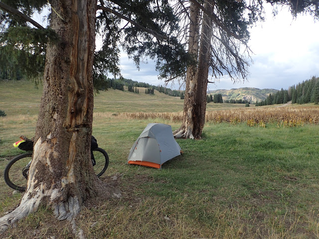
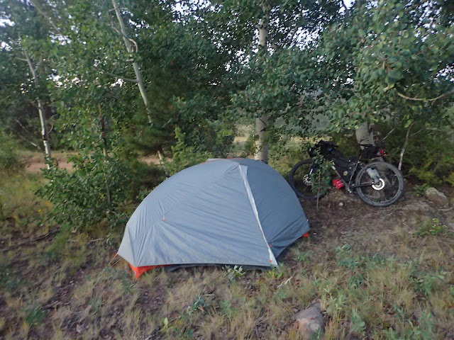
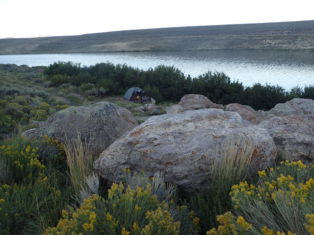
Idyllic dispersed campsite at Apache Creek, just inside the New Mexico border.

Welcome to New Mexico, pilgrim.

After that rude introduction, I bump along rough roads through the mountainous highlands of Carson National Forest, eventually dropping into open grasslands along Rio San Antonio. Threatening storm clouds build as I turn onto USFS Secondary Road 133, noted in the ACA cue sheet as "potentially mucky if raining" with a recommended paved alternative. I can see getting stuck back here for hours, maybe even overnight. Over the next 12 miles, I plow through plenty of standing water and soft mud from recent rains, but the dark clouds refrain from adding to the slog. 

With a deep sigh of relief, I reach paved U.S. Highway 64 for the final 5 mile climb to my evening's destination of USFS Hopewell Lake campground. Time for a celebratory snack. Friendly voices from behind add to the light mood. It's Rob and Andrea, leap frogging South Bound Great Divide riders who also are heading to Hopewell Lake. Sweet.

What is that?

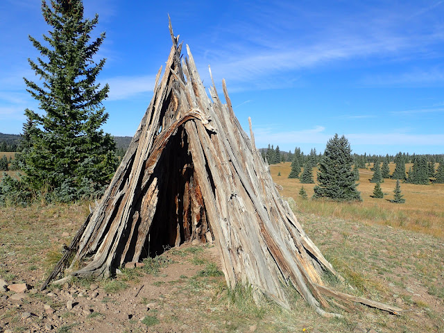
Unknown structure on the Continental Divide near Olguin Mesa.

Just as I start to pedal up the final, paved climb for the day, those heavy clouds lose their grip. The rain falls hard, and I laugh. Loudly. I'm giddy and grateful to be off that dirt road. No rain now can dampen today's ride.

That doesn't mean I'm not tired from the day's effort. About halfway up that final climb, I stop for a break and hunch over the handlebars. As I gather myself, a pickup truck barreling down the mountain slows to a stop, presumably to check up on me.  I smile and wave to say that I'm OK.

No matter. The driver of the pickup truck rolls down her window, "Are you riding the Great Divide and heading for Hopewell Lake?" To my affirmative response, she says, "I'm Dawn, the camp host. There's good water at the shelter, and you can stay there for free. I've got to go to town, but I'll be back later." She takes another, harder look at me and says, "Can I get you anything? How about a burger from Wendy's?"

"Dawn, that sounds awesome! I will eat anything you bring back and gladly pay for it! Did you talk with my two friends a little ahead of me? I'm sure they would say the same!"

Dawn laughs, waves, and disappears down the mountain.

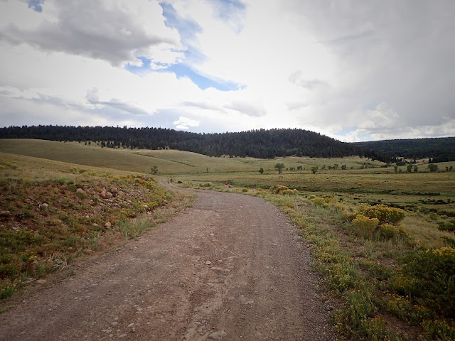
Storm clouds gather as the primitive road winds up Montoya Canyon.

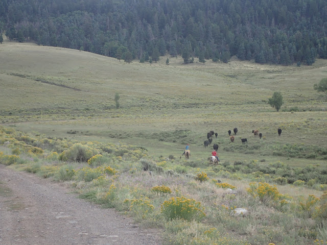
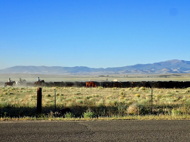
Two cowgirls push a herd of cattle toward another pasture.

At Hopewell Lake I find Rob and Andrea, already well into setting up camp. It's great to share a camp site with them again, but we're all more excited about whatever treats Dawn brings back to us. As we catch up and attend to evening duties, another South Bound Great Divide rider, Mark, rolls in looking for water. He decides to stay, too, making us a party of four.

As the sun sets, Dawn drives into our camp site to deliver mammoth Wendy's burgers and bags of french fries. But she said that didn't seem enough, so she stopped by another store and bought milk, yogurt, fruit, candy bars, and more. Wow. 

That's a seasonal Forest Service Campground Host recognizing and surpassing the needs of weary Great Divide cyclists seeking shelter and sustenance. Thank you, Dawn. Another Trail Angel.


Magic, Pilot (1974)


Tuesday, January 18, 2022

The Great Divide - Solo, Not Alone

Spent the last year
Rocky Mountain way
Couldn't get much higher

Out to pasture
Think it's safe to say
Time to open fire

Rocky Mountain Way, Joey Vitale, Joe Walsh, Ken Passarelli & Rocke Grace (1973)

La Garita Cash Store didn't offer much for supplies, although the hand scooped ice cream is great.
Even better is the hospitality of the owner and his family.

Late afternoon, deep into the high, dry plateaus of Rio Grande National Forest in southern Colorado, I scan the horizon for any sign of respite from the 95 degree sun and incessant wind. I've ridden almost 60 miles today, climbing both Cochetopa Pass and Carnero Pass to drop down in the heat of Coolbroth Canyon. Del Norte is within reach, but I hear that a long closed general store in the village of La Garita may have re-opened recently. So, I take a half mile off-route risk for the chance of buying a cold Coke.

I find so much more.

Riding south of Como into windswept ranch land on washboarded county roads.

Empty playgrounds and sports fields that apparently have never been used.

Since leaving the comfortable Como Hospitality Bunkhouse four days ago, I've ridden solo over 220 miles of remote, high country backroads, passing only through the one cafe town of Hartsell and resupplying the next day in Salida. I disperse camp all three nights, encountering few people and little traffic. It's a big change from the Steamboat Springs to Breckenridge stretch of touristy bustle.

Right from the start at Como, I ride into steady 15-20 mph headwinds for the 30 miles of rolling, wide open ranch land to Hartsel. There the Highline Bar and Grill offers free camping in a sketchy backyard lot, but I opt for a quick burger and remount. Bouncing along a gravel county road, I pass by miles of empty paved streets, as if laid out for hundreds of houses and stores that were never built. Abandoned, apparently unused playgrounds and sports fields punctuate the odd landscape. Although it points to a real estate scam or tax evasion scheme, it's still a bit eerie.

My little dispersed camp site just inside San Isabel National Forest.

The Collegiate Peaks of the Sawatch Range on a morning descent into Salida.

Challenged by stout headwinds, deep washboards, and sporadic showers, I eventually plow through another 30 miles of private ranch land, fill water bottles at Boulder Creek, and camp just inside the border of San Isabel National Forest. In the morning, a short, steep pitch over a watershed divide leads to a 15 mile plummet into the bicycle centric town of Salida. Time to refuel and resupply. 

On the climb toward Marshall Pass, memories flash back of descending this very road several times after riding the renowned Monarch Crest Trail. On the last of those rides, now over 20 years ago, my non-cyclist, but willing-to-try brother Chris joined me for an unforgettable afternoon of alpine single track. Lost in thought, I pedal up toward the pass as the afternoon hours fade.

Steady climb toward Marshall Pass in southern Colorado.

Easterners fresh off the Monarch Crest Trail onto USFS 200 toward Salida.

I grab some shade by a turn-off for a reportedly nice campground at O'Haven Lake. I'm really not ready to call it a day, so I pull out maps and snacks. Abruptly, a boisterous pack of four cyclists on high end, full suspension mountain bikes burst upon the scene and skid to a stop. They are a group of old friends, now scattered around the east coast, who spend a week together each year mountain biking. When they hear of our trails and rough roads in the Black Hills of South Dakota, they think that may be their next destination.

Re-energized by fellow cyclists and peanut butter/honey/tortillas, I quietly spin up the final 10 miles to Marshall Pass. Near the top, I pause to watch five moose feeding among the willows in an adjacent meadow. Finishing the day with a flourish, I share a dispersed camp site right on the Continental Divide with a couple of CDT hikers on their own adventure. Now that's a nice finish to a long day.

Moose grazing in willows near the top of Marshall Pass, elevation 10,842 feet.

Sunset from inside my tent atop Marshall Pass right on the Continental Divide.

The next morning I drop 17 miles down Marshall Pass Road for breakfast at the Tomichi Creek Trading Post in Sargents. There I meet a fun family of four, each riding an enduro motorcycle on a back road, cross-country trip of their own. One asks about the motor on my bike. "It's a two stroke," I reply, paraphrasing a favorite line of Paul's, "left and right." They laugh and power off. I top off supplies, as I'm unlikely to find anything before Del Norte, about 110 miles away.

Riding into late afternoon, I indulge a fleeting thought of climbing Cochetopa Pass to the highly regarded USFS Luders Creek campground for the night. But then I spot an older couple on a hillside searching the ground for something. Politely declining my offer of help, they explain they are hunting for a particular type of volcanic rock unique to this area. Every year, they drive from Louisiana to southwestern Colorado just for this. Passionate rock hounds, indeed. 

Dispersed campsite along Upper Dome Reservoir.

Climbing toward Cochetopa Pass, elevation 10,067 feet.

After showing me some of their treasured finds, Barbara and Dave offer me water while asking about my journey. Excited to hear that I'm riding the Great Divide Mountain Bike Route, they say that they picked up their son at Antelope Wells when he finished it a few years ago. As our conversation broadens and deepens, I realize that Luders Creek campground isn't happening tonight. That's alright. Meeting interesting people makes this ride special. After a time, I soft pedal a few more miles to Upper Dome Reservoir to disperse camp.

Even though it's a much lower elevation than last night atop Marshall Pass, the morning brings 28 degrees with frost on everything. Hot coffee helps, but the climb up Cochetopa Pass still requires several layers of extra clothes to stay warm. Not surprisingly, the cold doesn't last much past the first pass. By the time I climb and descend Carnero Pass, some hours later, it's 95 degrees and windy. Late afternoon, I'm one whipped puppy dog hoping to find a cold Coke at that store in La Garita.

Climbing toward Carnero Pass, elevation 10,166 feet.

Ready for some downhill after cresting two passes today.

Oh, Yayh! The La Garita Cash Store is open! Inside I find mostly empty shelves with very little food, other than chips, candy bars, and some canned goods. In a corner sits a small refrigerator with a few cans of soda pop and energy drinks. At the counter are a couple of containers of hard ice cream. That's basically it. However, for this cyclist, on this day, this store promises a feast.

I ride here hoping for a cold Coke, but now I'm really ready to stop for the night. I ask the teenaged store clerk whether anyone in town rents a cabin, or a room, or a tent site. She says, "No, but you can camp in our side yard and use our bathroom, which has a shower. No charge. Our cafe closed at 2, but opens at 7 for breakfast."

Are you kidding? A place to pitch a tent, with access to water, a bathroom and a shower? Right here? That would be great. I'll find something here to eat now. And I'll definitely be back at 7 for breakfast!

My campsite alongside the La Garita Cash Store.

Early morning cattle drive, right across the road from my tent site by the La Garita Cash Store.

I inhale a couple of cans of soda pop and a hand-scooped ice cream cone while checking out the rest of the store to try to piece together dinner. There's something that will work. A big can of Bush's Best Baked Beans and a bag of Fritos. Score!

I enjoy that luxurious meal on the front porch of the store, soaking in the moment, and the day. Interesting people traveling remote roads, with more Trail Magic and yet another Trail Angel. This trip is amazing.


Rocky Mountain Way (live at Santa Monica Civic Auditorium), Joe Walsh (1976)

Tuesday, January 11, 2022

Black Hills BackBone & DoubleBackBone - With Map & Story Links

The Black Hills BackBone is simply a bicycle route that I created 7 years ago to ride myself. 

There is no Black Hills BackBone race, or organized public event, or "Grand Depart," or anything like that. It's just a route I created to ride myself. Then I created this blog to document my journey, in part as a digital scrapbook and in part to share my experience with family and friends.  

That's it.

The broad shoulders of Flag Mountain reveal the granite peaks of the Central Black Hills.

But, oh, what a route.

Inspired by the cross-country routes of the TransAmerican Trail and the Great Divide Mountain Bike Route of the Adventure Cycling Association, I wondered whether I could piece together a remote road ride on primarily gravel and dirt roads that spanned the height of the State of South Dakota along the spine of our beloved Black Hills. That whimsical daydream led to many days of scouring maps, scouting back roads and pedaling all over Western South Dakota. There seemed to be no end of options.

I struggled with this route, primarily because the Black Hills National Forest offers a staggering number of amazing roads to ride. Scouting a promising road invariably led to more. At some point, I simply had to stop, prioritize, and choose. The Black Hills BackBone is the resultBlack Hill BackBone - Cue Sheets & Other Links. Update - here's a link to a ridewithgps.com file that I created for the BackBone in 2021. Black Hills BackBone - 2021 Update.

Conceived as an unsupported, solo, continuous ride, the Black Hills BackBone readily lends itself to a multi-day bikepacking ride or even a multi-day supported tour. In 2017, a small group of friends rode the entire route over three days in the heat and winds of a Fourth of July weekend. For my reports on that ride, go to these posts. An Idea Takes ShapeGatheringCrossing The Northern PrairieUp And Into The Black HillsFocus On The FinishA Weekend To RememberFriends.

Over a cold, rainy Memorial Day weekend in 2019, an intrepid group of eight cycling enthusiasts from Colorado made a run at the Black Hills BackBone. On that particular weekend of difficult conditions, they rode about as much of the route as one reasonably could. They said they had a great time, particularly Day 3 from O'Neil Pass to Custer, and now make an annual road trip to the Black Hills to ride gravel. New Friends On The BackBone.

To my knowledge, the entire Black Hills BackBone has not been ridden on a bicycle as an unsupported, solo, continuous ride. In my first attempt in 2015, I stumbled into ferocious prairie winds with horizontal rain that eventually spit me out in Spearfish 135 miles later, barely able to stand.  A Rancher's Kindness.  In my second attempt in 2016, I flew across the 135 miles of Northern Prairie in ideal conditions before plowing into a freak ice blizzard climbing O'Neil Pass, dropping me into a trail head outhouse shaking like a frozen leaf.  A Sudden Turn.  My third attempt remains undocumented, as I still cannot wrap my mind around that ride.

Throughout this blog you will find details and pictures of the Black Hills BackBone route. To save a trip through the archives, here are links to some posts for the route. IntroductionOverviewFinal CutNew Cue Sheets & TweaksBackBone Photo Essay.


But wait, there's more.

Miles and miles of remote back roads on the Black Hills DoubleBackBone.
Self-sufficiency required.

Imagine riding along the Black Hills BackBone to the stop sign finish at the Nebraska border. Celebrate for a moment, but then head west onto Dakota Line Road to access the Wild, Wild Western reaches of the Black Hills. A serpentine network of barely used gravel and dirt roads wind generally north for a return trip back to the North Dakota border.

Now, that's one big, bad loop. Well over 600 miles, all told. 

It's the Black Hills DoubleBackBone. Black Hills DoubleBackBone Cue Sheets.

Sometimes, more is more. More rolling prairie patrolled by herds of cattle, buffalo, pronghorn and elk. More obscure canyons scoured by flash floods. More twisty ridge lines climbing to soaring views. More hills stuffed with pine and aspen. More dirt near-roads connecting with secondary Forest Service gravel. And even more remote than the easterly side of the loop, which is a bit hard to believe until you're out there.

The Black Hills DoubleBackBone, like the original BackBone, is just a route that I think is fun and challenging, however one chooses to experience it. Solo or group. One continuous ride, a series of days or in sections over time. Self-supported, shuttled or fully supported. Maybe some combination or even all of the above.

The Black Hills BackBone. Go big.
The Black Hills DoubleBackBone. Go bigger.
The Black Hills. Just go.


Tuesday, January 4, 2022

The Great Divide - Dreams (Reprise)

One year ago, I published the following post as I worked my dream of riding the Great Divide Mountain Bike route into a plan of action. After months of detailed preparation, I lived that dream over an unforgettable 2,651 miles. Whenever the topic comes up of riding the entire route in a continuous ride, I still cannot wrap my mind around the simple fact that I did it. But, my goodness, I did. The Great Divide - Living A Dream.

Dreams. Impossible to ignore. Impossible not to do.

Dream on.


Showing some age from 7 weeks of use on the Great Divide.
Great Divide Mountain Bike Route maps, Adventure Cycling Association
Cycling The Great Divide, Michael McCoy & Adventure Cycling Association
Spot X 2-way satellite messenger


And oh, my dreams, 
it's never quite as it seems, 
never quite as it seems.

I want more, 
impossible to ignore, 
impossible to ignore.

And they'll come true, 
impossible not to do, 
impossible not to do.

Dreams, Noel Hogan & Delores O'Riordan (1992)


Christmas gifts from an amazing wife.
Great Divide Mountain Bike Route Map Set #1-6, Adventure Cycling Association
Cycling The Great Divide, Michael McCoy & Adventure Cycling Association
Spot X 2-way Satellite Messenger

Dreams.

Impossible to ignore.

Impossible not to do.

Bikepacking The Great Divide Mountain Bike Route.

Dreams, Cranberries (1992)