In 2021, cycling buddy Paul Brasby rode the Great Divide Mountain Bike Route with me from Roosville, Montana to Rawlins, Wyoming, where he ran out of vacation time. During those unforgettable 24 days, we rode 1,300 miles of back roads over every kind of surface and condition, repeatedly climbing high mountain passes and crossing endless prairie, skirting rampant forest fires and steaming grizzly scat, dodging thunderstorms and lightening, and meeting a stream of interesting people.
Throughout this journey, Paul captured hundreds of remarkable images, some of which appear in my blog posts of our ride together. Now, Paul has created a photo gallery of his favorite Great Divide images that he wishes to share. For earlier installments, go to Roosville to Clearwater Lake; Clearwater Lake to Basin; Basin to Hansen Livestock Ranch; Hansen Livestock Ranch to Warm River Campground.
Hello All!
After a ten year dream, the first half of the GDMBR finally came true last year!
As Craig's blog posts of the GDMBR draw to an end, Craig was nice enough to let me share a few photo dumps showcasing the beautiful landscape, road conditions, people we met, and our POI along the way. I'll include some narrative with the pictures, as well. This is geared more to the first time touring riders of the GDMBR/Tour Divide adventures in the near future. I'll include distance and elevation gain of each day's ride as a helpful touring guide. For those that have already partaked in this amazing adventure, whether touring or racing, I hope these pictures bring back fond memories of a ride not soon forgotten.
Join along as Craig and I pedaled SOBO following the ACA's GDMBR from the Canadian border to Rawlins, Wyoming, at which point Craig pushed on solo to Antelope Wells, New Mexico. Enjoy!
One more footnote. A big shout out to all those planning and prepping for this year's Tour Divide and for all those touring riders giving it a go this year. Whether SOBO or NOBO, I wish you a safe and exciting adventure! Cheers!
Paul Brasby
Warm River Campground to Colter Bay Campground
Day 17, August 5, 2021 (66.1 miles/4,468 feet of elevation gain)
Day 18, August 6, 2021 (Zero Day at Grand Teton National Park)
 |
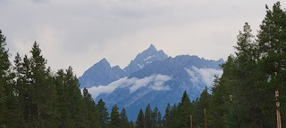
| Easy riding in the morning with distant views of the Teton Range. |
 |
| Wyoming border crossing. There's dispersed camping in this area along with lodging. A buddy of ours had a close encounter with a grizzly bear near the border and another friend with a black bear. |
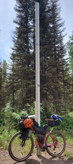 |
| A 16 foot snow gauge near the top of the Teton range. Your legs will feel this climb! |
 |
| Colter Bay! We stayed in the main campground at Colter Bay. |
 |
| If no one is manning the booth, grab a map and ride to the Hiker/Biker camping area and pitch a tent. Square up with them in the morning. |
 |
| The Village of Colter Bay is a short ride from the CG. |
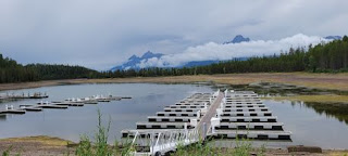 |
| All amenities are available. Everything is expensive!!! The laundry mat also has shower facilities and charging power strips. |
 |
| Due to weather issues, we took our only rest day or zero day here. |
Colter Bay Campground to Lava Mountain Lodge
Day 19, August 7, 2021 (62.6 miles/4,267 feet of elevation gain)
 |
| We say farewell to Grand Teton National Park. |
 |
| The scenery on this leg of the trip was amazing! Have your cameras at the ready! |
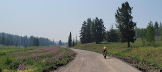 |
| This is the first of three sections off of Hwy 26/287 that could be muddy when wet. We had a full day of rain the day before we encountered these roads. |
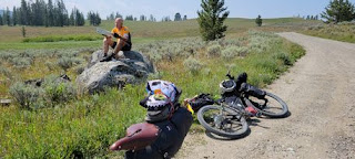 |
| The 1st section was fine, the 2nd section we had to turn back and take the highway, it was too muddy. And the 3rd was just passable, muddy sections right off the bat for about 3 miles. |
 |
| Riding Hwy 26/287 instead of section 2. Toward the summit of Togwotee Pass to section 3. |
 |
| Do not take this sign lightly! SOBO riders will find out right away if it's possible or not. NOBO riders will encounter the muddy roads deep into this section and will be forced to push on!!! |
 |
| The views are spectacular on Brooks Lake Rd! |
 |
| Campsite at Lava Mountain Lodge. Full amenities and a good restaurant in the lodge. |
Lava Mountain Lodge to Strawberry Creek Safety Shelter
Day 20, August 8, 2021 (38.2 miles/5,110 feet of elevation gain)
 |
| Lava Mt Lodge. |
 |
 |
| For me, Union Pass was the 2nd hardest climb of the trip. |
 |
| Top of Union Pass. |
 |
| This was a shortened day after stumbling across Strawberry Shelter. Strawberry Shelter is located about half way between Union Pass summit and Mosquito Lake. |
 |
| FYI. No water on site at the Safety Shelter. There's a good flowing stream about a mile before and one a mile past the shelter. Either way you have to climb a bit to get to the Shelter. |
 |
| Bathrooms and firewood on site. The shelter will be on the right if SOBO. |
Strawberry Creek Safety Shelter to Boulder
Day 21, August 9, 2021 (73.6 miles/2,281 feet of elevation gain)
 |
| After a warm and comfortable night's sleep in colder temps, we were off by sunrise. |
 |
| Easy miles prevail early in the morning, before a ruff section as you drop down into the valley below. |
 |
 |
| There's good flowing water in the valley followed by washboards that run the whole width of the road before hitting pavement for the rest of the day. |
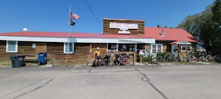 |
| We find ourselves enjoying a tailwind before stopping for a break in Cora. |
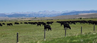 |
| We stopped for lunch in Pinedale and topped off with food and a bike cleaning for Craig. |
 |
| Then heading 12 more miles to the town of Boulder for the night and stayed at Highland RV Park. Bathroom, showers and a laundry room. |


No comments:
Post a Comment