If tomorrow all the things were gone, I'd worked for all my life
And I had to start again, with just my children and my wife
I'd thank my lucky starts, to be living here today
Cause the flag still stands for freedom, and they can't take that away.
And I'm proud to be an American, where at least I know I'm free
And I won't forget the men who died, who gave that right to me
And I'll gladly stand up next to you, and defend her still today
Cause there aint no doubt I love this land, God Bless The USA.
God Bless The U.S.A., Lee Greenwood (1984).
 |
| Mt. Rushmore framed by a tunnel on Iron Mountain Road, aka Pigtail Highway. (image by Paul Brasby) |
The BackBone Grande is my 420+ mile backroad bikepacking route across the State of South Dakota along the spine of the Black Hills and through the surrounding prairie. Inspired by my experience riding the Great Divide Mountain Bike Route, I designed it to create that type of experience here in my back yard. Tracking rough roads that showcase the best of our scenery, history, culture, and wildlife, the BackBone Grande is a great ride on its own and as a shakedown for the GDMBR. For a collection of my stories all about it, go the BackBone Grande Page.
For those more visual learners, I've selected images along the route from various scouting trips, the first through-ride, and other rides. Here is my third installment of the BackBone Grande Visual Tour, from the town of Custer to the town of Hill City, both the Main Route (miles 135-163) and the Mt. Rushmore Alternative Route (41 miles).
The BackBone Grande is a rough road bikepacking route across the State of South Dakota along the spine of the Black Hills. It generally follows dirt/lightly graveled USFS roads in Black Hills National Forest, barely discernible BLM roads in Buffalo Gap National Grassland, and county gravel roads out on the surrounding prairie.
The BackBone Grande occasionally uses pavement as a connector, where necessary, and even passes through a few small towns. At its core, however, it is a backcountry road route, like its inspiration, the Great Divide Mountain Bike Route.
So, the BackBone Grande follows the Mickelson Trail out of Custer, climbs up Spring Creek Road (USFS Secondary Road 305), turns onto highly variable Reno Gulch Road (USFS Secondary Road 303) past a Marmot Motel to Coad Hill for Harney Peak views, and then rapidly drops back to the Mickelson Trail for the final few miles into Hill City. Every bit of this stretch oozes the BackBone Grande vibe.
All that being said, people from the world over flock to the Black Hills for more conventional tourist experiences. Many drive paved highways that were actually purpose-built for tourism, including Needles Highway and Iron Mountain Road, aka Pigtail Highway. Being much busier, more developed, and overall more civilized than the roads on the Main Route, these roads provide a significantly different cycling experience than the BackBone Grande.
Nonetheless, in response to feedback from out-of-state bikepackers, earlier this year I added the Mt. Rushmore Alternative for the BackBone Grande stretch between Custer and Hill City. This alternative route climbs paved Sylvan Lake Road (State Highway 89) to Sylvan Lake and then follows paved Needles Highway (State Highway 87) up, through, and down the Needles. To inject a bit of backcountry, the route turns onto Camp Remington Road (USFS Secondary Road 345) and directly onto Iron Creek Trail for a bit of mellow single track with multiple creek crossings. Then it's back to paved Iron Mountain Road, aka Pigtail Highway (U.S. Highway 16A) and up a pitched 2 mile climb on U.S. Highway 244 to Mt. Rushmore National Memorial. West of Mt. Rushmore, the route turns off U.S. Highway 244 onto USFS Low Standard Road 356 to connect with paved Old Hill City Road for the short jog into Hill City.
So, the Mt. Rushmore Alternative is a mostly paved highlight reel of conventional tourist sights, with a smattering of short, rough patches as a reminder that it's still the BackBone Grande.
Choose, you must.
Here's a photo gallery of the BackBone Grande route from the town of Custer to the town of Hill City, both the Main Route (miles 135-163) and the Mt. Rushmore Alternative Route (41 miles).
Here are links to prior blog posts about this section. Introducing the BackBone Grande - Heart Of The Hills; Off-Route Mt. Rushmore Loops; The First Through-Ride - Rain; Mt. Rushmore Alternative; All American; Mt. Rushmore Plus.
Also, here are links to prior Visual Tour posts: Nebraska Border to Buffalo Gap (miles 0-95); Buffalo Gap to Custer (miles 95-135).
A. Main Route
 |
| Northbound on the Mickelson Trail north of Custer. (image by Paul Brasby) |
 |
| More Mickelson Trail magic riding north toward Crazy Horse Memorial. (image by Paul Brasby) |
 |
| About to top the climb en route to Crazy Horse Memorial on the Mickelson Trail. (image by Paul Brasby) |
 |
| Crazy Horse Memorial in the distance north of Custer Limestone Road (USFS 284). |
 |
| Fast USFS Primary Roads exist on the BackBone Grande, as an occasional respite. (image by Paul Brasby) |
 |
| Rolling up Spring Creek Road (USFS 305) in February 2021. |
 |
| Reno Gulch Road covers a spectrum of what I would call rough Secondary to solid Primary to eventually some pavement. |
 |
| Marmot Motel on Reno Gulch Road. I've ridden by dozens of those critters that live in those crags. |
 |
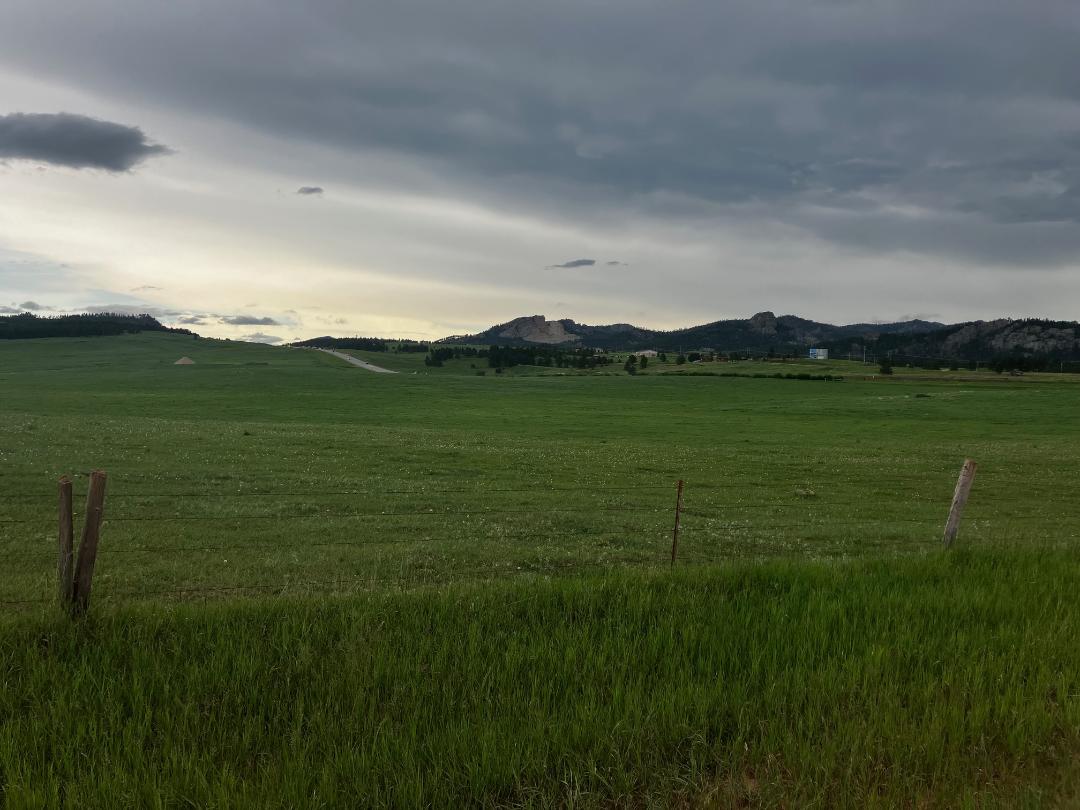
| View of Harney Peak, elevation 7,242', the highest point east of the Rockies & west of the Alps. This is from atop Coad Hill, along Reno Gulch Road. |
 |
| Another view of Harney Peak, a little further down Reno Gulch Road. |
 |
| Reno Gulch Road rapidly drops down toward Custer, first on gravel and then some pavement. |
B. Alternative Mt. Rushmore Route
 |
| Rolling north out of Custer on Sylvan Lake Road (State Highway 89). (image by Paul Brasby) |
 |
| Sylvan Lake. (image by Paul Brasby) |
 |
| Short climb up to the Needles on Needles Highway (State Highway 87). (image by Paul Brasby) |
 |
| The Needles close in along Needles Highway. (image by Paul Brasby) |
 |
| Looking to thread a needle. Needles Highway. (image by Paul Brasby) |
 |
| Going in! Needles Highway. (image by Lane Bergen) |
 |
| Camp Remington Road (USFS 345). (image by Paul Brasby) |
 |
| Iron Creek Trail. (image by Paul Brasby) |
 |
| Navigating one of several bridges on Iron Creek Trail. (image by Paul Brasby) |
 |
| Another bridge over tranquil waters. Iron Creek Trail. |
 |
| A "pigtail" under a bridge, over the same bridge, and through a tunnel. Iron Mountain Road, aka Pigtail Highway (U.S. Highway 16A). |
 |
| Mt. Rushmore peek-a-boo through the forest along Iron Mountain Road. |
 |
| Another one lane tunnel on Iron Mountain Road. That's a peek of Mt. Rushmore ahead through the trees. (image by Paul Brasby) |
 |
| Motorized escort through another one lane tunnel on Iron Mountain Road. (image by Paul Brasby) |
 |
| Walk your bike up to the Pavilion for this photo opp. (image by unknown volunteer) |
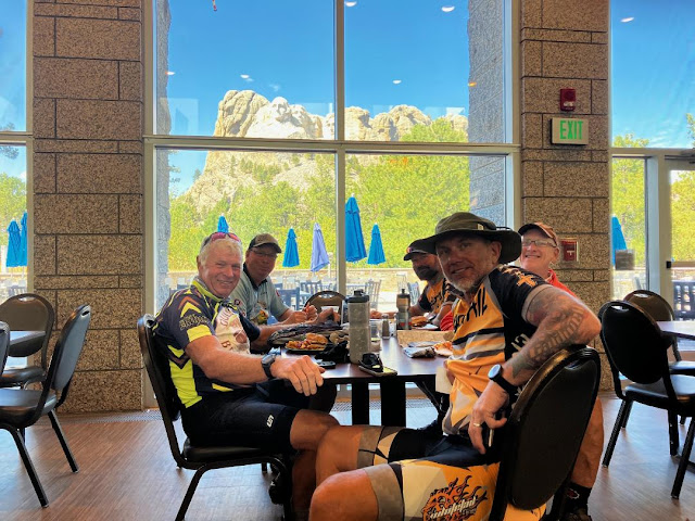 |
| Cafeteria at Mt. Rushmore. Do not miss the ice cream. (image by unknown volunteer) |
 |
| Riding west on U.S. Highway 244 offers a parting shot of George Washington. Mountain goats frequent this area. (image by Paul Brasby) |
 |
| Finally, crunching a Low Standard Road (USFS 356) to connect with Old Hill City Road. |
God Bless The U.S.A., Home Free (2016).
(recorded at Mt. Rushmore)
No comments:
Post a Comment