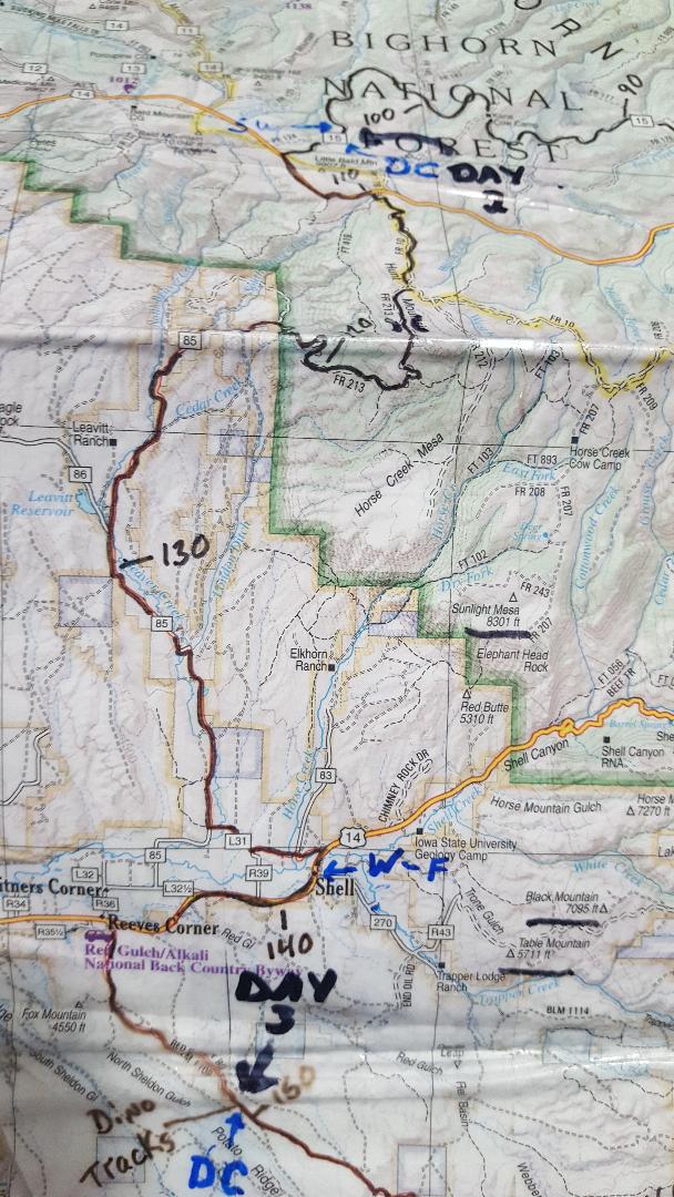
The Cloud Peak 500 is a 500 mile remote road loop in and around the Big Horn Mountains of Wyoming. This post is part of a series that describes some of each day's logistics involved when we rode the route on bicycles loaded for a 7-8 day self-supportedtour in early August 2020. It also includes a screen shot and link to a digital map on ridewithgps.com, which I created after the trip to show our ride for each separate day. Finally, it adds a photo gallery. This post covers Miles 104-151 of the route, which was our Day 3. Go to Miles 0-52 for Logistics for Day 1 and Miles 52-104 for Logistics for Day 2.
A cursory look at the route profile today suggests a relatively flat 12 mile start, a quick 15 mile descent, and a flat 20 mile roll-out to the finish. Easy-peasy? Don't believe it.
We start Day 3 from a dispersed camping site just off of USFS 15 at about Mile 104 on the Cloud Peak 500 route. USFS 15 gradually climbs on good gravel for about 3 miles to paved U.S. Highway 14. From this spot at about 9,250 feet, we obtain cell phone coverage for the first time since early on Day 1. The paved road climbs steadily for about 2 miles and then sharply descends for about a mile to Hunt Mountain Road (USFS 10). More dirt than gravel, Hunt Mountain Road climbs briskly through alpine grassland to about 10,000 feet, with big views to the east. After about 4 miles, the route turns onto primitive USFS 213, which starts rough and gets rougher ahead. After a couple of miles, the route flattens and delivers drop-off-the-earth views to the west.
Now, for Dude's Downhill. That's what I call the next 8 miles of steep, loose, rocky, narrow, twisting double track ahead on USFS 213 from about Miles 114-122. This is the most technical stretch of the Cloud Peak 500, by far, and is certainly full-on, gonzo downhill, mountain bike territory. Some stretches flow for a little bit, but often just enough to build speed to bounce through the next rock garden, plow into the next sand pit, or overcook the next hairpin turn. I would not wish to ride this at the end of the day when tired and certainly not in the dark. Your technical skills and risk assessment will certainly vary. Know that emergency extraction would be long and difficult.
At about Mile 122, the route turns onto good gravel on Beaver Creek Road (85), emerges from the forest, and enters open grassland again. It drops into a small valley, climbs out, and then generally descends to the small town of Shell at about Mile 139. This stretch is exposed to the elements. We certainly were hot in late morning August 2020, even though riding mostly downhill.
Shell offers the recently renovated Shell General Store, with a nice assortment of snacks and a full on bistro. It's also the first commercial establishment since Bear Lodge Resort at Mile 82 and the last one until the town of TenSleep at Mile 251. After lunch, we wash off 3 days of gravel, dirt and dust at a water pump out back. We love this place and the people working there.
The Cloud Peak 500 rolls west out of Shell on paved U.S. Highway 14 for about 5 miles to Reeve's Corner. It then turns south on Red Gulch Road (BLM 1109), also called Red Gulch/Alkali National Back Country Byway. At this intersection, signs warn of the rough, rutted, remote roads ahead and that travel is not advised when wet. Believe it. When wet, this road will stick to everything and stop a bike cold. Fortunately, the heat and wind quickly dry everything. On a hot August day in 2020, I was able to ride about 20 minutes after a hail storm.
From the pavement of U.S. Highway 14, it's about 5 miles of very gradual uphill to the Red Gulch Dinosaur Track Site at about Mile 151. This site has 2 covered shelters, each with 3 picnic tables, and outhouses, but no power and no water. One can read some informational displays about the dinosaur tracks and walk right down to them.
Overall, the route from Elk Meadows to Dino Tracks is about 47 miles and 3,000 feet of elevation gain. For the Cloud Peak 500 route so far, that's about 151 miles/14,800 feet of elevation gain total.
Descending "Dude's Downhill" (USFS 213) toward the town of Shell far below.
(photo by Paul Brasby)
After yesterday's re-affirming ride and relaxing evening, I awaken before dawn, jazzed for another day on the Cloud Peak 500. I am thankful for yesterday, the company of a patient friend, and the opportunity to ride another day.
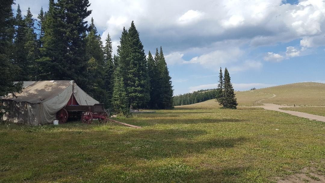
While packing in the diffused early light, we gaze across a mountainside meadow to spot a large herd of elk emerge from a shadowy draw. We enjoyed their chorus of bugling throughout the night and now pause to watch them meander to higher ground. They move slowly, as a herd, to graze. More and more keep drifting out of that draw, soon numbering in the hundreds. As we watch in wonder, they slip into the forest. What a cool start to the day. We christen the camp site "Elk Meadows."
Climbing above treeline to U.S. Highway 14A early on Day 3.
We reluctantly leave Elk Meadows and spin up USFS 15 to paved U.S. Highway 14A for some big views all around. These high altitude grasslands are summer home to domestic sheep, their guardian sheep dogs, and shepherds with their wagons. It's also the year around home for native marmots, the heaviest members of the squirrel family, who duck around, over or under rocks with surprising quickness.
Turning off pavement onto primitive USFS 10, we immediately start climbing again. As the rough gravel road winds through high pastures, it seems built for occasional, slow moving traffic, such as the sheep herders. Bike packers, too, I suppose. As USFS 10 turns to drop to the east, we take a steep, rutted pitch up primitive Hunt Mountain Road (USFS 213), which tops out at a craggy plateau with breathtaking views to the west.
Lightly sprinkled gravel turns to dirt and rock as we approach the summit of this climb.
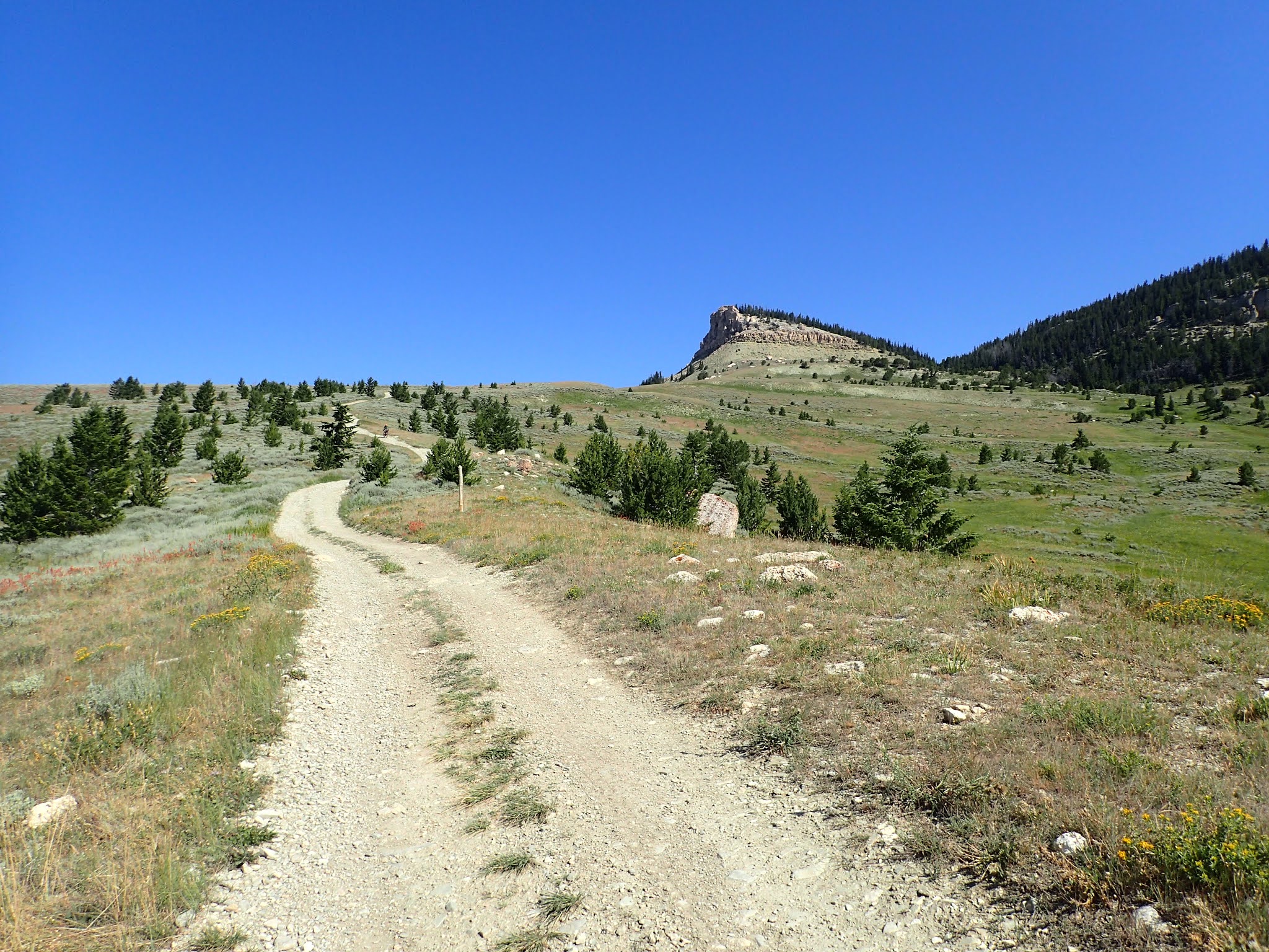
It's a great time and a great spot for a break. At over 10,000 feet, this is the highest elevation of the Cloud Peak 500 route. The 360 degree views span miles upon miles to a hazy horizon. We take some time to soak it in. Paul even rides out to a rocky crag for a postcard picture for some semblance of scale. It's a special place that very few others likely have experienced. It's worth the trip, all by itself.
From here, the route profile shows a steep descent to the prairie below and then a gradual descent to the town of Shell at Mile 139. By now, we know not to trust that general profile, which already has failed to show some significant elevation changes, both up and down, and reveals nothing of the road surface. But we also know that Shell lies almost 6,000 feet below us and that we already have completed most of our climbing for today. That's a good feeling to have in the morning.
Paul takes his post on the citadel of Hunt Mountain.
We hop back on USFS 213, a primitive Forest Service road that may be passable in a suitable 4x4 with a skilled driver. From this rocky plateau, it rolls along just far enough for us to pick up some speed to hurl down the steepest, rockiest, loosest, twistiest downhill this side of the X-Games. And, at 8 miles long, it's not short. Oh, some stretches flow a short while, but often just enough to build speed to bounce through the next rock garden, plow into the next sand pit, or overcook the next hairpin turn. Maybe all at the same time. This is full-on gonzo downhill mountain bike territory that drops over 4,000 feet in short order.
I call it "Dude's Downhill." That's either a contraction or a possessive noun, take your pick. That is, it can be a contraction of "That Dude Is Downhill," as a statement of unsurpassed understatement. Or, it can be the possessive downhill of a gonzo dude, as in that's his downhill. Maybe both. Probably both.
The dirt road is about to drop out from beneath us.
The start of Dude's Downhill looks innocent enough.
Dude's Downhill rolls quickly down a rocky ridgeline with views plummeting all around. While moving on this rough road, however, it's hard to enjoy the scenery and it's hard on the body. So, I stop frequently to take in the views and to recover.
As I start to get comfortable bouncing along uncomfortably, the road drops straight down into a series of rutted, rocky, loose hairpin turns. More than once, I skid around a turn almost to a stop, just to stay on the "road." For me, it's a white knuckle descent and far too much work, especially for the price we paid to gain all that elevation.
Finally descending into the forest, the road changes, repeatedly and unpredictably. Hard scrabble gravel drops into a loosey-goosey steep that levels to smooth, straight, soft doubletrack, which turns to rutted, pot-holed dirt, and then abruptly jolts up a short, rocky, uphill steep. It's a crazy mix of mayhem, requiring focused attention and checked speeds. Definitely not a relaxing cruise.
Paul flies down a smooth stretch of Dude's Downhill.
Eventually, I manage Dude's Downhill on my loaded Jones mountain bike, with 3.25 inch Vee BullDozer knobby tires, but not without time, focus and difficulty. Paul also manages it without serious incident on his Salsa Cutthroat with 2.2 inch mountain bike tires. However, this is one stretch of the Cloud Peak 500 where a Jones 29+ mountain bike held a clear advantage over a drop bar Salsa Cutthroat.
We're relieved to start and finish this road relatively early in the day and without damage to bodies and bikes. I would not wish to ride this at the end of the day when tired and certainly not in the dark.
Wondering what's next, Craig rounds another corner on Dude's Downhill.
(photo by Paul Brasby)
Back on firm and fast gravel on Road 85, we cruise primarily downhill along a narrow green band of irrigated ranch land surrounded by hulking hills of brown earth and sagebrush. For the first time since Big Horn, we roll past an occasional ranch house and spot some new construction. And, like in Big Horn, we're back into the heat. We spin into Shell for a break.
We beeline to the Shell Store, recently renovated and re-opened as a general store and restaurant. Once again, we replenish with big burgers, fries and multiple Cokes. Again, Paul adds a salad, restocks snacks and charges batteries. I don't miss the chance for ice cream. Later, we douse everything in cold water from a pump out back and chill in the air conditioned bistro. We love this place and the folks working here.
Craig prepares to re-enter the forest to ride whatever lies ahead.
(photo by Paul Brasby)
After a second straight day enjoying a well-timed and well-executed lunch break, we're back on the road heading toward the Red Gulch/Alkali National Backcountry Byway. We start with a rare stretch of pavement, about 5 miles on U.S. Highway 14 to Reeve's Corner, where the route turns south on dirt.
Near this intersection, the Bureau of Land Management built a small covered display describing the storied road ahead and the land it passes through. Signs warn of the rough, rutted, remote road that is "hazardous if traveled by the unprepared" and that no services of any kind are available for the 32 miles of this National Backcountry Byway. Another sign adds that no travel is advised when wet.
Believe it.
Now, we're cooking again. Still on Dude's Downhill.
(photo by Paul Brasby)
A brief afternoon hail storm strikes as I'm reading those signs. We've seen some rain every day, usually starting around 4:00 pm and lasting less than half an hour. I wait for it to end and then start on that dirt road. Like the sign warned, the clay-like mud stops all wheel movement within 50 feet. I retreat to the pavement, clean mud from everything, and wait some more.
Water doesn't last long in these parts. Within about 20 minutes, the heat and wind take care of most of the puddles. Time to try again. In the first mile or so, my tires pick up some mud, but not enough to clog. A couple of miles later, a fast, dry downhill wipes clear the remaining mud from the tread. Now, I'm flying. The firmed up dirt road now rolls better than before the rain.
End of Day 3 at the "Dino Tracks."
(photo by Paul Brasby)
The afternoon storm also cools temperatures a little and I comfortably roll the 5 miles to the Red Gulch Dinosaur Tracksite. Here, the Bureau of Land Management built a nice exhibit to showcase dinosaur tracks preserved in rock now exposed. I stop to read the material and walk right down to the tracks. To think that a dinosaur walked right here and left tracks in the mud that still show today. Hmmn. We each may be leaving our own impressions that we cannot imagine.
I return to my bike and pull out maps. On that road, in those conditions, with the relatively less difficult riding day so far, I definitely could ride several more hours today. To do so would certainly mean a dry, dispersed camp somewhere along this remote road in the middle of sagebrush country. Nothing wrong with that. Dispersed camping last night led us to the enchanting Elk Meadows.
However, the Dino Tracks exhibit features covered shelters, picnic tables, an outhouse and plenty of flat space. Tonight, we decide to lounge in luxury by staying here.
The Cloud Peak 500 is a 500 mile remote road loop in and around the Big Horn Mountains of Wyoming. This post is part of a series that describes some of each day's logistics involved when we rode the route on bicycles loaded for a 7-8 day self-supportedtour in early August 2020. It also includes a screen shot and link to a digital map on ridewithgps.com, which I created after the trip to show our ride for each separate day. Finally, it adds a photo gallery. This post covers Miles 52-104 of the route, which was our Day 2. Go to Miles 0-52 for Logistics for Miles 0-52 (Day 1).
We start Day 2 from USFS Ranger Creek Campground at Mile 52 at an elevation of about 7,700 feet. The route continues climbing Red Grade Road (26) about 11 miles to over 9,300 feet at Mile 63. Relative to the climb from Big Horn, the gradient is significantly less and the road surface is consistently good. The route winds through forested hills with occasional views of big peaks. It then drops about 1,000 feet over the next 10 miles to about 8,300 feet at Mile 73, all on good gravel. If you need water or an outhouse, stop at USFS Dead Swede Campground at about Mile 72. There's a small incline before dropping quickly on good gravel and then generally downhill pavement on U.S. Highway 14 to Burgess Junction at about Mile 82. This is a very nice 30 mile stretch of remote mountain roads.
From Burgess Junction at Mile 82, look to the west to see Bear Lodge Resort. This is the last commercial establishment until the town of Shell at about Mile 139. We stopped for water and a long lunch break of burgers, fries and Cokes. Good, solid short order food. Paul also recharged batteries and electrical devices.
Back on the bike, the route turns north for about 5 miles of rolling gravel through treeless hills and then climbs steadily for the about 6 miles to gain another 1,200 feet. The gravel is good, but the climb is relentless and exposed to the elements, with exceptionally long sight lines and views. A short descent leads to a steeper 2 mile climb to Kane Cow Camp at about Mile 96 and the afternoon's high elevation of about 9,100 feet. No cowboys were at the camp when we were there on Thursday, August 6, 2020, but it was set up for a large operation that appeared to be happening soon.
The following 6 miles or so primarily descend on good gravel through trees. Both the descent and the trees are a pleasant change. The route then climbs gradually along a valley, with many places to disperse camp in and out of trees. We camped at a great spot at about Mile 104.
Overall, the route from Ranger Creek Campground to our dispersed camp is about 52 miles and 5,000 feet of elevation gain. For the Cloud Peak 500 route so far, that's about 104 miles/11,800 feet of elevation gain total.
It's a hard life to live, but it gives back what you give And I'm not missing a thing, watching the full moon crossing the range Riding the storm out. Riding the storm out. Riding the storm out. Riding the storm out. Riding The Storm Out, Gary Richrath, REO Speedwagon (1973).
Dawn breaks early, after yesterday's meltdown. Our Cloud Peak 500 trip hangs in a precarious balance. My morning Bible study is brief and simple, leaving me with a singular thought. Trust.
I quietly pack, eat a hot breakfast and ease out of Ranger Creek Campground as the sky ambles toward blue. Today I carry no expectations. I'll pedal into whatever the day brings. Trust.
The first 11 miles climb about 1,600 feet to an elevation of about 9,300 feet. Then the route rolls generally downhill, with a few bumps, to Burgess Junction at about 8,100 feet at Mile 82. There we plan to stop at the Bear Lodge Resort to eat lunch, top off water, and re-charge batteries. We also will decide whether to continue this trip or not. Trust.
Red Grade is a hard road to ride, but it gives back what you give.
But today is not a day for numbers. Today is a day to just ride. A day to find a sustainable rhythm and a positive mindset. To enjoy the day, whatever it brings. Whether the end of the trip, a fresh start, or something entirely different.
Right away, I feel good. Solid. Smooth. Comfortable. Familiar. I'm turning pedals at a steady cadence on a cool morning ride in the mountains. I feel at home. This is good. This is very good.
The initial 11 mile climb winds up forested mountains, with occasional glimpses of snowy peaks above. It's a civilized start today, thanks to the reasonable grade, solid road surface and moderate temperatures. The miles pass calmly, almost meditatively. Before long, we pull into the USFS Dead Swede Campground for a congratulatory break. The big climb up Red Grade Road is essentially over.
Early on Day 2, I'm riding the storm out on Red Grade Road. (photo by Paul Brasby)
What a wonderful morning. We cruise mostly downhill to U.S. Highway 14 and then a few paved miles to Burgess Junction at Mile 82. Well before noon, we've covered about 30 miles and gained about 2,500 feet of elevation. More importantly, I feel great. With a short break to re-fuel, I'm ready to roll.
So, just like that, the anticipated big decision at the Bear Lodge Resort turns into a non-event. No turning off this trip. I'm back.
We order burgers, fries and bottomless Cokes. Paul adds a salad and some snacks for the road, while charging his batteries. Conventional tourists stop by to chat, ask questions and share their cycling stories. It's a relaxing, replenishing, re-affirming break.
Paul Brasby and Craig Groseth celebrating at USFS Dead Swede Campground, Mile 72.
Leaving the comforting confines of Bear Lodge Resort, we turn north on USFS 15 to climb into the largely tree-less expanse of Bull Park up to the high altitude Kane Cow Camp. By now, the sun burns brightly, but not unreasonably hot at our 8,000+ foot altitude. Yee-Haw! We're about to enter the high country of the Northern Big Horns.
We roll comfortably for several miles and then climb steadily for another 6 miles on solid gravel roads with moderate gradients. This stretch requires some work, but rewards with ever-expanding views, above and below. Other than a couple of cowboys in pickups, we ride alone.
Climbing toward Kane Cow Camp at an elevation of about 9,100 feet.
A couple of steep switch backs and a long, sweeping pitch bring us up to Kane Cow Camp, the top of this climb at about Mile 96 and 9,100 feet elevation. We have ridden past other spots identified as "cow camps" along the route, but they have been devoid of people and equipment. Here, Kane Cow Camp looks to be completely set up for a large round up soon, although we don't see anyone there.
We drop down Dayton Gulch a bit as it winds toward the Little BigHorn River. The gravel road remains relatively firm and fast, rolling between 8,500 feet and 9,000, in and out of the forested mountains. Then, an unexpected, almost 4 mile descent elicits random hoops and hollers as we coast those loaded bikes up to warp speed. Sweetness! Rock & Roll is here to stay!
After that boost to morale and average speed, we climb gradually along the Little BigHorn River, as the afternoon wanes. Not far ahead, the route crosses U.S. Highway 14A and turns decidedly up and above tree line. We look for a nice spot to disperse camp among the trees.
Riding into the Clouds and toward the Peaks on Day 2. At this point, we're not ready to camp anyhow.
We spot a picturesque meadow at the edge of the forest with a stream and mountain top view to the east. Perfect spot. Perfect time to stop for the day. Perfect place to start tomorrow's ride.
After pitching our tents, we process the day over a hot meal. In total, we rode 52 miles and gained over 5,000 feet of elevation. So, for Paul, that makes 104 miles and 11,800 feet of elevation gain for the first 2 days. I'm at 93 miles and 9,200 feet of elevation gain, due to my truncated Day 1.
As the day unfolded, we certainly could have ridden more miles, but this day was not about numbers. We rode steadily all morning, ate a solid meal at a long lunch break, and continued to ride steadily into late afternoon. Throughout the day, we successfully managed hydration, nutrition, heat, effort, and, most importantly, mindset. We started and ended during day light at reasonable hours. We even found a great camp site in time to enjoy a quiet evening watching the surrounding mountains turn colors as the sun set.
Sunset reflected on a mountain top from our dispersed campsite.
This day is awesome. This day is why we ride. And why we continue to ride after a day like yesterday.
Our Cloud Peak 500 trip continues, as we ride yesterday's storm out.
I begin the day focused on trust. I finish with gratitude.