Search This Blog

Saturday, April 30, 2016

Here for Each Other

Sometimes I wonder why I wander.  A compelling answer is the people.  Though quantities are low, qualities are high.  

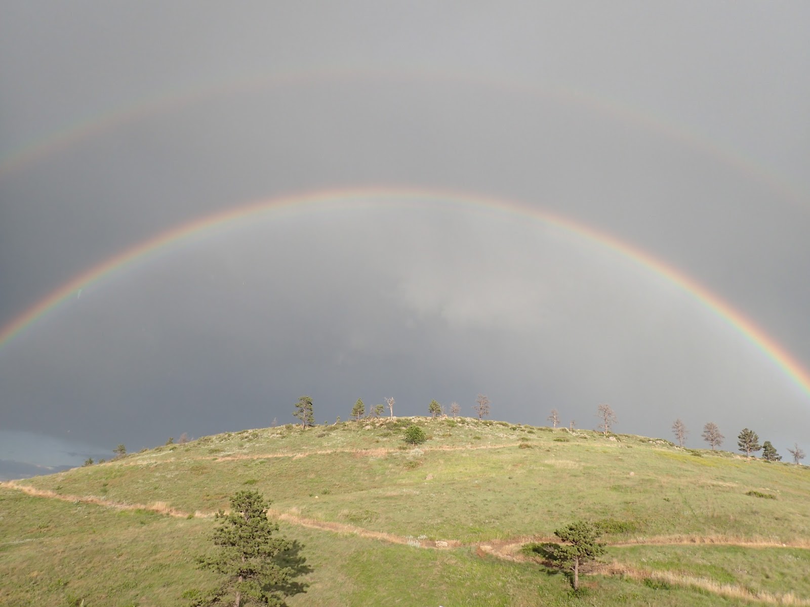
Roads in the Black Hills of South Dakota twist into tattered spider webs of gravel and dirt, beckoning the curious spirit and spilling out into the expansive prairie.  These roads reach deeply into remote, sparsely populated areas to connect with the outside world.  Many were purpose built long ago to log forests or raise cattle and then haul the harvest to town.  Following ridge lines and valleys, they branch and simply dead-end where accomplishing their objective.

Hours often pass, without human interruption, while spinning a bicycle through such country.  But perhaps four or five times over the course of a day, I'm jolted into the here and now by the crunching of gravel and billowing of dust.  In the prairie, or in the Southern Black Hills with its yawning meadows, the approaching vehicle is most likely a truck driven by a local rancher, out working and living.

Out here on a bicycle, I've encountered hundreds of such folks over time, but never a negative one.  Most slow, smile and wave, probably not sure what to make of the sight.  At least one or two, per ride, will stop.  After an introductory "G'Morning!" or "G'Afternoon!" or, yes, "Howdy!" the first question typically is, "Are you okay?"  I assure them that I am just out riding and will safely get home.  With that, most go about their business, leaving me to mine.

That alone is comforting.  That folks out here look after each other, and look after others.  I'm a stranger traveling in a strange way through their lands, yet I know that if I ever needed help out on those roads, the very first person coming by would do so.  Granted, that may take some time, but I won't be abandoned.

It's easy to lose that spirit of humanity, of caring for each other.  As our numbers increase and our institutions expand, our interactions with other diminish, especially with those we don't know.  It's easy to think someone else, or some program, will take care of others.

Riding remote roads reminds me we're here for each other.

Megan Shearer, Pennington County rancher, making sure I'm OK.

Wednesday, April 13, 2016

M-Hill - A Black Hills Jump Start

You're pulling into Rapid City on a road trip, jazzed to start turning pedals.  Maybe you're out here for a mountain bike race like the challenging Black Hills Back 40, the legendary Dakota Five-O, or the NUE guy on the block Tatanka 100.  Maybe it's the Gold Rush Gravel Grinder or the acclaimed 109 mile rails-to-trails Mickelson Trail.  Maybe even the obscure Black Hills BackBone.

But you only have an hour or so right now.  That's plenty of time to jump start your adventure at Hanson-Larson Memorial Park, which locals call M-Hill, right in the middle of Rapid City.  With a box-of-chocolates assortment of trails to sample, you can spin the lethargy out of your legs and stoke your spirit for the miles ahead.  

Here are three of my favorite quick spins on M-Hill.  Each should take less than an hour for most folks, with a generous allowance for taking in the views and stopping for pictures.  Easy to add miles, if you're smiling too much to stop.  Guaranteed that you'll yearn to return.


1.  Silky Smooth (west side climb to the M, to the top, and back)
This is a steady, rhythm climb up smooth, bench cut single track, with rewarding views at every pedal stroke.  As a School of Mines grad, I love to stop at the "M" for the memories and for the vista of the distant prairie stretching toward the Badlands.  A short jaunt to the top reveals Bear Butte to the north, the big granite of Harney Peak, Cathedral Spires and Mount Rushmore to the southwest, and a stunning 360 degree panorama of Rapid City.  After that visual feast, it's smooth, flowing downhill back.  Sure to be smiles all around.
The name, degree and graduation year of every School of Mines grad is cast in metal and set in concrete,
in the "M", or the "S", or the "D".  Looking east to downtown Rapid City and the prairie beyond.
Directions for Silky Smooth.  Start at Founder's Park, cross the bridge, immediate left onto Cowboy Hill Road; continue straight onto T Trail (the road veers right); at the large HLMP sign, continue straight on Far West; right on Sunset South to the "M"; stay straight at the intersection to stay on Sunset South; at a saddle intersection of several trails, left on Sunset North to the top and loop back to the saddle; back on Sunset South to reverse route back to the start.
On Sunset North, almost at the top for the big view and the smooth descent to follow.

2. Rougher Rider  (east side climb to the top and rocky descent)
For the intermediate and advanced rider, this trail bolts right from the gate with five steeper switch backs, then rolls for a bit before climbing looser, rockier, steeper pitches to the top.  A rocky, occasionally armored descent drops back to the rollers to return to the start.  This is a more focused, technical climb and descent that is more like the relatively primitive single track common in the wilds of the Black Hills.  Ride this to know better what to expect for your excursions out there.
On Sunset North approaching Sun Climb, which drops precipitously from those trees.
Directions for Rougher Rider.  Start at Founder's Park, cross the bridge, continue straight onto the paved parking lot; left onto Far East; left onto Lower Wild Turkey; climb to saddle, right onto Sunset North; as Sunset North sweeps left, take the right for the descent on Sun Climb; at the bottom, right on Far East to reverse route to the start.  
Catching your breath on a rare flat dropping down Sun Climb, just after a series of armored and rocky steeps at the top.


3. Into the Valley of Flow (shoulder rolls along the east valley)
This is a series of sweet, twisty rollers on smooth, 38 inch wide bench cut single track.  No sustained climbs.  No real difficult terrain.  Up and down along one shoulder of the east valley, a short switch back laden climb part way up and down one shoulder, more rollers, a short ridge line loop and then back along the other shoulder.  It's where to go when you want more than a single, longish climb and resulting descent and only have an hour or so.  Into the valley of flow.
With the meandering, 8 switchback climb below, a quick descent to the valley awaits.
Directions for Into the Valley of Flow.  Start at Founder's Park, cross the bridge, continue straight onto the paved parking lot; left on Far East; right on Founder's Valley; left on Founder's Valley Connector; right on Far East; left on Horse Shoe; left on Far East; straight through intersection to Sunrise Loop; take left to go on the relatively easier clockwise loop; back at the intersection, left on East Founder's Valley; left on Founder's Valley; left on Far East to return to the start. 
Double rainbow on Sunrise Loop.
Note that the dirt on that side of the valley is nasty when wet.  Practically unrideable.

Yes, M-Hill is single track, but it's primarily IMBA standard, 38 inch bench cut, with 10% maximum grade.  I have ridden all of these routes, and most all of the other trails on M-Hill, on my cyclocross bike with 32 mm semi-slicks, which for me was plenty of tire for Silky Smooth, a bit of a stretch for Into the Valley of Flow (namely, the Horse Shoe loop), and a challenge on Rougher Rider.  If you have a mountain bike, take it.  But you can have a lot of fun on a lot of miles on M-Hill on skinnier tires. 

Finally, don't hesitate to drop me a line.  I'm always up for a ride on M-Hill.