The Cloud Peak 500 is a 500 mile remote road loop in and around the Big Horn Mountains of Wyoming. This post is part of a series that describes some of each day's logistics involved when we rode the route on bicycles loaded for a 7-8 day self-supported tour in early August 2020. It also includes a screen shot and link to a digital map on ridewithgps.com, which I created after the trip to show our ride for each separate day. Finally, it adds a photo gallery. This post covers Miles 251-299 of the route, which was my Day 6. Go to Miles 0-52 for Logistics for Day 1, go to Miles 52-104 for Logistics for Day 2, go to Miles 104-151 for Logistics for Day 3, go to Miles 151-201 for Logistics for Day 4, and go to Miles 201-251 for Logistics for Day 5.
Here we go again. Much like our prior two days, today looks relatively short on paper at 48 miles, but it aggressively climbs about 5,800 feet on dusty roads across exposed prairie, with no trees and no shade. Unlike the prior two days, there is no big summit and no big descent. All day it's sagebrush country until a creek creates a small oasis at the very end. Search that satellite image for signs of anything green. And look forward to another long, hot, dusty, uphill day on an arid mountainside.

We start Day 6 from the village of Ten Sleep at Mile 251 of the Cloud Peak 500. The route repeatedly rolls, mostly up and some down, on paved 434. This is a nice warmup before both the gradient and temperature skyrocket.
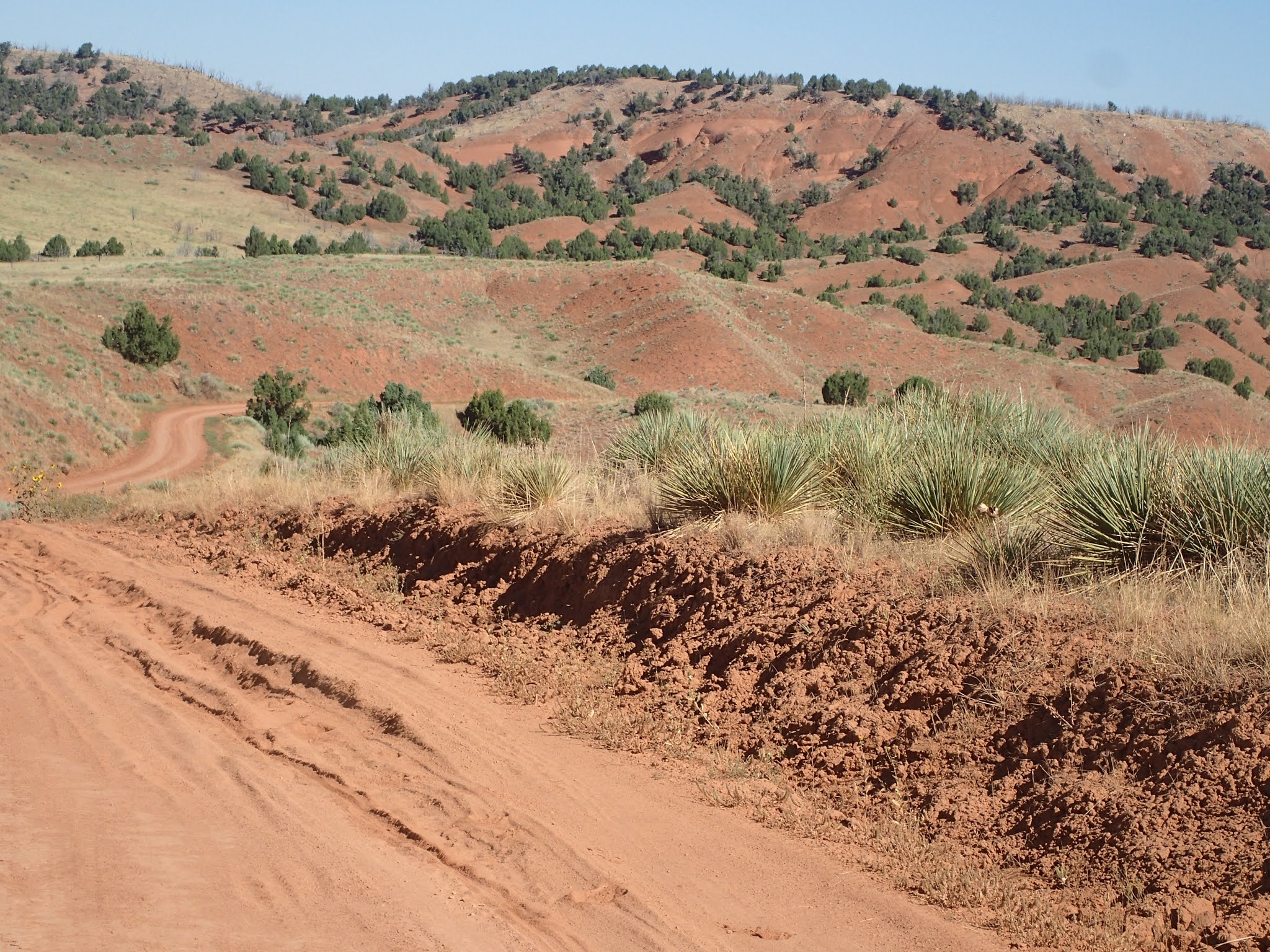
After almost 8 miles, the route turns left onto Spring Creek Road (58), a solid dirt road with some gravel that looks to handle some ranch traffic. Like paved 434, Spring Creek Road repeatedly rolls, mostly up and some down. It's mostly packed dirt, with occasional soft patches. This is the smoothest, fastest rolling start of a day on the route so far.
Spring Creek Road rolls along for about 16 miles to a spot on the map called Big Trails. However, there are no commercial establishments or services of any kind here. Spring Creek Road simply T-bones into another remote dirt road, Dry Farm Road (85).
Now the road softens and reaches for the sky. The next 10 miles on Dry Farm Road climb 2,800 feet on powder dirt roads, with virtually no break. Just steep and steeper. With the soft surface, resistance is high and traction is low. There is no shade and no water. In August 2020, the road was bone dry, dusty and soft, the air was hot, and the wind was calm. In those conditions, in late morning on Day 6 of our ride, I worked over 4 hours to cover those 10 miles. Paul took over 3 hours. Do not underestimate Dry Farm Road.
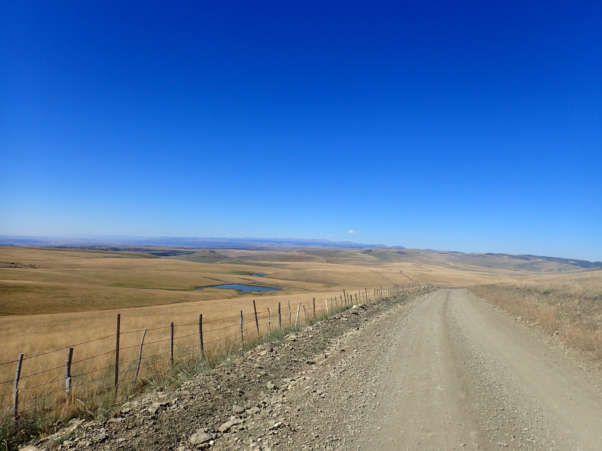
A rolling mile after the big climb, Dry Farm Road T-bones into Hazleton Road (81). A simple wooden sign marks the intersection and provides a sliver of shade. But the climbing isn't over. The next 12 miles roll along a high pasture ridge, gaining almost 1,400 more feet. Finally, at mile 46 for the day and Mile 297 of the Cloud Peak 500 route, Hazleton Road drops precipitously 2 miles down a loose, steep, newly graded switchback.
At the bottom of that pitch, a dispersed campsite sits on the west side of the road, alongside a swift moving Rock Creek. A small corral protects a hand pump that provides water. A little bit further downstream, Rock Creek flows into the Middle Fork Powder River. There, the Bureau of Land Management built a campground, with developed sites, outhouses, picnic tables and water. Both spots provide a welcomed oasis at roughly half-way between the towns of Ten Sleep and Kaycee.
Paul Brasby Photo Album


Craig Groseth Photo Album