The Cloud Peak 500 is a 500 mile remote road loop in and around the Big Horn Mountains of Wyoming. This post is part of a series that describes some of each day's logistics involved when we rode the route on bicycles loaded for a 7-8 day self-supported tour in early August 2020. It also includes a screen shot and link to a digital map on ridewithgps.com, which I created after the trip to show our ride for each separate day. Finally, it adds a photo gallery. This post covers Miles 151-196 of the route, which was our Day 4. Go to Miles 0-52 for Logistics for Day 1, go to Miles 52-104 for Logistics for Day 2, and go to Miles 104-151 for Logistics for Day 3.
Once again, this day looks short on paper at about 50 miles, but it aggressively climbs over 6,000 feet with virtually no shade and much of it on soft roads. The final 15 mile descent is something special, though.
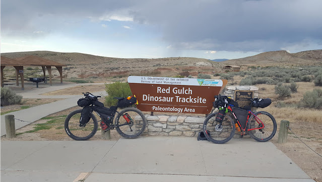
We start Day 4 from the Red Gulch/Alkali Dinosaur Tracksite at Mile 151 at an elevation of about 4,500 feet. The route continues to aggressively climb Red Gulch Road for about 4 miles, then drops about a mile into a dry valley. This mountainside is arid, supporting sporadic grasses, shrubs, and sage brush, as it stretches west to a flat horizon and yearns east to snow capped peaks. No shade. No water.
The road is primarily dirt that is soft, almost powdery. Yesterday's rain firmed up the road surface yesterday, making for faster and easier travel yesterday. All that is gone this morning. It's soft.
Where the road is occasionally more hard packed, it can get rutted by traffic and gullied by rain. However, these rougher sections were relatively few, short, and less work to ride than the soft stuff.
After that short descent to a dry valley, Red Gulch Road climbs over 2,000 feet in the next 10 miles to T-bone into Alkali Road at about Mile 166. This stretch is consistently and aggressively uphill with steeper gradients. The soft surface adds to the challenge. Still no shade. Still no water.
Here at this intersection is a potential bail out point for the day, which I took. More specifically, I turned off the Cloud Peak 500 route here to ride south on Alkali Road (228) about 15 miles to Hyattville and then backtracked about 6 miles to the Medicine Lodge State Archaeological Site. My day's ride is shown in the separate ridewithgps.com screen shot below.
Alkali Road leads into high, forested mountains and must attract more traffic than Red Gulch Road. Riding south toward Hyattville, the road surface is consistently more hard packed, but also consistently has ruts, gullies and washboards. Loose dirt still prevails, however, and it's a quick descent. In general, the terrain is similar to Red Gulch Road, with no shade and no water until entering the Archaeological Site. It's just a lot faster because it's basically one long downhill. Once in the town of Hyattville, I found one commercial establishment, a small bar that claimed to open at 4 pm.
Back at the intersection of Red Gulch Road and Alkali Road, Paul continued on the Cloud Peak 500 route. He turned north on Alkali Road to continue climbing another 1,700 feet in 7 miles, much like the prior 10 miles. Consistently soft and aggressively uphill, with occasional steeper sections. No shade. No water.
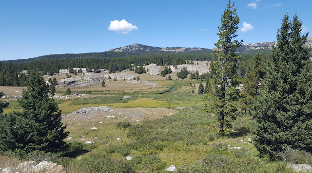
The route then turns south on USFS 17 and soon enters some forest. Finally, there is at least an opportunity of shade. Nonetheless, the route continues to mostly climb the next 10 miles, albeit at a generally lesser gradient.
USFS 17 ends at Medicine Lodge Lakes, which offers water and a popular campground at an elevation of 9,300 feet. Hiking and ATV trails fan out from this area. It's not exactly crowded, but is certainly more populated than the dry prairie below.
From Medicine Lodge Lakes, the route generally descends on primitive USFS 344 south about 7 miles to Cold Springs Campground. After so much climbing in the heat of sagebrush country, this descent through the forest is most welcomed. Pay attention to the route and stay on course. This popular area has many other roads and trails.
Riding through Cold Springs Campground, the route continues on Cold Springs Road (268), dropping almost 4,000 feet in the remaining 10 miles to Medicine Lodge State Archaeological Site. Paul called this the best descent of the entire trip. He warned that the final half mile is steep, loose, rocky and overall reminiscent of Dude's Downhill from Miles 114-122.
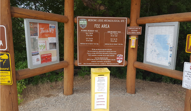
The Medicine Lodge State Archaeological Site is a gem. The petroglyphs and pictographs are fascinating, the displays well done, and the site well maintained. The State of Wyoming also operates a campground on site that is worth the stop by itself. Reservations are required to obtain a camp site, which was completely booked the first weekend of August 2020.
Overall, the route from the Dinosaur Tracksite to the Archaeological Site is about 50 miles and 6,100 feet of elevation gain. For the Cloud Peak 500 route so far, that's about 201 miles/20,900 feet of elevation gain total.
Paul Brasby Photo Album.
Craig Groseth Photo Album.


No comments:
Post a Comment