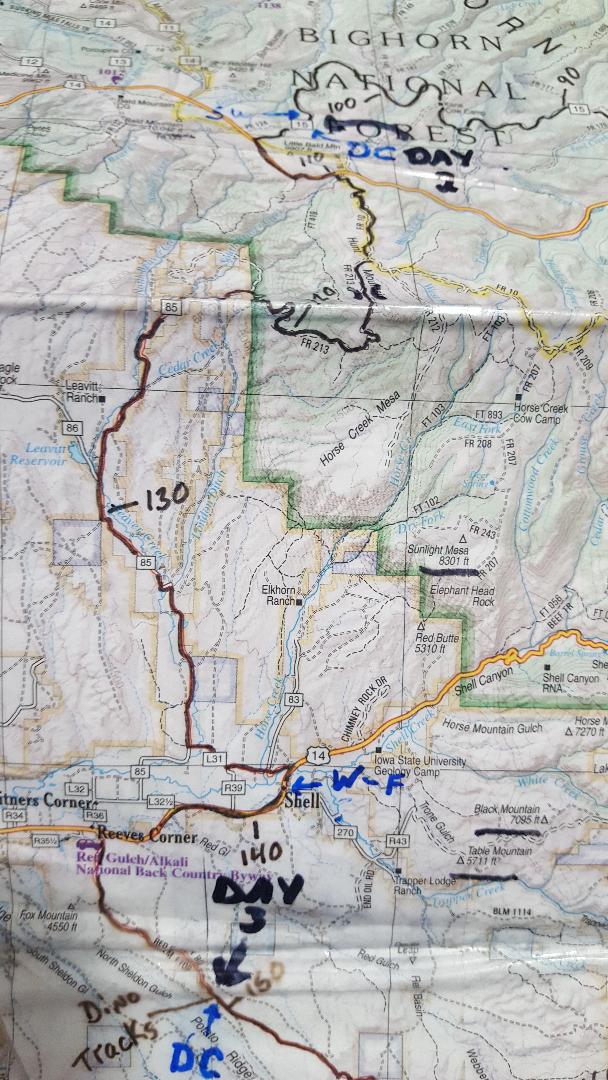
The Cloud Peak 500 is a 500 mile remote road loop in and around the Big Horn Mountains of Wyoming. This post is part of a series that describes some of each day's logistics involved when we rode the route on bicycles loaded for a 7-8 day self-supported tour in early August 2020. It also includes a screen shot and link to a digital map on ridewithgps.com, which I created after the trip to show our ride for each separate day. Finally, it adds a photo gallery. This post covers Miles 104-151 of the route, which was our Day 3. Go to Miles 0-52 for Logistics for Day 1 and Miles 52-104 for Logistics for Day 2.
A cursory look at the route profile today suggests a relatively flat 12 mile start, a quick 15 mile descent, and a flat 20 mile roll-out to the finish. Easy-peasy? Don't believe it.
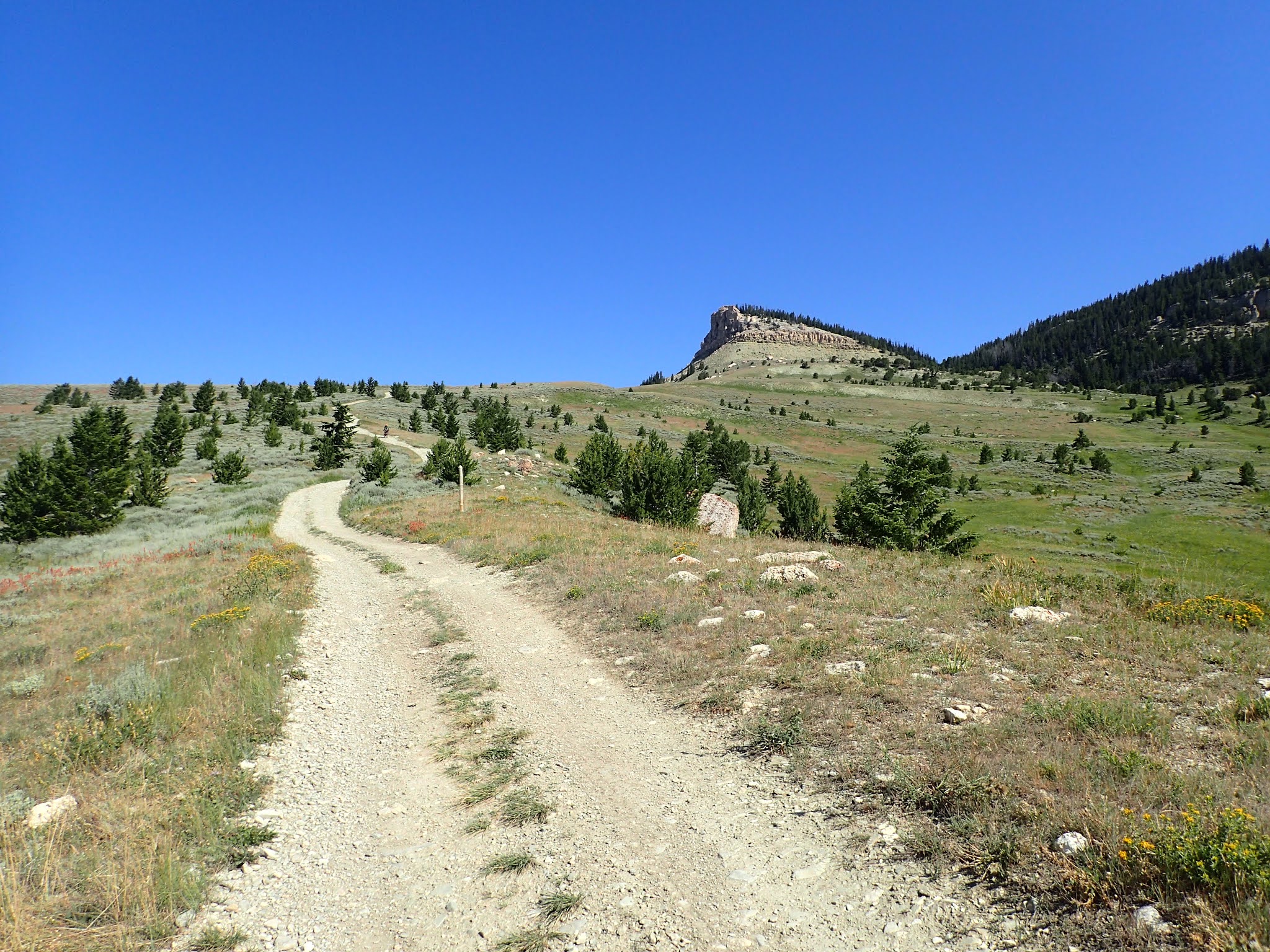
We start Day 3 from a dispersed camping site just off of USFS 15 at about Mile 104 on the Cloud Peak 500 route. USFS 15 gradually climbs on good gravel for about 3 miles to paved U.S. Highway 14. From this spot at about 9,250 feet, we obtain cell phone coverage for the first time since early on Day 1. The paved road climbs steadily for about 2 miles and then sharply descends for about a mile to Hunt Mountain Road (USFS 10). More dirt than gravel, Hunt Mountain Road climbs briskly through alpine grassland to about 10,000 feet, with big views to the east. After about 4 miles, the route turns onto primitive USFS 213, which starts rough and gets rougher ahead. After a couple of miles, the route flattens and delivers drop-off-the-earth views to the west.
Now, for Dude's Downhill. That's what I call the next 8 miles of steep, loose, rocky, narrow, twisting double track ahead on USFS 213 from about Miles 114-122. This is the most technical stretch of the Cloud Peak 500, by far, and is certainly full-on, gonzo downhill, mountain bike territory. Some stretches flow for a little bit, but often just enough to build speed to bounce through the next rock garden, plow into the next sand pit, or overcook the next hairpin turn. I would not wish to ride this at the end of the day when tired and certainly not in the dark. Your technical skills and risk assessment will certainly vary. Know that emergency extraction would be long and difficult.
At about Mile 122, the route turns onto good gravel on Beaver Creek Road (85), emerges from the forest, and enters open grassland again. It drops into a small valley, climbs out, and then generally descends to the small town of Shell at about Mile 139. This stretch is exposed to the elements. We certainly were hot in late morning August 2020, even though riding mostly downhill.
Shell offers the recently renovated Shell General Store, with a nice assortment of snacks and a full on bistro. It's also the first commercial establishment since Bear Lodge Resort at Mile 82 and the last one until the town of TenSleep at Mile 251. After lunch, we wash off 3 days of gravel, dirt and dust at a water pump out back. We love this place and the people working there.
The Cloud Peak 500 rolls west out of Shell on paved U.S. Highway 14 for about 5 miles to Reeve's Corner. It then turns south on Red Gulch Road (BLM 1109), also called Red Gulch/Alkali National Back Country Byway. At this intersection, signs warn of the rough, rutted, remote roads ahead and that travel is not advised when wet. Believe it. When wet, this road will stick to everything and stop a bike cold. Fortunately, the heat and wind quickly dry everything. On a hot August day in 2020, I was able to ride about 20 minutes after a hail storm.
From the pavement of U.S. Highway 14, it's about 5 miles of very gradual uphill to the Red Gulch Dinosaur Track Site at about Mile 151. This site has 2 covered shelters, each with 3 picnic tables, and outhouses, but no power and no water. One can read some informational displays about the dinosaur tracks and walk right down to them.
Overall, the route from Elk Meadows to Dino Tracks is about 47 miles and 3,000 feet of elevation gain. For the Cloud Peak 500 route so far, that's about 151 miles/14,800 feet of elevation gain total.
Paul Brasby Photo Album.
Craig Groseth Photo Album.


No comments:
Post a Comment