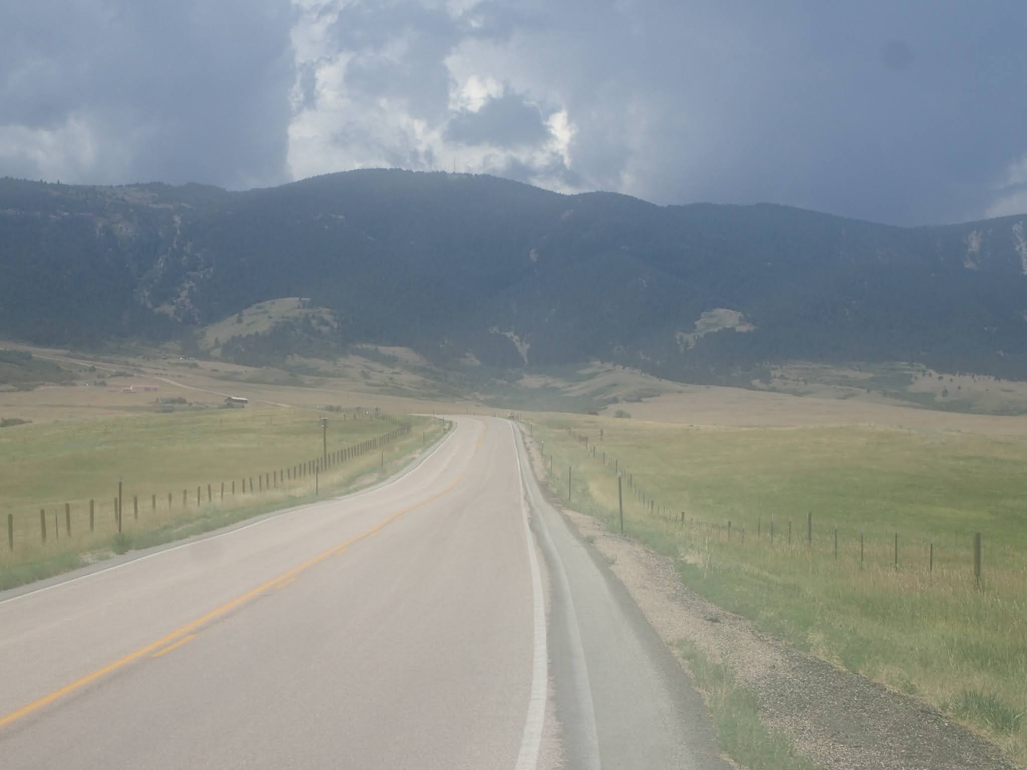
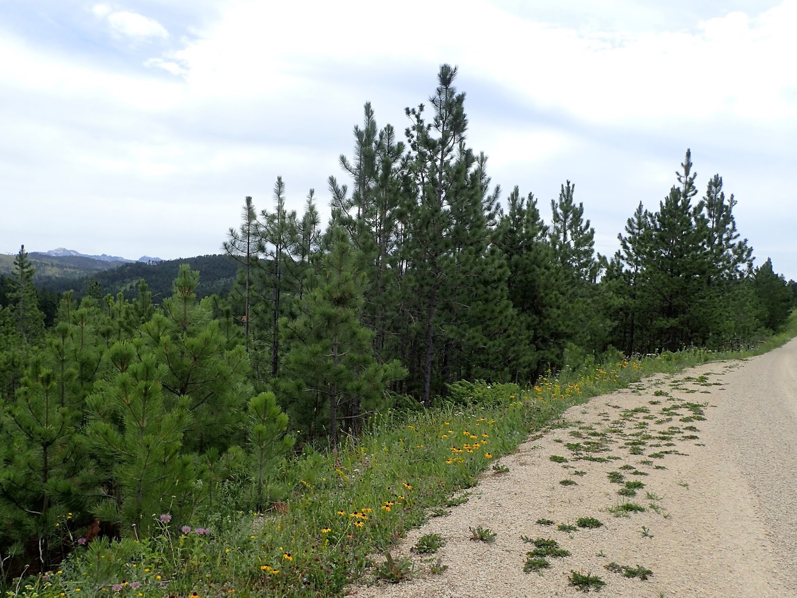
The Cloud Peak 500 is a 500 mile remote road loop in and around the Big Horn Mountains of Wyoming. This post is part of a series that describes some of each day's logistics involved when we rode the route on bicycles loaded for a 7-8 day self-supportedtour in early August 2020. It also includes a screen shot and link to a digital map on ridewithgps.com, which I created after the trip to show our ride for each separate day. Finally, it adds a photo gallery. This post covers Miles 0-52 of the route, which was our Day 1.
The Cloud Peak 500 starts and ends in downtown Sheridan, Wyoming, which offers many motels and restaurants. In fact, Paul stayed across the street from the start/finish at the America's Best Value Inn. He also obtained permission from the motel manager to leave his truck there for the next 7-8 days during our trip. I stayed a few miles to the south in a Day's Inn. Both worked. The night before the start, we met for dinner at Ole's Pizza & Spaghetti House, which sounded fun but received ho-hum reviews from my wife and daughter. I thought the burgers and fries were good.
Onto the route, the Cloud Peak 500 starts in downtown Sheridan on East 5th Street in front of the Health Nut & Wellness Center and simply heads west out of town on 5th Street. Do not underestimate or overlook the 34 miles to the town of Big Horn, which took us about 5 hours to ride. Right from the start, the route goes uphill. Soldier Creek Road (74) turns to good gravel, but is uphill for much of the 15 miles to Beckton Road (89). South on Beckton Road (89) rolls more often, up and down, but occasionally the grades are steeper and the road surface softer. Then Big Horn Road (99) has pitches even steeper and softer, although they are not long. The generally downhill final 4 miles into Big Horn are a pleasant break. There is no shade or wind break on any of it. There are no services of any kind, either. By mid-morning, it was plenty hot.
In Big Horn, we found two commercial establishments on the route, both of which were closed until 4:00 pm. That wasn't much help at noon. One, a restaurant sporting a misleading "Big Horn Mercantile Co." sign, was receiving a delivery and the cheerful delivery person managed to convince a reluctant employee to allow us to refill our water bottles from a bathroom. Then, as we were leaving, I heard the restaurant manager say, "Lock the door, so no one else tries to come in." So, I would not depend on water from those two businesses in Big Horn. In contrast, throughout the entire remainder of our week long trip, all the other locals we encountered were fantastically friendly and helpful. I would not hesitate to ask for water from anyone passing by in any kind of vehicle. I also would not hesitate to knock on a door to ask for water.
Turning south and then west out of Big Horn, the route passes some houses while climbing steadily on pavement and then gravel. The good surface, and the steady, significant climb, continue until about the first big switchback. Then the road points decidedly upward and the road surface gets softer. The next 5 miles or so throw some of the steepest pitches of the entire 500 mile route, including one that reportedly is 19 percent. The road also enters Big Horn National Forest, where it is less developed and less maintained. After that stretch, the road still climbs, but at a lesser gradient and with a few short breaks. Finally, near the end of the day, trees appear for the first time other than around Big Horn.
From Big Horn, the route climbs about 4,300 feet in 18 miles to USFS Ranger Creek Campground, again with no commercial establishments of any kind en route. Once there, Ranger Creek Campground has drinking water, an outhouse and camp sites with picnic tables and fire grills. We camped there at the end of our Day 1.
By the way, some maps show a "Big Goose Campground" at this place. On site, the USFS campground is signed as "Ranger Creek Campground," while an adjacent building site is signed as USFS "Big Goose Ranger Station." To add to the confusion, the USFS map for Big Horn National Forest shows 2 different campgrounds identified as "Ranger Creek Campground." The other one is located about 15 miles due west near the Adelaide Trailhead leading into the Cloud Peak Wilderness Area.
Overall, the route from Sheridan to Ranger Creek Campground is about 52 miles and 6,800 feet of elevation gain. For the Cloud Peak 500 so far, that's about 52 miles/6,800 feet of elevation gain total.
Took my love, I took it down Climbed a mountain and I turned around And I saw my reflection in the snow covered hills 'Til the landslide brought me down
Landslide, Stevie Nicks (1975).
A warm sunrise awakens a clear blue sky. Ahead lies 500 miles of remote back roads repeatedly snaking up and down the imposing Big Horn Mountains of Wyoming. Months of preparation lead to downtown Sheridan for a weeklong bike packing trip on the Cloud Peak 500, a unique route created by locals Sarah Wallick and Aaron Dernberg. Cycling friend Paul Brasby of North Platte, Nebraska arranges valuable vacation time to join. Expectations could not be higher.
Eight hours later, I hit bottom. Hard.
The end of my Day 1. Maybe the end of my trip. Maybe even the end of my bike packing.
Early morning on the first Wednesday of August, Paul and I ride to the start of the Cloud Peak 500. Our bikes are loaded for 7-8 days of self-supported bike packing and we're jazzed to finally get started. On that first day, we aim to reach USFS Ranger Creek Campground at Mile 52, but would love to continue to USFS Dead Swede Campground at Mile 72. Let's ride!
With all the food, camping gear, clothes, repair tools, and especially water, Paul's 19 pound uber-bike, a new carbon Salsa Cutthroat, now weighs 72 pounds. I purposely do not weigh my steel Jones 29+ bike, but it is noticeably heavier. It all adds up, especially since I'm determined to ride self-supported, including carrying food for the entire trip. As we learn, that's a lot of weight to be lugging up the long, steep, rough climbs ahead.
Paul Brasby and Craig Groseth in downtown Sheridan, Wyoming on Day 1.
Right from the paved start in downtown Sheridan, the Cloud Peak 500 points uphill. Foretelling the ride ahead, Paul immediately pulls away as we climb our way out of town. Settling into a sustainable rhythm, I know that the general profile of the route shows a meandering 34 miles of gentle prairie gravel to the town of Big Horn, where the big climb up Red Grade Road effectively begins.
Wrong.
Those first 34 miles indeed start with a few miles of pavement and then a few miles of fast gravel. But even with the good road surfaces, we're working hard to pull our loaded bikes uphill. Turning southward, Beckton Road (89) gets lumpy in a hurry and then Big Horn Road (99) gets downright grumpy. Rutted, loose, dirt steeps demand maximum effort in my lowest gears just to stay upright. Eventually, I'm off the bike, pushing it up another steep.
I glance at my cyclometer. Mile 19. I'm walking at Mile 19. Out of 500. And the big climb today doesn't even start until after mile 34. Oh, man. I scramble to extinguish the brush fires of doubt popping into my mind. Keep moving.
Foreshadowing many, many miles ahead, Paul waits while Craig crawls up a shadeless, exposed, rocky climb en route to Big Horn. (photo by Paul Brasby)
Stopping for a moment, I see another cyclist riding up to us. Who could possibly be out riding this forsaken road in the gathering heat of a Wednesday morning? It's none other than Sarah Wallick, one of the creators of the Cloud Peak 500 route, out for a ride on the course. How cool is that?
Sarah excitedly peppers us with all sorts of questions about our plans and checks out our bikes and gear, before zipping off toward Red Grade Road for her climb of the day. Well after she disappears up the road, her enthusiasm, good cheer and spunk linger. What a treat! Thanks, Sarah!
Who's that flying up to catch us? None other than Sarah Wallick, co-designer of the Cloud Peak 500 route, out for a ride.
After 5 hours of hard pedaling, we finally limp into Big Horn. I am beat. Even though we've ridden only about 34 miles, we've already climbed over 2,500 feet on some pretty rough roads on a hot morning. This aggressive start crosses the thin line between warming up and wearing out.
It's far past time for a long break. I need to cool off, drink a boat load of water, eat a ton of food, and just get off the bike for awhile. But the pickings are slim in Big Horn. The route passes but two commercial establishments, neither of which open until 4:00 pm. We scrounge for some water, eat an energy bar and search for shade. Red Grade Road looms on the horizon and in my darkening thoughts.
A short, sweet stretch of downhill gravel early on Day 1. (photo by Paul Brasby)
Our lofty early morning thoughts of reaching Dead Swede Campground at Mile 72 dissipated hours ago in the morning hills and heat. Indeed, we're still about 18 miles and 4,300 feet of elevation gain just to reach Ranger Creek Campground at Mile 52. Normally, that would be challenging. Right now, it's daunting.
With every mile hard-earned and with many more ahead, I'm not enthused about riding off route in search of some refreshments that may or may not even be available nearby. So, we soft pedal out of Big Horn to start the climb, with just a bit of the edge removed from the heat, thirst, hunger, and fatigue.
Big mistake.
Soft, rough, exposed uphill dirt road leading to Big Horn. (photo by Paul Brasby)
As soon as the road leans uphill, Paul spins off into the distance. He looks good, perhaps a normal-tired for the effort so far, but determined to keep pedaling. It's a hard day right out of the blocks, even harder than expected, and he's working through it.
I'm relieved to see Paul moving well, but I am not. I pedal, but at a snail's pace. No power at all. I am empty. There's nothing there. No legs. No lungs. No heart. Nothing.
Just 2 miles out of Big Horn, I spot a final sliver of shade before miles of sun-scorched climbing. I stop to re-set mind and body. I get off the bike and lay down. This got ugly quickly.
Red Grade Road turns to gravel around that curve. No where to go but up.
I eat a few bites of an energy bar, but I'm cratering. What I really need is a big, immediate calorie boost. Where's that Hammer Gel? Pillaging through my food bag, I find 3 empty flasks that should contain 5 servings of gel each. Oh, man. In my early morning excitement, I forgot to fill them. Instead of a boost, it's a body blow.
I inhale a couple of shots of peanut butter, grab some beef jerky and plow up the road after Paul. For the next hour or so, it looks and feels like I'm pedaling in place, on a constant incline, in an oven. I work hard, but the road doesn't change and the mountains don't get any closer. It's like the entire road is one giant set of rollers and the mountains are a painting on the basement wall.
Enough. I need a different mental picture. I dismount, drink more water, and lean over my bike. After a few minutes, I pedal again. Too soon thereafter, I dismount again. After a few minutes, I pedal again. Repeat. Repeat again. To keep moving, I force myself to ride a mile before stopping. That works once. Then it's half a mile. Soon I'm walking. Then I'm not. I'm in free fall.
Red Grade Road. (photo by Paul Brasby)
I plop down in the ditch, in the sun. Like a bad dream, I can't move. I can't think. I am physically, mentally and emotionally empty. I have nothing left. I'm done.
My dreams of this day, of riding the Cloud Peak 500 route, of riding the Great Divide, of bike packing anything, all come crashing down. All of it. All buried in a landslide of utter fatigue and crushing doubt.
Negativity floods my addled mind. I can't even ride one day. I can't do this. I can't do anything like this. It's not in me.
Red Grade Road, reportedly 19%. Looks like an Evel Knieval launch ramp. (photo by Paul Brasby)
Stop. I force myself to think through options. First and foremost, I work through how to make it under my own power to the Ranger Creek Campground, still about 11 miles and 2,500 feet of elevation gain to go. Even under these circumstances, I believe I can make it, after some rest, cooling, food and water. It may be well into the evening, maybe even after dark, to get there. So, what? I can do this. I've finished plenty of long, hot, one day events well into the night and even into early the next morning.
But, Craig, this is not a one day event. You plan to ride 6-7 more days, none of which are much different in distance or elevation gain than today. What about tomorrow? And the next day? And the next?
I don't know. I really don't know. How does this work? How do I make this work? What if I somehow manage to power through today? What then? Eventually, I painfully conclude that recovering from such an effort would take more than one short night. Finishing this day would jeopardize tomorrow for sure, and maybe the rest of the trip.
At that moment, I realize I'm kidding myself. Even with a significant break, I seriously doubt that I could cover another 11 miles straight up and then repeat that effort every day for another week. No chance. This trip is toast.
A stray thought from the depths suggests that I call my wife Colleen, who was still in Sheridan for the day, to come pick me up right there. NO! Then another says to just coast down to Big Horn for Colleen to pick me up there. NO! Piling on, another says to do nothing at all, just sleep there in that ditch until I have the strength to continue, whether up or down. NO! But it's relentless. As soon as I extinguish one, another flares up. Even when I regain my bearings for a moment, I berate myself for even having such thoughts.
It's a brutal battle in a sun baked ditch.
On Red Grade Road looking back toward Big Horn. (photo by Paul Brasby)
As I drown in doubt and despair, a local in a pickup truck pulls up to ask if I need help. The heavens part to reveal another option. Accept a lift from this Good Samaritan to the Ranger Creek Campground, recover as best I can tonight, and start again tomorrow. Live to ride another day. More accurately, live for the possibility of riding another day.
That's what I do, because I conclude that's the only way I have any chance of continuing this trip. In a surreal moment, I accept a lift in a truck to the end of the day's planned ride.
Along the way, we stop to check on Paul, who has worked his way up the first big switchback. He's still engaged in the heat of the battle on that monster climb and is determined to keep riding. We agree to re-connect at the Ranger Creek Campground at Mile 52.
Paul works his way up Red Grade Road, leaving Big Horn far behind and far below.
(photo by Paul Brasby)
After a bittersweet ride as a passenger, I unload at the Ranger Creek Campground, scout it out, select a site, and take a nap. About 3 hours later, Paul pulls in. Somehow, he manages to ride the entire 52 miles from Sheridan, gaining over 6,800 feet in elevation, on that fully loaded bike, over those rough roads, in that heat, in an 11 hour day. He even endures a 30 minute hail storm late on that big climb. Amazing. Simply amazing.
But Paul doesn't celebrate. He's rightfully concerned about me and the rest of the trip. So am I.
We talk about the day and the days ahead. I did climb over 4,200 feet in 41 miles of rough roads today. That's not nothing, but it's also not enough. I dump everything out to try to sort through it. But I'm an emotional mess incapable of thinking rationally to put it back together. I can't make sense of the day. I can't decide what, if anything, I am capable of riding tomorrow. Maybe nothing at all. I ramble on and on. I don't know what to do. I don't know what to think. I don't even know where to start. I'm on an endless loop monologue.
Paul listens patiently. I'm certain he wonders what he got himself into. Exasperated with myself, I finally ask him point blank what he thinks. I will forever remember Paul's response, "Craig, you're a cyclist. You've finished rides that I couldn't. You've finished ahead of me on rides I could. You just have to decide what you want to do."
To a guy with his confidence buried in a ditch near the base of the Big Horn Mountains, Paul's simple acknowledgement of our prior experiences calmed my internal torment. I'll find a way.
USFS Ranger Creek Campground at the end of Day 1.
Almost immediately, I map out a plan that requires no conclusions and no decisions at the moment. Tonight, I will stop analyzing and just eat, drink and rest. Tomorrow, I will pack up my bike and continue on the Cloud Peak 500 route from the Ranger Creek Campground at Mile 52. I will climb another 2,000 feet to Dead Swede Campground at Mile 72, roll into the Bear Lodge Resort at Burgess Junction at Mile 82, and then assess the future of this trip. It could be a coast down Highway 14 toward Sheridan for pickup by Colleen. It could be a night at Burgess Junction. It could be continuing on the Cloud Peak 500 route further into the Big Horns. It could be an option yet unknown.
Tomorrow will tell.
Landslide, Fleetwood Mac (1975), performed by Stevie Nicks (2009).
Once committed to commuting by bike (see prior post Commit), the next step is to find a go-to route. One route to go to work. One route to go home. They may be the same, but not necessarily.
You may have many, many options. You may have only a few. But seek that go-to route. And find it now before the weather turns cold. By then you'll be ready to take on the Icy Bike Winter Commuting Challenge. Icy Bike Challenge.
Riding to work on a quiet fall morning along the Rapid City bike path. That's the southwest side of M-Hill in the background.
Start with safety. Part of the magic of bike commuting for me is the relaxing ride into work in the early morning, my favorite time of the day, and the decompressing ride from work, to leave work at work. This magic has a chance to happen when the route is safe.
So, I look for a go-to route that carries little to no traffic. That probably won't be the most direct route and almost certainly won't be the one you drive. Absent a bike path or lane, look for wide shoulders, good sight lines, lower speeds, lower volume, well controlled intersections, and minimal driveways to parking lots and houses. If there's any traffic on your route, you want to be able to see it and hear it, especially at intersections. Assume no driver sees you.
Avoid routes that lead directly into low sun, which blinds everyone. If needed, change routes with the seasons, or change your time of day on that route. Do what it takes to avoid riding into that low sun.
My path home. Memorial Park looking west toward M-Hill. Yes, that's a white concrete "M" on that hill, representing South Dakota School of Mines and Technology.
My most direct, car-driving route to work is less than 4 miles, mostly on a busy 4 lane road with 50+ mph traffic and a narrow shoulder. The rare occasion I bike commute on that road is not all that relaxing or safe. Over the years, drivers have buzzed me, swerved toward me, honked at me just as they're passing, screamed at me, and even hit me between the shoulder blades with a thrown soda. Most drivers are fine, but all it takes is one. I don't ride that road very often.
However, if I'm running late, riding in before traffic, or facing particularly nasty weather, I may ride that road, or a portion of it anyhow. Typically, after about 1.5 miles, I jump onto a bike path for most of the remaining 2.5 miles. That takes the edge off a bit.
My go-to route is longer, more like 6 miles, but much more relaxing. And that's some bonus time on the bike. Here in Rapid City, a bike path follows Rapid Creek through a continuous ribbon of parks spanning the width of most of the city. From home, I meander through quiet neighborhoods for over a mile in the wrong direction before eventually hopping on the bike path. Then I ride the well-maintained bike path winding all the way to downtown.
My go-to route is embarrassingly easy and safe: mostly bike path, separate from traffic, relatively short, flat, protected from the worst of the wind, and scenic. The city even plows the bike path promptly after our frequent snow storms. I really don't have a reason not to ride every day.
Detour on some skinny dirt roads on Skyline Park right by downtown. I took this picture one day taking "The Long Way Home."
Of course, I don't ride the same route every day. I've found many alternatives, including some stretches of gravel alleys and limestone paths. Also, with M-Hill and Skyline Park right by downtown, I can catch some amazing single track on my ride home. And there's always Skyline Drive for some fast, curvy pave, if you're willing to climb a bit. (see prior post The Long Way Home).
In any event, all those alternatives come with time. The starting point is finding a go-to route to get to work, ready to work, and a go-to route to get home, dropping work along the way.
First, commit. Then, find your way.
Getting ready to roll some ridge line pave on Skyline Drive on a "Long Way Home."
Addendum for those with a "too long" commute: It doesn't have to be all or nothing. That is, if your commute is too far to ride your bike, create an alternative. One way is to drive some and ride some. For many years in Denver, I enjoyed a 27 mile one-way commute that I would ride on occasion. Typically, however, I drove 10 miles of busy roads to a public transportation park-n-ride, where hundreds of train commuters parked their cars all day. From there, I rode on a bike path winding 16 miles along the South Platte River, leaving but a mile in traffic across downtown Denver. Find your way.
It's been such a long time I think I should be goin', yeah And time doesn't wait for me, it keeps on rollin'
Long Time, Tom Scholtz, Boston (1976)
After moving back to South Dakota, I raced the Dakota Five-O three times in the 00's on my rigid single speed. Drifting away from mountain bike racing, I have not returned since 2009. Now, the 20th Anniversary edition beckons. I think I should be going. Yeah.
Back on the Dakota Five-O course in 2020.
The Dakota Five-O is the event of the season for Black Hills mountain biking. Hundreds of avid mountain bikers from 30 states flock to Spearfish, South Dakota every Labor Day weekend, eager to take on 50 miles of sweet, singular, sumptuous single track. Race Directors Kristi and Perry Jewett amp up the enthusiasm with Smokey The Bear at the start, boisterous volunteers at the aid stations, and many others joining racers at a rollicking after-party featuring live music, local micro-brews, catered dinner, kids' races, and generous prize drawings. All in all, it's the annual Black Hills par-tay for mountain bikers.
This year, Kristi and Perry reluctantly cancelled the Dakota Five-O due to COVID-19 virus issues. Although the event would not happen in person, they announced a virtual one. Cyclists could ride any 50 mile mountain bike ride on their own schedule, submit documentation, and be eligible for prize drawings. In a classic turn-of-phrase, the Jewett's tab the virtual event as the DaCOVID Five-O.
What about just riding the actual race course? Well, a freak summer tornado wiped out thousands of trees that blocked many miles of the course. To open as much as possible, Kristi and Perry, along with the Ridge Riders Mountain Bike Club, rousted a big crew to clear debris, create detours, and mark intersections. They also distributed digital maps of the re-routes so that folks could ride the actual race course on their own time, if desired.
Well, alrighty then. Let's ride.
The Ridge Riders have actively built and maintained trails in the Black Hills for over 20 years.
So, early Saturday morning, I head to the start at Spearfish City Park. With forecasts approaching 100 degrees and no aid stations on the fifty mile course, I want to knock off much of that initial 2,500+ foot elevation gain before the heat hits. Others must think the same, as the parking lot is sprinkled with cyclists at a dark 05:30.
I don't wait for the sun. The first several miles pass through town and then a graveled Tinton Road before finally jumping onto the legendary Tinton Trail. The sun can meet me there.
Winding up Tinton Trail, I quickly re-discover that climbing skinny single track requires an endless series of short bursts of energy. I've been away from this too long. Although I work to develop a steady effort, the trail dictates what it takes to clear each pitch. All those miles of steady, rhythmic pedaling on gravel do not help much for what effectively is hundreds of short intervals.
As I seek my pace, a parade of others catch up. Energetic locals Lucas Haan and Bob Prann stop to check on me, before vanishing up the hill. Shortly after, spunky Spearfish sisters Jen DeHueck and Kim Kinney fly by with good cheer and encouragement. Later, I meet Tony and Sullivan Graham, a father-son team from Minnesota, testing themselves on the Five-O course on their first trip to the Black Hills. Over the next few hours several others also pass, including a festive group of 8 from Colorado. It's nowhere near a normal Dakota Five-O, but I'm not alone out there.
Bob Prann and Lucas Haan are all smiles riding up Tinton Trail early on the Dakota Five-O course.
Eventually, the trail starts a roll a bit. Good. It's heating up quickly as I pass what would be the Old Baldy Aid Station at about Mile 22. I miss the enthusiastic volunteers and the brief interactions with other riders. On this day, I also miss the chance to cool off by dumping water over my steaming noggin.
Leading into that Aid Station, the traditional Five-O course bounces over rock-infused single track through an aspen forest. Not today. Even with logging crews feverishly working to salvage lumber from that tornado and the Ridge Riders clearing miles of trail, this part of the course could not be opened by race day. So, we bypassed the havoc with a re-route on some rock-infused double track.
For those out riding the Five-O course, all those piles of chain-sawed trees along the trail were cleared by someone working to make your ride possible. And that someone was likely Kristi and Perry Jewett, the Ridge Riders, and lots of other volunteers. That's why you support your local people and groups improving your community. That's why you ride the Dakota Five-O and, this year, the DaCOVID Five-O.
Some of the tornado damage in the aspen forest around the Old Baldy Aid Station.
Now, it is hot. No getting around it. No getting out of it. I leap frog with a few others and stop at a sign for a half-mile detour off-course to the Iron Creek Lake Campground & Store for re-supply. With every mile hard earned, I cannot bring myself to add another, not even one. That is a mistake.
Although the finish lies far below, I still have at least two significant climbs ahead, plus some inconvenient bumps. But at about Mile 29, the course turns decidedly downward for a welcomed 5 mile drop on new single track. Ridge Riders will laugh, but that sweet stretch of single track is new to me. The last time I rode this course in 2009, that stretch dropped down a gravel road.
At the bottom of that drop normally would be the Ball Park Aid Station. It's really too bad to be empty now, as the next climb is the hardest of the day, about 700 feet of elevation gain in the first mile and more after that. I could use a cold dousing and a longer break. I stop briefly for a gel and check water. It's getting low, but OK. I start up.
No bacon. No station. Very sad.
This climb turns brutal. Accumulated fatigue from hours of effort, the oppressive heat, and now the relentless pitch of this climb drag me down. Yes, it is relatively short. But not short enough. I end up taking several breaks and walking part of it. But I finally summit.
Somewhere in the wind, I hear cheers at the Bacon Station. Party hearty volunteers at this quasi-aid station have handed out bacon strips and cold beer to racers since the very beginning of the Dakota Five-O. If nothing else, their enthusiasm and encouragement injects a powerful boost at a desperate time. As I ride past the famous spot, the spirit of the Bacon Station spirit conjures a much needed smile.
2020 DaCOVID Five-O. A missed turn and a warmdown pushed it over 50 miles.
The rest of the ride is a hot, tired blur. I ration water and energy. I seek shade for frequent breaks, even downhill. Maybe especially downhill, as the risk of crashing is certainly greater when this tired.
Coasting down Tinton Road back to Spearfish, I realize the wind is not cooling me down. I am way overcooked. On pavement near the finish, the course passes through a neighborhood with a final uphill for a block or two. I drop another gear, and my head, and plod forward. I must look pretty beat. Abruptly, a voice belts out, "You're doing great! You're almost there! At the top, you'll be shouting 'WHEEEEE!' to the finish! GO! GO! GO!" It was a woman in her front yard on that final hill, cheering me on.
Nothing virtual about that.
Thank you, Kristi and Perry Jewett for making the most of the situation by hosting the DaCOVID Five-O. Same for the Ridge Riders and the other volunteers that made all this possible. And thank you all for 20+ years of serving the cycling community.
Country roads, take me home To the place, I belong South Dakota, Black Hills gravel Take me home, country roads apologies to John Denver, Take Me Home Country Roads (1971)
Another season of the Black Hills Gravel Series brought together a growing community of cyclists to share their love of riding remote roads. The Black Hills Gravel Series attracts all kinds of folks, from young to old, beginner to veteran, novice to expert. It's a community treasure, created and nurtured by the indomitable force of nature known as Lucas Haan.
Behind that friendly face, Lucas Haan is constantly cooking up amazing Black Hills Gravel routes.
This fourth season offered seven start locations scattered throughout the Black Hills area, each with a Green route (easy 10-15 miles), Blue route (moderate 20-25 miles) and Black route (difficult 45-55 miles). Generally, the Green routes not only are the shortest, but also have fewer, easier hills and better road surfaces. The Blue routes basically double the number of miles, as well as gain more elevation on less developed roads. The Black routes double the miles again, gain even more elevation on more difficult climbs, and often include stretches of "roads" that challenge even the most accomplished cyclist.
To keep the good times rolling all summer long, Lucas released the routes about once a month from March through August. Even with the popular group starts and after ride gatherings canceled due to COVID-19 concerns, folks eagerly anticipated the announcement of the next route, rode their chosen distance on their schedule, and shared their experience on social media. With this regular Black Hills Gravel connection, our local gravel community not only survived, but thrived throughout this season.
Here's a snapshot of each of the seven Black routes of the 2020 Black Hills Gravel Series. The first three ventured into the rolling prairie surrounding Piedmont, Sturgis and Spearfish. The next four dove deeply into the Black Hills from Custer, Merritt, Hill City and Rochford. Each route offered a unique mix of fast gravel and lumpy dirt roads, with the Black routes adding a little something extra, like some rocky two track, gutted ATV trail or overgrown single track. All are creative, memorable routes worthy of riding again and again. Thank you, Lucas, for another season of Black Hills Gravel!
2020 Black Hills Gravel Series #1 (Piedmont)
The Black Hills Gravel Series kicks off in late March with a prairie ride east and north out of Piedmont. In brilliant sunshine, 60 degrees and little wind, cyclists fly over dry, hard, fast gravel, if a little rough from our snowy winter. It's a great spin fest to start the season. (2020 Piedmont Photo Album).
Bear Butte looms on the horizon early on the Piedmont route.
2020 Black Hills Gravel Series #2 (Sturgis)
Just three days after a foot of fresh snow in early April, the Black Hills Gravel Series streaks back into the rolling prairie, this time north and east out of Sturgis. Surprisingly, cyclists revel in sunshine, light winds, 40-50 degrees and hero gravel everywhere. Everywhere, that is, except a mischievous 3 mile Minimum Maintenance Road filled with snow, ice and mud. Well, alrighty then! Let the infamous route twists on the Black Hills Gravel Series begin! (2020 Sturgis Photo Album).
One mile into a three mile stretch of ice, snow and mud on the Sturgis route. Otherwise, it's hero gravel all day.
2020 Black Hills Gravel Series #3 (Spearfish)
Building momentum for upcoming rides deep into the Black Hills, the Black Hills Gravel Series adds longer and steeper climbs on the next ride out on the prairie and surrounding hills from Spearfish. Maybe it's a bit more cloudy and more windy this time, but nobody complains about the 60-70 temperatures and great gravel. Even gullied Lookout Mountain Road isn't too hard to navigate, nor is a closed bridge. We're ready to hit the Hills! (2020 Spearfish Photo Album).
On the Spearfish route, a closed bridge awaits at the bottom of this twisty steep.
2020 Black Hills Gravel Series #4 (Custer)
Into the Hills! North and west out of Custer stream a series of remote roads that quickly spider web into a mass of sometimes interconnecting gravel, dirt, two track, barely a track and even elk "roads." Factor in virtually no cell coverage for a true Black Hills remote road adventure. This day dawns even more magical with early morning mist and 55-65 degree temperatures. Recent snow and rain softens the various road surfaces, slowing everyone. This is where it's at. (2020 Custer Photo Album).
Early on the Custer route, a Forest Service road climbs toward the mist.
2020 Black Hills Gravel Series #5 (Merritt)
Bring your "A" game to this course. Primary, secondary, and tertiary USFS back roads, logging trails, ATV trails with Black Hills sized gravel, overgrown single track and multiple creek crossings, including a mid-thigh creek fording if you're not paying attention! Hot, dry, and dusty all day, with plenty of exposed, steep climbs in the second half, including right at the end. This one's earned. (2020 Merritt Photo Album).
Innocent enough start to a long, hot, hard day on the bike on the Merritt route.
2020 Black Hills Gravel Series #6 (Hill City)
Into the Heart of the Hills from Hill City, cyclists climb over 5,000 feet of elevation in 55 miles on mostly secondary USFS roads with virtually no traffic and little development. Rough roads follow streams lined with meadows and granite. Rolling ridge lines reveal the biggest peaks in the Black Hills. And just when it looks like a downhill coast to the finish, the route turns onto a rock-infested ATV trail for 3 miles of bonus bike handling clinic. On a Black Hills Gravel ride, it aint over 'til it's over. (2020 Hill City Photo Album).
Ridge line view of Harney Peak from a wild flower lined road on the Hill City route.
2020 Black Hills Gravel Series #7 (Rochford) In the season finale, the Black Hills Gravel Series rolls out of Rochford up postcard perfect Black Fox Camp Road to summit Flag Mountain, quickly descends fast gravel with big views, jumps on a nifty 3 mile dirt connector, and then climbs up a rough, winding Castle Creek Road. Recent rains deliver hero gravel everywhere, although some navigation is required around puddles and cow pies. All rideable. All fun. A worthy finish to another outstanding season. (2020 Rochford Photo Album).
Rolling up toward the high country early on the Rochford route.
Go to Lucas' website BlackHillsGravel.com for news of all things Black Hills Gravel, including a digital library of GPX files for all of the Black Hills Gravel Series routes over the past four years. Also, check out his Black Hills Gravel FaceBook Page for the latest Black Hills Gravel news. Then, get out there and ride!