 |
| Typical two track Black Hills gravel on USFS secondary roads. |
There are not many route options to climb south out of Spearfish up to O'Neil Pass on gravel, unless one is willing to venture west into Wyoming. The Black Hills BackBone is a South Dakota route, so it goes up Tinton Road, USFS 134. This a "primary" USFS road designed and maintained for higher volume and higher speed traffic, at least relative to my preferred "secondary" USFS roads. In general, one finds more gravel on a wider, three track road bed, with longer sight lines, more gradual grades and washboards. But it's all relative. It's still really good. From Spearfish, it's about 10 miles uphill before there's any respite at all and then another 20 miles of mostly uphill to O'Neil Pass Road.
 |
| Tinton Road climbing up to O'Neil Pass from Spearfish. |
 |
| Returning to the Mother Lode scene. It looks so benign in daylight, coasting downhill, with no clock running. |
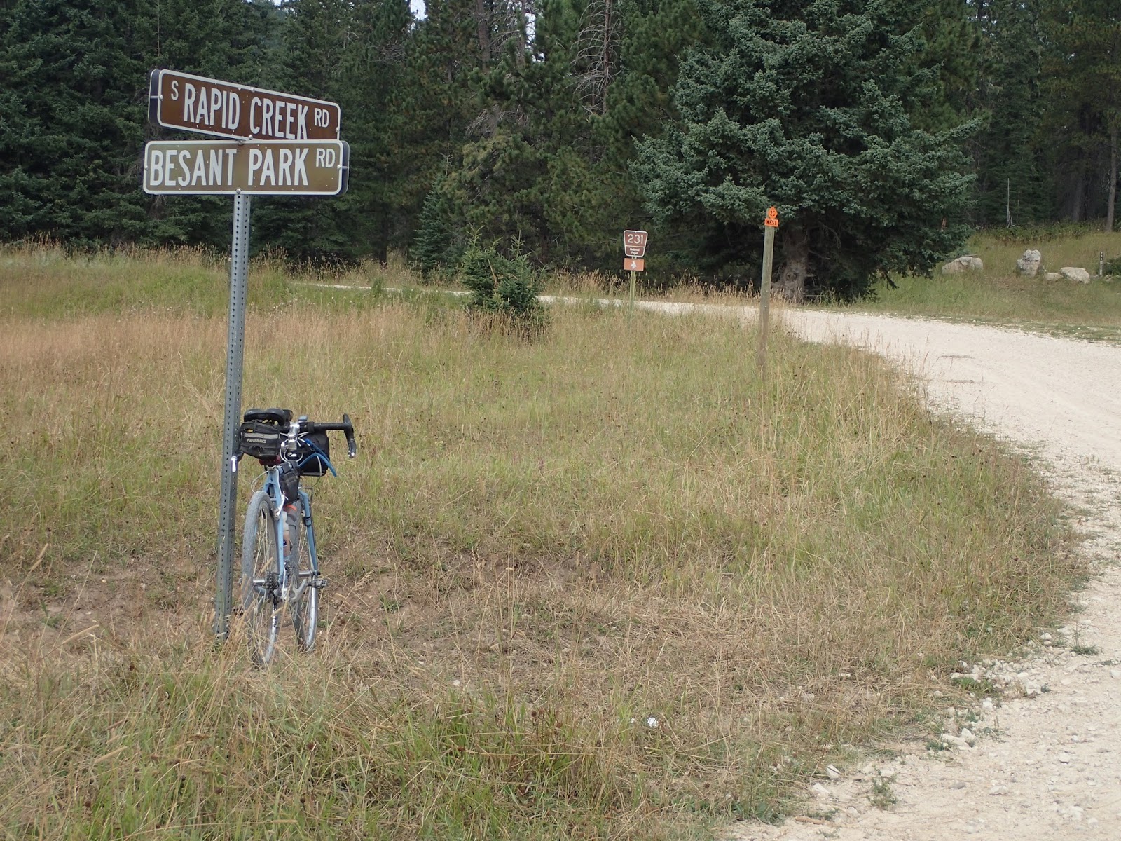
Another mile of climbing on O'Neil Pass Road leads to South Rapid Creek Road. After the first few miles of vacation homes and retreats, the road narrows and enters more remote forests. This is a most welcomed descent, after hours of climbing. I had to stop at Besant Park Road for a moment. This is where I had stopped, hard, at the Gold Rush Mother Lode, before Amy and Randall Smith of North Platte, Nebraska whizzed by, inspiring me to just beat the cut-off time at O'Neil Pass and eventually finish. A moment worth remembering. See Mother Lode Race Report
 |
| Black Fox Camp Road - primo Black Hills gravel. |
Although Black Fox Camp Road was mostly uphill, too soon I turn off to continue to climb on Flag Mountain Road, secondary USFS road 189. This road climbs up to and rolls along a ridge line, offering expansive views to the western horizon before cresting yet another ridge to showcase the monuments to the east - Harney Peak, Mt. Rushmore, Cathedral Spires and more. After hours of riding through the thickly forested steeps of the Northern Hills, these big views seem even bigger.
 |
| The Montana wild fire haze hides most of the big peaks, but not the high plains below. |
No problem. A couple of minutes and I'll be flying down to Deerfield Lake for my planned lunch and water stop at the lakeside White Tail Campground. I remove the spare tubes, tools and patch kit from the seat bag and reach for the pump in the top tube Tangle bag. I find my turned-off cell phone, wallet, mud shank, spare batteries for the lights, spare map and no pump. Ahhhhh.
With that sinking feeling in the gut, I remember removing that pump from the Tangle bag to carry in a CamelBack on my M-Hill mountain bike rides last week. I had other pumps to use, but for some reason, I took that nicer one from the gravel bike and forgot to put it back. I don't know how I didn't notice that when loading up the bike for this ride.
It doesn't matter. This ride is over, until I find a pump that takes a Presta valve. My cue sheets and odometer shout the bad news - almost 7 miles to the Mountain Meadows Resort. Time to start walking.
 |
| A sad sight to see. At least nothing is broken. |
No comments:
Post a Comment