Spent the last year
Rocky Mountain way
Couldn't get much higher
Out to pasture
Think it's safe to say
Time to open fire
Rocky Mountain Way, Joey Vitale, Joe Walsh, Ken Passarelli & Rocke Grace (1973)
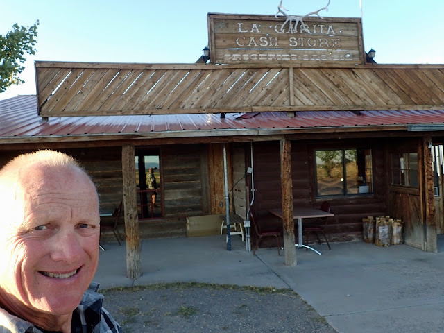 |
| La Garita Cash Store didn't offer much for supplies, although the hand scooped ice cream is great. Even better is the hospitality of the owner and his family. |
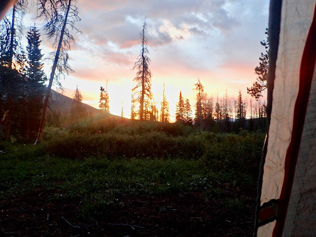
Late afternoon, deep into the high, dry plateaus of Rio Grande National Forest in southern Colorado, I scan the horizon for any sign of respite from the 95 degree sun and incessant wind. I've ridden almost 60 miles today, climbing both Cochetopa Pass and Carnero Pass to drop down in the heat of Coolbroth Canyon. Del Norte is within reach, but I hear that a long closed general store in the village of La Garita may have re-opened recently. So, I take a half mile off-route risk for the chance of buying a cold Coke.
I find so much more.
 |
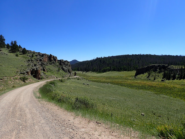
| Riding south of Como into windswept ranch land on washboarded county roads. |
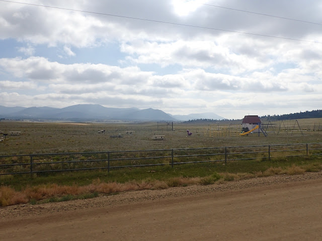 |
| Empty playgrounds and sports fields that apparently have never been used. |
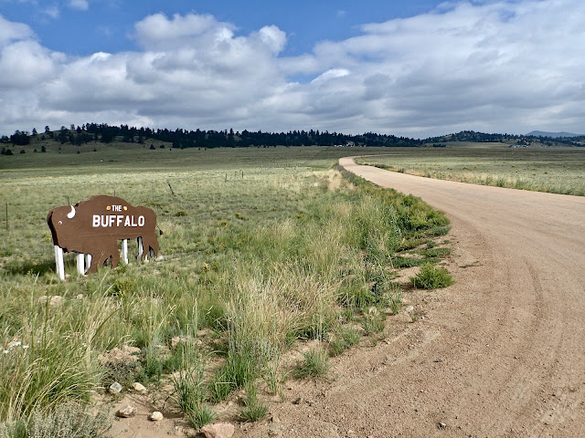
Since leaving the comfortable Como Hospitality Bunkhouse four days ago, I've ridden solo over 220 miles of remote, high country backroads, passing only through the one cafe town of Hartsell and resupplying the next day in Salida. I disperse camp all three nights, encountering few people and little traffic. It's a big change from the Steamboat Springs to Breckenridge stretch of touristy bustle.
Right from the start at Como, I ride into steady 15-20 mph headwinds for the 30 miles of rolling, wide open ranch land to Hartsel. There the Highline Bar and Grill offers free camping in a sketchy backyard lot, but I opt for a quick burger and remount. Bouncing along a gravel county road, I pass by miles of empty paved streets, as if laid out for hundreds of houses and stores that were never built. Abandoned, apparently unused playgrounds and sports fields punctuate the odd landscape. Although it points to a real estate scam or tax evasion scheme, it's still a bit eerie.
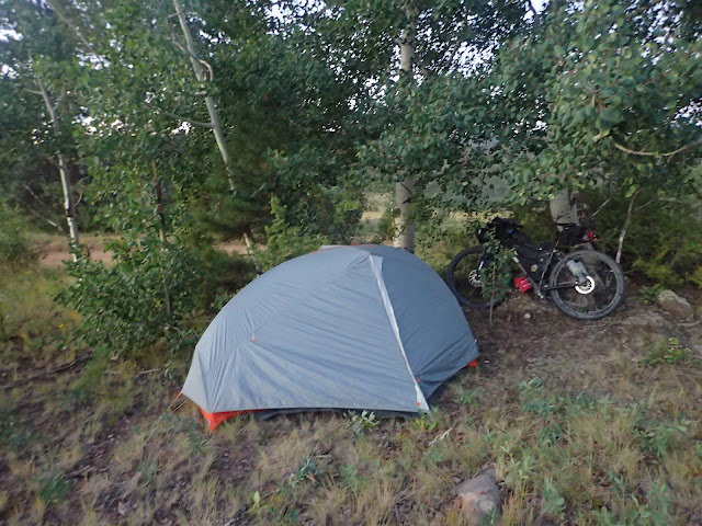 |
| My little dispersed camp site just inside San Isabel National Forest. |
 |
| The Collegiate Peaks of the Sawatch Range on a morning descent into Salida. |
Challenged by stout headwinds, deep washboards, and sporadic showers, I eventually plow through another 30 miles of private ranch land, fill water bottles at Boulder Creek, and camp just inside the border of San Isabel National Forest. In the morning, a short, steep pitch over a watershed divide leads to a 15 mile plummet into the bicycle centric town of Salida. Time to refuel and resupply.
On the climb toward Marshall Pass, memories flash back of descending this very road several times after riding the renowned Monarch Crest Trail. On the last of those rides, now over 20 years ago, my non-cyclist, but willing-to-try brother Chris joined me for an unforgettable afternoon of alpine single track. Lost in thought, I pedal up toward the pass as the afternoon hours fade.
 |
| Steady climb toward Marshall Pass in southern Colorado. |
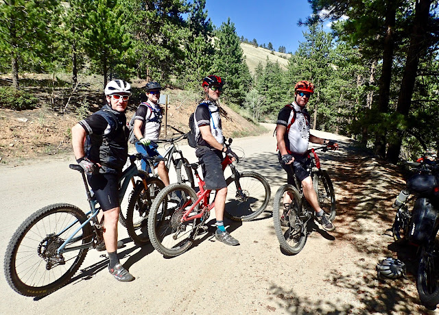 |
| Easterners fresh off the Monarch Crest Trail onto USFS 200 toward Salida. |
Re-energized by fellow cyclists and peanut butter/honey/tortillas, I quietly spin up the final 10 miles to Marshall Pass. Near the top, I pause to watch five moose feeding among the willows in an adjacent meadow. Finishing the day with a flourish, I share a dispersed camp site right on the Continental Divide with a couple of CDT hikers on their own adventure. Now that's a nice finish to a long day.
Riding into late afternoon, I indulge a fleeting thought of climbing Cochetopa Pass to the highly regarded USFS Luders Creek campground for the night. But then I spot an older couple on a hillside searching the ground for something. Politely declining my offer of help, they explain they are hunting for a particular type of volcanic rock unique to this area. Every year, they drive from Louisiana to southwestern Colorado just for this. Passionate rock hounds, indeed.
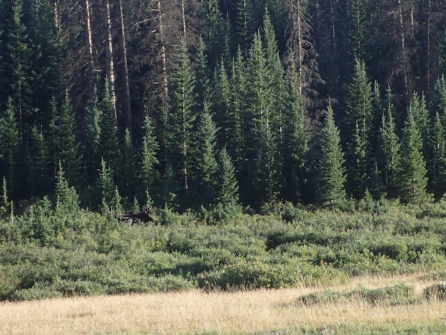 |
| Moose grazing in willows near the top of Marshall Pass, elevation 10,842 feet. |
 |
| Sunset from inside my tent atop Marshall Pass right on the Continental Divide. |
The next morning I drop 17 miles down Marshall Pass Road for breakfast at the Tomichi Creek Trading Post in Sargents. There I meet a fun family of four, each riding an enduro motorcycle on a back road, cross-country trip of their own. One asks about the motor on my bike. "It's a two stroke," I reply, paraphrasing a favorite line of Paul's, "left and right." They laugh and power off. I top off supplies, as I'm unlikely to find anything before Del Norte, about 110 miles away.
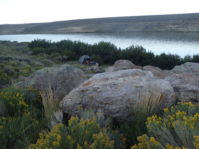 |
| Dispersed campsite along Upper Dome Reservoir. |
 |
| Climbing toward Cochetopa Pass, elevation 10,067 feet. |
After showing me some of their treasured finds, Barbara and Dave offer me water while asking about my journey. Excited to hear that I'm riding the Great Divide Mountain Bike Route, they say that they picked up their son at Antelope Wells when he finished it a few years ago. As our conversation broadens and deepens, I realize that Luders Creek campground isn't happening tonight. That's alright. Meeting interesting people makes this ride special. After a time, I soft pedal a few more miles to Upper Dome Reservoir to disperse camp.
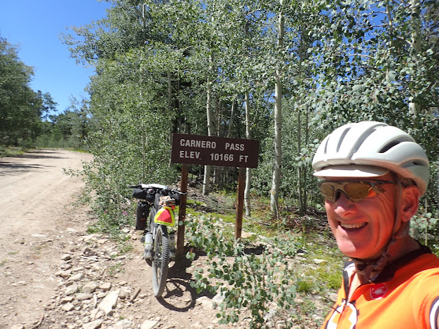
Even though it's a much lower elevation than last night atop Marshall Pass, the morning brings 28 degrees with frost on everything. Hot coffee helps, but the climb up Cochetopa Pass still requires several layers of extra clothes to stay warm. Not surprisingly, the cold doesn't last much past the first pass. By the time I climb and descend Carnero Pass, some hours later, it's 95 degrees and windy. Late afternoon, I'm one whipped puppy dog hoping to find a cold Coke at that store in La Garita.
 |
| Climbing toward Carnero Pass, elevation 10,166 feet. |
 |
| Ready for some downhill after cresting two passes today. |
Oh, Yayh! The La Garita Cash Store is open! Inside I find mostly empty shelves with very little food, other than chips, candy bars, and some canned goods. In a corner sits a small refrigerator with a few cans of soda pop and energy drinks. At the counter are a couple of containers of hard ice cream. That's basically it. However, for this cyclist, on this day, this store promises a feast.
I ride here hoping for a cold Coke, but now I'm really ready to stop for the night. I ask the teenaged store clerk whether anyone in town rents a cabin, or a room, or a tent site. She says, "No, but you can camp in our side yard and use our bathroom, which has a shower. No charge. Our cafe closed at 2, but opens at 7 for breakfast."
Are you kidding? A place to pitch a tent, with access to water, a bathroom and a shower? Right here? That would be great. I'll find something here to eat now. And I'll definitely be back at 7 for breakfast!
 |
| My campsite alongside the La Garita Cash Store. |
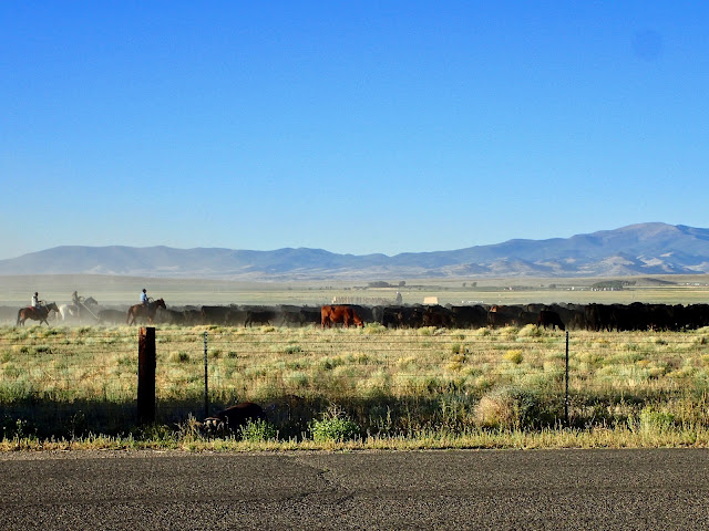 |
| Early morning cattle drive, right across the road from my tent site by the La Garita Cash Store. |
I inhale a couple of cans of soda pop and a hand-scooped ice cream cone while checking out the rest of the store to try to piece together dinner. There's something that will work. A big can of Bush's Best Baked Beans and a bag of Fritos. Score!
I enjoy that luxurious meal on the front porch of the store, soaking in the moment, and the day. Interesting people traveling remote roads, with more Trail Magic and yet another Trail Angel. This trip is amazing.
Rocky Mountain Way (live at Santa Monica Civic Auditorium), Joe Walsh (1976)
No comments:
Post a Comment