Carry on my wayward son
There'll be peace when you are done
Lay your weary head to rest
Don't you cry no more
Carry On My Wayward Son, Kerry Livgren (1976)
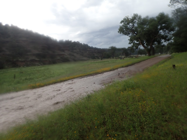 |
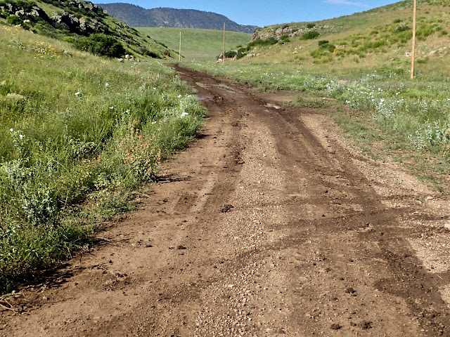
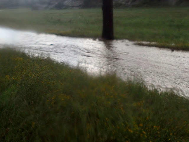
| USFS Secondary Road 150 turns into a raging river on my second day out of Pie Town. To get to this spot where the road surface is visible, I walked over a mile uphill along the flooded road. |
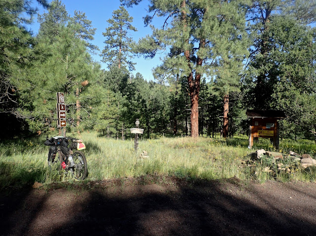
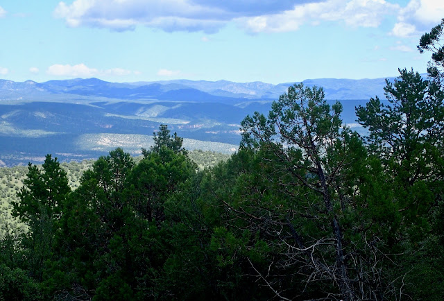
Relaxing at the Toaster House in Pie Town, I spread out my map, cue sheets, book and notes to assess the upcoming stretch of the Great Divide Mountain Bike Route. It's almost 190 miles and 12,000 feet of elevation gain through the rugged mountains of Gila National Forest, with no commercial re-supply and very little development of any kind. I'll be alone out there, so I must carefully plan food and water. And work to steer clear of trouble.
The long, high altitude, big mountain climbs are behind me, but these New Mexican back roads are not to be underestimated. As I've learned, the general elevation profiles of the ACA maps show a nice overview of big elevation changes, but are not detailed enough to show shorter ups and downs. Those little guys add up, as it's difficult to settle into a sustainable rhythm on repeated steeper pitches on rocky, rutted roads.
In an unexpected twist, the roads in New Mexico get wetter and softer as I ride south. Four locals in Cuba and two in Grants each tell me that monsoon season arrived about a month late, destroying my best laid plan to avoid them by starting at the Canadian border in late July. In addition to almost daily afternoon showers, I got hammered with a monsoon on the first day out of Cuba. Without warning, the front wind burst of that storm almost knocked me off the bike and drove me to cover under some rocks. Horizontal rain for 20+ minutes created calf deep torrents of water all around me. I lost an hour of pedaling and all my energy for the day. Those monsoons are no joke.
I believe the 190 miles from Pie Town to Silver City may be possible for me in two long days in ideal conditions, more likely three solid days under reasonable conditions, and possibly four+ days under unreasonable, monsoon conditions. I decide to pack three days of food, ample snacks, and an additional liter of water. I also pack an extra load of caution, as I don't relish the idea of an injury or bike failure back there.
 |
| Leaving Pie Town through the remnants of yesterday's monsoon. |
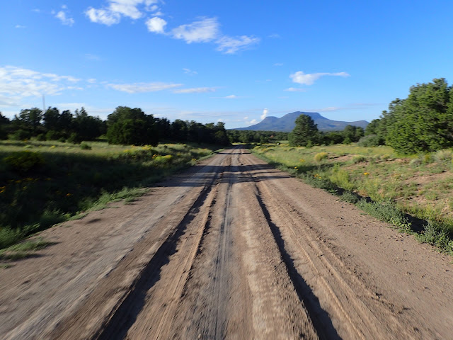 |
| Roads start to dry at the base of the climb into San Antoine Canyon. |
Fueled with day old Strawberry Lemon Rhubarb pie, I ride out of Pie Town on soggy W. Bar Road. With all the recent rain, vehicle traffic to Pie Town Pies creates deep ruts and pot holes filled with water. Even where less torn up by mud, the road is wash boarded. Good morning to an unexpected slug fest.
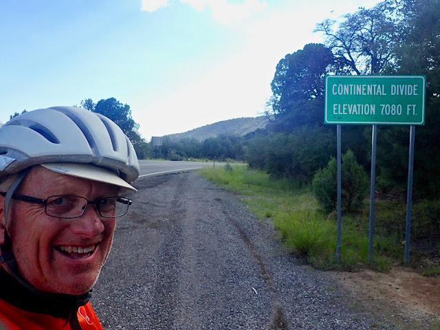
After about 20 miles of that nice warmup, the road surface improves when I finally turn to start a gradual 8.5 mile climb up San Antoine Canyon to cross the Continental Divide. As I'm about to crest, I see movement in the forest. It's an elk hunter at a dispersed campsite right off the dirt road moving toward me and yelling, "Hey! Do you need anything?" I say thanks, I'm good. He keeps at it, "I just made breakfast and my buddy went back to sleep. Would you like something to eat?" Well, I would be stopping for lunch soon anyhow, so I may as well stop here with him. Turns out, George from Albuquerque is an excellent cook and conversationalist. That is time well spent.
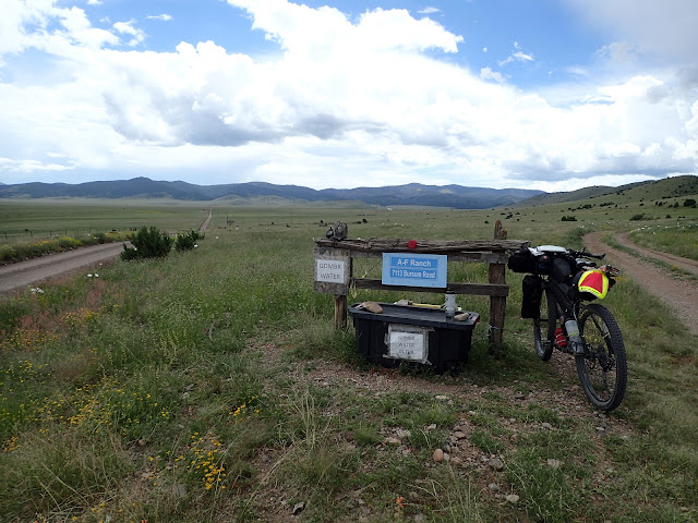 |
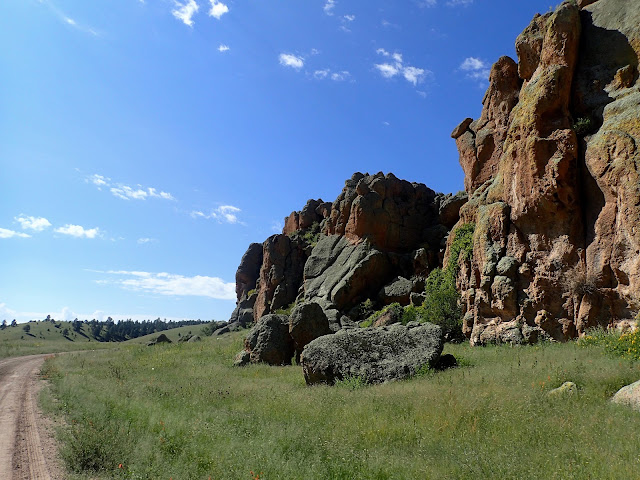
| A-F Ranch offers roadside water and snacks for GDMBR riders. Meanwhile, Bursum Road stretches toward the mountains. |
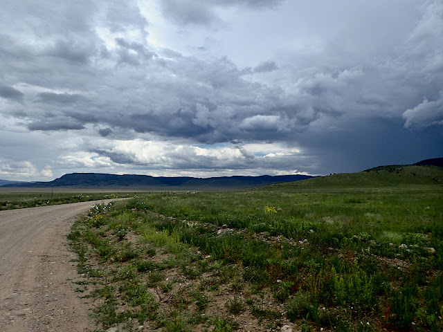 |
| Yeah, my road heads straight up the mountain to the darkest of those clouds. |
Back on the bike, I drop quickly to the Plains of San Agustin, a surprising expanse of grassland with a couple of large cattle ranches. Just like that, I'm riding into a stiff headwind and blazing sun through open prairie. This is country that overheats in a hurry. As I enjoy the big view, a road runner sprints up alongside me and then accelerates across the road. I couldn't catch it, not even for a picture. No coyote in sight.
The road goes on, as does the heat and wind, almost like the dry grasslands of Wyoming. My mind drifts to the emptiness of the Great Basin, but jumps back to New Mexico when I spot a sign "GDMBR WATER" next to two containers by the road. It's the celebrated A-F Ranch water/snack stash for Great Divide riders. I really don't need anything, but I fill a water bottle and jot a note in their journal. At this remote location, however, it's easy to see these provisions making all the difference to some.
 |
| Slugging up Y Canyon shortly after that afternoon's monsoon. Some parts are rideable. |
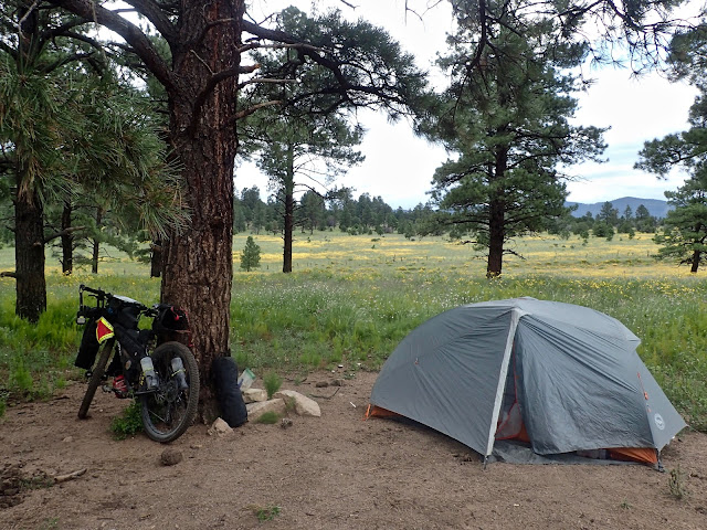 |
| Relatively dry spot to camp just off the Continental Divide. |
I study a serious issue overhead to the southwest, where heavy clouds aggressively hurl down sheets of water to the beat of thunder and the flash of lightening. Even though that chaos is probably more than 10 miles away, I'm heading directly into it. As Bursum Road turns to climb Y Canyon, the angry storm dissipates and moves away to the south. Somehow I avoid the heaviest rain, but water-filled pot holes and ruts abound. I'm back to another muddy slug fest, now at the end of the day while climbing up a canyon toward yet another Continental Divide crossing.
It's really slow going in the sludge. As soon as I enter Gila National Forest, I search for a place to disperse camp. No dice. The few spots that are relatively flat hold standing water. So, I keep climbing, mostly pedaling, but sometimes walking. This mud is a mess. When a bicycle tire makes a 2 inch deep rut in the road, it's a mess. About 8 miles later, almost to the Continental Divide, I finally find a small place to camp. Daylight wanes and new storm clouds gather, so I quickly set up camp, eat, and turn in.
Thinking of the ride tomorrow, I recognize that today's ride was a long, comfortably hard day in the saddle for me. After all, I rode 68 miles with 3,000 feet of elevation gain through early mud, up a hot climb, across a hot, windy prairie, and then up a muddy climb in the rain. That's another really good day for me on the Great Divide, made possible and even enjoyable by all the long days over many weeks behind me. Every day, I am stronger, physically, mentally, and emotionally. I love this journey.
 |
| Nothing like starting the day atop the Continental Divide! |
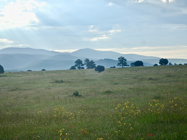 |
| Yes, those are pronghorns in a meadow right on the Continental Divide. |
At first light, I cross the Continental Divide at almost 8,000 feet, I discover a meadow overflowing with wildflowers of every color and so big it looks like a prairie with mountains on the horizon. Then, the real shocker. A large herd of pronghorn dash across the road and disappear over a rise. Pronghorn! Up here! Atop the Continental Divide!
Along the top of this ridge, the road is still wet from yesterday's rain, but rideable. Descending O Bar O Canyon, however, soon deteriorates into a game of weaving around standing water and plowing through mud. Occasionally, mud cakes the bike to a stop and I'm off, walking and sometimes carrying the bike. Downhill. What could be a fast, fun, occasionally rough descent turns into another messy start to the day.
Emerging from that canyon muck almost 10 miles later, I roll along a lumpy, bumpy road. Now, it's hot. Like yesterday, the early mud gives way to heat and headwinds as I gradually climb to the Beaverhead Work Center. There I find several buildings of different sorts scattered around, but see no people at all. There is a public water pump, outhouse and picnic table, so I stop for water and lunch in the shade. The sun shines bright in a clear sky. Little do I know that a monsoon builds beyond the horizon.
 |
| No fast, easy descent off the Continental Divide. Not on muddy O Bar O Road. |
 |
| Rolling toward Beaverhead Work Center. |
From Beaverhead Work Center, I briskly descend to picturesque Wall Lake, a particularly low spot in this area drawing water from all sides. Just a bit beyond the lake, a monsoon strikes without warning. I'm in the wrong place at the wrong time. I dismount before the wind dismounts me and huddle in full rain gear against a wide tree on higher ground well off the road.
In a flash, hurricane-like winds drive heavy rains and hail. Temperatures drop from 85 to 55 in minutes. The earth here only grudgingly accepts water, so it just sits on anything flat, but runs off every little grade at great speed. Within a few minutes, my road is a raging river several feet deep. I think I'm standing high enough above the road, but the gap is closing. I look up the mountainside to my right for even higher ground and see instantaneous streams now cascading toward the road, many of which are 5-10 feet wide. This better end soon.
It does not. That angry wind howls for over 20 minutes, and the heavy rain pounds for 20 minutes more. Water everywhere continues to rise and moves even faster downhill. My spot of refuge keeps me above the raging surface water, but not from the wind-driven rain and hail.
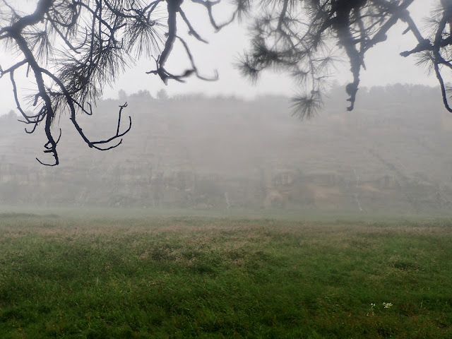 |
| The sudden, heavy rain creates instant waterfalls on the opposing cliff. |
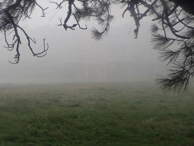 |
| Just a moment later from the same spot as above, heavier rain and hail obliterate sight of that cliff. |
As abruptly as it began, the monsoon ends, leaving an occasional sprinkle, an overcast sky, and water everywhere. It's now close to 3:00 pm, everything is soaked, I'm still over 15 miles to my planned safe haven of the primitive USFS Upper Black Canyon campground, and my road is now a river. I briefly consider camping right there, but anything reasonably flat is under water. I must follow the route south to gain altitude to get above the massive amount of run-off surrounding me.
I walk parallel to the road along the mountainside, but progress is painfully slow due to downed trees and those flash flood streams cascading from above. Every step delivers water into my shoes and most steps plunge my entire shoe under water. Many times I have no choice but to ford one of those flash flood streams, with water mid-calf to knee deep. I work to keep my loaded bike's bottom bracket and hubs above water, but I'm not always successful. It's over a mile before I can even see the surface of the road.
After 3 miles of almost all walking, I gain over 750 feet of elevation, but find little relief from the water. The road then drops into another valley that somehow is less flooded. So, after crossing Diamond Creek, I'm able to ride the final 8 mile 1,500 foot climb to higher ground. With no great spot to camp up there, I pick my way down a steep, slippery 2 miles to Black Canyon campground. After almost 4 hours of battling the aftermath of the monsoon, I finally reach a place of rest. Daylight fades.
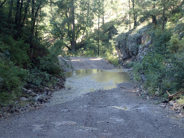
 |
| No riding that road now. |
 |
| USFS Secondary Road 150 finally shows its surface over a mile uphill. |
I quickly set up camp, change out of my wet clothes into somewhat less wet Smart Wool base layers, re-fill water bottles from the stream, eat dinner, and crawl inside my tent before another storm hits. My SeaToSummit Extreme liner not only adds warmth, but protects my down sleeping bag a bit from my wet base layers and from me. I'm grateful to be in my tent, done for the day.
Thankfully, throughout it all, I never feel cold. I believe that results from staying fully hydrated and fueled, moving forward without over-exerting, keeping a level, problem solving mindset, and wearing quality gear. I cannot more highly recommend my Showers Pass Refuge hooded jacket and all my Smart Wool products, including socks, liner gloves, skull cap, ear band, stocking cap, and especially top and bottom base layers, as well as the Sea To Summit eVent water proof compression bags protecting my down sleeping bag and hoodie. Those products earn their way on a day like today.
On paper, or on the computer screen, today looks like a very ordinary 60 mile/3,500 feet gain day. Maybe it is. Indeed, the early mud, the hot and windy climbs, and the afternoon rain and mud all sound a lot like yesterday. Although today tossed in a memorable monsoon in a tight spot, every day on the Great Divide seems to throw something in your face. Yeah. It's just another great day on the Great Divide.
 |
| Crossing the CDT (Continental Divide Trail) near Rocky Canyon. |
 |
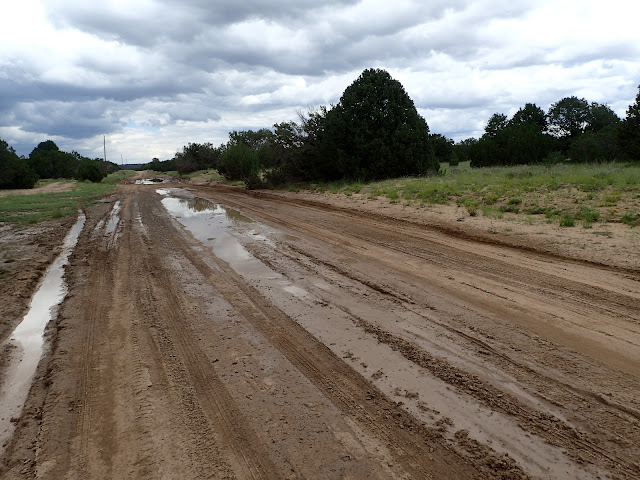
| Yesterday's monsoon run-off still running over roads the next morning. |
Waking to the rushing sounds of bloated Black Canyon Creek, I pack all that wet gear and study my map over coffee to sketch out the day. I sit 60 miles and 6,000 feet of elevation gain from Silver City, with most all that climbing split between first thing and last hurrah. The Gila is relentless.
Since my campground is down by a creek at the bottom of a canyon, the road immediately claws up over 1,000 feet in 3 miles to reach the top of a mesa. And, for the third straight day, it's a mud fest right from the start. Not for the first time, I spin that super low 24x42 granny gear to inch my way up. (For the 1X drivetrain crowd, that's equivalent to 32x56, or 36x63).
The recent monsoons leave water everywhere, including ankle-to-knee deep streams running haphazardly across the road. During the short descent into Rocky Canyon, I ford such streams 21 times, with the depth and force of water increasing as the road drops elevation. I manage to ride through them without incident, but attribute that to my Jones 29+ mountain bike and wide 2.60 inch tires. This is no place to crash.
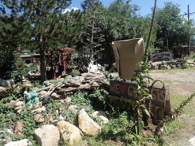 |
| Spirt Canyon Lodge & Shop claims to love cyclists, but I found no one there. |
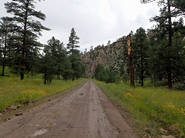
 |
| Climbing Trail Of The Mountain Spirits National Scenic Byway. |
I haven't seen a soul since George the elk hunter two days ago. Now atop North Star Mesa right on the Continental Divide, I see or hear a vehicle with elk hunters regularly. They are consistently friendly and courteous to me. Maybe they appreciate the visibility and familiar color of my bright orange ChristianCycling team kit. More than anything, I think they are simply curious and respectful of a solo bicycle rider traveling through this remote, rugged land.
After a final dirt descent to Highway 35, I cruise the next 12 miles of down right delightful pavement. The sun burns brightly to microwave the exposed road, but I'm air cooled by speed generated wind. In no time, I coast into the Lake Roberts Camp Store for water and lunch. I celebrate completing the morning ride out of the mud, but know that fully half the day's climbing looms ahead.
In the full heat of a cloudless, windless, 98 degree New Mexican day, I start the climb up Wild Horse Mesa on the Trail Of The Mountain Spirits National Scenic Byway. This narrow, no shoulder, winding road is stuffed with vehicle traffic, some of whom take exception to this cyclist's mere presence. I just smile and wave to everyone and most reciprocate.
This bad boy doesn't mess around. The first 3 miles gain over 1,200 feet and the following 7 miles gain another 1,000. Yes, it's steep. It's hot. It's long. It's exposed to the sun and to unfriendly traffic. But it's not a mud fest through a raging monsoon on a remote dirt road. And the views keep getting bigger.
 |
| Pinos Altos, New Mexico. |
 |
| A final Continental Divide crossing before descending into Silver City, New Mexico. |
Eventually, I drop into Pino Altos, which doesn't offer much but an RV campground. I roll on to Silver City and stop at a mom-and-pop motel. With plenty of heat and some sunlight left in the day, I lay out absolutely everything to dry, shower for the first time since The Toaster House, and enjoy a cooked meal at a restaurant. Living large in the big city.
In three magnificently challenging days, my 190 mile adventure into Gila National Forest is over. I know that I belong out here. A powerful sense of accomplishment gives way to simple gratitude for the opportunity and ability to joyfully ride through this beautiful, unforgiving land.
The Chihuahuan Desert awaits. Antelope Wells lies just beyond the horizon.
Carry On My Wayward Son, Kansas (1976)
No comments:
Post a Comment