Search This Blog

Showing posts with label bikepacking. Show all posts

Thursday, April 10, 2025

BackBone Buffet Update - It Gets Better

I'm going up the rough side of the mountain on my way home, meet my people (Trying to get home)
I'm going up the rough side of the mountain on my way home, oh yeah (Trying to get home)
I'm going (Climbing)
Up the rough side of the mountain (Climbing)
Oh, Jesus (Climbing)
On my way (Climbing)

Climbing Higher Mountains, Traditional.

Contrary to the sign, USFS 818.1A is not a "DEAD END" for those on a bicycle.

Last month I introduced the BackBone Buffet, my new rough road bikepacking route showcasing the best of the Central Black Hills of South Dakota. I've ridden all the roads on the route, although not in one ride put together this way. I look forward to bikepacking it this summer. See, Introducing The BackBone Buffet.

Starting the climb up to Elk Mountain Lookout Tower on USFS Low Standard Road 818.1A.

The BackBone Buffet started with the idea of creating an easily accessible 4-5 day rough road bikepacking loop smack in the middle of the Black Hills. With all my riding, scouting, and routing throughout that area over the years, I decided not to start from scratch, but rather cherry-pick favorite sections of my original BackBone, DoubleBackBone, BackBone Grande, BackBone DoubleGrande (not yet released) and even some Black Hills Bounty roads and combine them in a single 200 mile loop out of Hill City.

Those existing routes occasionally intersect, e.g., the original BackBone and the BackBone Grande meet on Black Fox Camp Road, but connecting the chosen sections often required some distance of different roads. Eventually, I fashioned together and published the loop. BackBone Buffet - RideWithGPS Map.

Looking back on the climb up USFS Low Standard Road 818.1A.

Analyzing those new connectors more closely over time and coffee, I unearthed a couple of areas to improve. For example, I did not particularly like the connection from the bottom of Red Bird Canyon (about Mile 103) to Dewey Road (USFS Primary Road 769) (about Mile 108) and beyond. That stretch required over 5 miles on paved U.S. Highway 16, followed by more miles on highly developed Dewey Road before finally reaching some primo Bounty roads to McKenna Spring. There must be a better way.

So, from USFS paper maps and RideWithGPS satellite images, I pieced together a possible re-route that turned off U.S. Highway 16 a couple of miles short of Dewey Road onto an unnumbered, double-dashed, apparently abandoned "Road Closed Yearlong To Motorized Traffic." After about a mile, that "road" t-boned into USFS Low Standard Road 818.1A for a suck-it-up steep pitch to a fire lookout tower and then a gradual descent over to Dewey Road. What's not to love about that! 

It looked to be an awesome add to the BackBone Buffet, and possibly to the BackBone DoubleGrande, if that first mile of abandoned "road" is public. However, I could not determine that from home, since it was not clearly labeled and passed through private land. Time for a road trip.

Elk Mountain Lookout Tower, with 360 degree views from the top.

Score! That little unnumbered, double-dashed "road" is a public road that actually does connect with USFS Low Standard Road 818.1A. It is closed to motorized vehicles yearlong, but is always open for travel by foot, horse, and bicycle. Sweet!

Know that it's not easy. From the paved highway, the route climbs over 700 feet in the first 2 miles and another 400 feet in the next 2.5 miles, with at least one pitch of 19% (according to RideWithGPS). But the 360 degree views from atop the lookout tower are breathtaking, as are the sharp elevation drop views along the relatively long, gradual descent.

Uffda! 

Absolutely I added it to both the BackBone Buffet and the BackBone DoubleGrande.

So, for anyone riding any of my routes, check the RideWithGPS file for the latest update. 

I'm always looking for the best.

Updated BackBone Buffet map on RideWithGPS, showing the climb up Elk Mountain Lookout Tower.
The new section leaves U.S. 16 to climb to the tower and then descend to Dewey Road.

Same map as above, but in "Google Terrain" mode to show relief. Would you look at that!


Climbing Higher Mountains, Aretha Franklin (1972).


Monday, February 17, 2025

Cloud Peak 500 Page - 2025 Bump

The Cloud Peak 500. A unique ride through the Old West. And another great shake out ride for the Great Divide Mountain Bike Route.

In late 2019, compadre Lucas Haan alerted me to the Cloud Peak 500 bikepacking route in the Big Horn Mountains of Central Wyoming. I immediately recognized its potential as a primo shake out ride as part of my long running preparations to ride the Great Divide Mountain Bike Route. The Cloud Peak 500 offered about 20 percent of the distance and elevation gain of the Great Divide on a seemingly similar variety of remote roads and terrain, with occasional small towns for re-supply. As a bonus, the Big Horns are but a few hours from Rapid City. I marked it as a priority ride for 2020. 

Meanwhile, cycling friend Paul Brasby of North Platte, Nebraska caught wind of my Cloud Peak 500 plans. As a long time successful road racer, Paul was an enthusiastic gravel racer and bikepacker with both eyes fixed on riding the Great Divide. He also concluded that the Cloud Peak 500 looked to be an ideal ride to prepare for that, as well as a great ride on its own. We decided to start together and see how it goes. 

Dropping off Dude's Downhill on the Cloud Peak 500.
(photo by Paul Brasby)

Over seven long, hot days in August 2020, we rode the Cloud Peak 500 route, which was my longest, hardest, and overall biggest ride of that year. Although I stopped short of 500 miles, Paul rode on, through a gauntlet of challenges, to become the first, and still only, official finisher of the Cloud Peak 500 bikepacking race.

I then wrote a series of blog posts about our experience, primarily as a scrapbook for me and any friends that might enjoy it, but also as a resource for others who may be intrigued. Those Daily Ride reports describe our experience and the Logistics reports reveal much to help plan such a ride. 

Eventually, I compiled all those blog posts onto a single Page called Cloud Peak 500 Page (2020) that appears within a column of Pages on the right side of the Black Hills BackBone blog. If you're looking for a shake out ride to prepare for the Great Divide Mountain Bike Route, or just looking for a unique 500 mile bikepacking adventure in Central Wyoming, take a look at the Cloud Peak 500.


Sunday, June 25, 2023

BackBone Grande - The First Through-Ride


Celebrating at the North Dakota border on 6/22/2023.

Over 9 days, Paul Brasby and I rode the BackBone Grande across the State of South Dakota from the Nebraska border near Ardmore to the North Dakota border near Picnic Springs Campground, self-navigated and self-supported, with resupply as available along the way. 

425 miles with 24,880 feet of elevation gain on primarily dirt and gravel roads. In this Spring, mostly wet.

But this ride, and this route, mean far more than numbers. 

Hidden gems await.

I designed the BackBone Grande specifically for bikepacking, drawn from years of exploring these back roads by bicycle and from bikepacking across the country on the Great Divide Mountain Bike Route. It showcases our best roads and most memorable sights put together to create a Great Divide type of experience. But creating a route on the computer is one thing. How would it actually ride?

I love it.

Our through-ride of the BackBone Grande resulted in one Great Divide experience after another. We faced a wide variety of challenging variables and met an array of interesting people. Every day. Day after day. For over 400 miles. No day was easy. Some spots were very hard. Every day was amazing. 

I will be writing more about our trip and will be making a few minor changes to the route. Mostly, I will be looking for the next chance to get out there to ride again.

For links to all my posts about the BackBone Grande and to a RideWithGPS map, go to BackBone Grande Page (2023).

Sunday, May 14, 2023

BackBone Grande (Miles 46-114) - Open Range Buffalo

The BackBone Grande is a 400 mile bikepacking route running south to north across the State of South Dakota along the spine of the Black Hills. It's a highlight reel showcasing the best of the Black Hills and surrounding prairie, connected by a unique mix of remote gravel and dirt roads. It's a Great Divide type of bikepacking experience right here in my backyard. See, Introducing The BackBone Grande.

Picking up the route from Buffalo Gap National Grasslands at Mile 46, the BackBone Grande turns onto 2 miles of pavement on lightly traveled U.S. Highway 18. A limited re-supply opportunity lies just 1 mile off-route to the west in the small rodeo town of Oelrichs, which offers a small, but moderately stocked C-store, two bars, and a primitive, self-service RV park.

Buffalo roam free throughout Wind Cave National Park and Custer State Park.

Then, it's generally north through rolling ranch land, hopscotching the small towns of Smithwick, Oral, and Buffalo Gap. These roads carry some local traffic, so they can have more gravel, some washboard, and even pot holes. A few residents occupy these towns, but the only commercial establishment is the Buffalo Gap Trading Post, which offers a bar with refreshments but little else. 

Although this land shows more human activity than the ghost town of Ardmore, many small cemeteries mark the pioneers' time and toil here over the years. It's a harsh life on the prairie.

Fall River County Road 6291 crossing the Cheyenne River en route to Buffalo Gap.

At the town of Buffalo Gap (Mile 74), the BackBone Grande turns west on Fall River County 7-11 Road to wind up Beaver Creek into the Black Hills through "buffalo gap." When buffalo freely roamed the Great Plains, those around these parts would move up from the prairie through this gap to winter in the more sheltered forested hills. Just imagine thousands and thousands of buffalo making their way up this narrow valley.

7-11 Road is a well developed, well traveled county road across private land, with more than the average amount of traffic, at least for gravel roads in the Southern Black Hills. But it's historic, scenic, fast, only 5 miles, and, importantly, it's our entry into the Black Hills through Wind Cave National Park and Custer State Park. 

Fall River County 7-11 Road looking west toward the buffalo gap.

Now, we're diving in the deep end. Turning off 7-11 Road onto Red Valley Road (Fall River County 5), the BackBone Grande ventures north past a couple of cattle ranches before entering Wind Cave National Park. Just to the west, the hills bump upward toward higher elevations and dense stands of pine trees. This is buffalo country.

I ride into Wind Cave National Park at least a couple of times every year and see buffalo every time. Every single time. Stay alert. Keep your distance. Check your speed. If you see cinnamon colored calves, increase your distance and decrease your speed. Stop, if appropriate. And always look for that one, big, solitary bull, separate from all the rest, who watches and protects the whole herd. These are wild animals, as fast and quick as a horse, but much bigger and with horns. Not to be underestimated.

Public Service Announcement from the National Park Service.

Riding north over Boland Ridge, the rough dirt road NPS 6 drops directly into Custer State Park, where even more buffalo roam. The paved Wildlife Loop is a tourist favorite that passes the Buffalo Corrals, where the State Game, Fish & Parks conducts an annual, very popular Buffalo Roundup in late September. It's worth returning just for that. There's nothing quite like witnessing 1,300 buffalo thundering over a ridge toward you. See, Buffalo Roundup.

About 2 miles up the Wildlife Loop, the Wildlife Station Visitor Center (Mile 89) offers water, bathrooms, shade, and a few refreshments in a vending machine. Not much, but it's a nice break after 15 miles of generally shadeless uphill since Buffalo Gap. 

NPS 5 looking toward Boland Ridge and then Custer State Park to the north.

Time to climb a little up Lame Johnny Road and then over to Fisherman Flats Road. Both are good gravel roads that wind through Custer State Park for tourists to venture a little bit more into the back country. But it's not heavily traveled, at least not by cars. Buffalo still roam this transitional area from prairie to forest, as do pronghorn, deer, and even elk.

As Fisherman Flats Road reaches into the forest, the BackBone Grande peels off onto Custer Trail 1. Although called a "trail," Trail 1 is a fun, little two track that skirts a few ridges for about 3 miles to reconnect with Lame Johnny Road higher up. Nothing like a little known, little traveled old road to dive a little deeper into the Black Hills.

A quick descent bottoms out at French Creek Horse Camp (Mile 99). This is a very popular state park campground, and may be full, but there's always water, bathrooms, shade, and a friendly campground host. There almost certainly will be horses all over. Tread lightly.

Trail 1, a two track traverse in Custer State Park.

A steady climb out of French Creek Horse Camp tops out by paved U.S. Highway 87, with Blue Bell General Store and Blue Bell Lodge (Mile 102) for some re-supply, meals, and possible lodging. A half mile later, a picnic area parking lot leads to a pedestrian bridge revealing barely recognizable single track heading north. This unmarked single track path can become a bit overgrown, but generally follows along French Creek without crossing it. 

In less than a mile, this little gem enters Black Hills National Forest, for possible disperse camping. It then connects to USFS Low Standard Road 408 to reach Hazelrodt Picnic Area and graveled USFS Lower French Creek Road 342.

One final pitch up rough USFS Low Standard Road 341 reaches a rocky ridge with views of the Cathedral Spires, a collection of granite spires drawing rock climbers from all over. Then a bouncy downhill lands on a paved bike path paralleling U.S. Highway 16A for a short cruise into Custer.

Yes, that's the BackBone Grande route, at least for about a mile.

County gravel, National Park Service dirt, pavement, State Park gravel and two track, barely single track, Forest Service Secondary and Low Standard Roads, and a paved bike path. Much of it through free roaming buffalo country. All in 68 miles.

That's the BackBone Grande (Miles 46-114) from Buffalo Gap National Grasslands to Custer, through Wind Cave National Park and Custer State Park, with a few choice connectors. You're now in the Black Hills.

Next up. A Greatest Hits Album of Black Hills back roads. Deep into the Heart of the Hills on the renowned Mickelson Trail for views of Crazy Horse Memorial and later through tunnels, favorite Forest Service back roads spiked with granite outcroppings crawling with marmots, big views of 7,242' Harney Peak, the highest peak east of the Rockies and west of the Alps, a restored gold mine, iconic Moonshine Gulch Saloon, and both Castle Peak Road and Black Fox Camp Road to top out at historic Cheyenne Crossing. Best of the best.


Sunday, November 13, 2022

2022 Black Hills Bounty - Southern Hills, Take Five

We'll Take Five days,
For the Bounty, no sweat,
So no lyrics today,
It's the Dave Brubeck Quartet.
Listen at the end to Take Five, Dave Brubeck Quartet, Live in Belgium (1964)

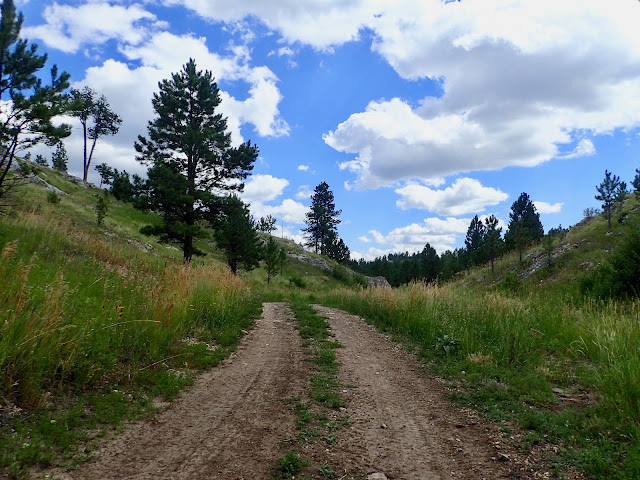
Scouting a rolling Low Standard Road for the 2022 Black Hills Bounty.

In 2021, at the request of my friend Paul Brasby, I created a 5 day bikepacking ride in the Central Black Hills of South Dakota for him and some out-of-state friends. I called it the "Black Hills Bounty" due to the treasure trove of remote, rough back roads through one-of-a-kind scenery. That route hit what I believe are some of the very best bikepacking roads in the Black Hills. We rode it in June of 2021, calling a few audibles and taking a few detours along the way. It turned out great because the guys riding it were great. 2021 Black Hills Bounty.

So, when they emphatically ask to return in 2022 for more, I'm not quite sure how to put together a sequel. Eventually, I decide to approach the ride as a glimpse of what it's like to ride the Great Divide Mountain Bike Route. Think of it as Bikepacking 202 directed toward the experienced cyclist, but moderately experienced bikepacker. I'll create a remote, rough road route that requires a variety of bikepacking skills, including finding and filtering water, preparing most meals, choosing dispersed and developed campsites, re-supplying from the occasional C-store, navigating poorly marked and unmarked roads, and re-charging devices. With very spotty cell coverage out there, I'll use a Spot Tracker to track our ride and communicate with my wife. Maybe we can take self-supported mindsets to a higher level.

To allow time and energy for all this, I significantly decrease mileage and elevation gain to about 40 miles and 3,000 feet of gain per day. Of course, I'll look for a Bounty mix of fast, medium and slow gravel, fast, medium and slow dirt, limited pavement, and probably some simple single track. For those wanting to explore more after setting up camp, I'll have maps and ideas for additional miles.

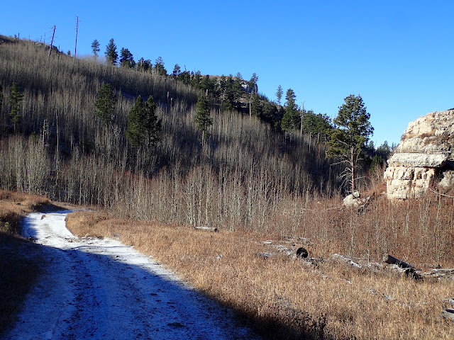
We're off to scout the Bounty. Just follow the snowy white road.

With that approach, I set out to create the 2022 Black Hills Bounty. Over time, after scouring many maps and scouting many miles, I decide to again start in Custer, but ride south and west into the Southern Black Hills that transition from forest to prairie. Few cyclists venture down there into the labyrinth of Forest Service Low Standard roads that don't always follow the federally documented maps. For example, some that map as spurs connect and some that connect do not. Tread on the trail is how to sort it out.

It's not a simple task. A host of Low Standard roads randomly shoot up and down hillsides and creep along canyons. Many are unmarked and, even if marked, simply dissipate into the forest after a spell. It's a spider web of tantalizing trails. Which to take? What combination? How to piece them together?

Further to the south, the number and variety of public roads diminish rapidly as private ranch land replaces National Forest. Well before reaching the town of Edgemont, the USFS Low Standard and Secondary roads are gone and only a handful of county gravel roads remain. But those roads are scenic and fun to ride. So, I keep at it. With some careful scouting, good fortune, and intel from a friendly rancher, I finally make it work by finding an abandoned Low Standard road that crosses a ridge to close a challenging gap between marked roads. See, Connecting.

The Black Hills are rich with a variety of USFS Low Standard Roads.

So, I had a plan for the 2022 Black Hills Bounty. It all added up to 5 days covering 202 miles and 15,447 feet of elevation gain, which averages about 40 miles and 3,100 feet of gain per day. With a bonus day six.

So, here's a breakdown of the daily plan. But it was just a plan. The riders will make or break the ride.


Day 1 (42 miles/3,073 feet gain)/7 miles Low Standard/3 Secondary/15 Primary/17 paved.
Mixed bag right from the start. Paved to access Low Standard climb, to Primary to access single track,
more Primary to access another rough, barely Low Standard, then rolling Primary and paved finish
to Wind Cave National Park. Water at mile 23 and at camp. No re-supply.


Day 2 (41 miles/3,948 feet gain)/10 miles Low Standard/11 Secondary/10 Primary/10 paved.
Twisty 10 mile paved start in Wind Cave National Park, middle 21 mile mix of Primary & Secondary,
with a rough climb on a 10 mile Low Standard to dry disperse camp.
Water & limited re-supply at Pringle (mile 29).
(photo by Kevin Fox)


Day 3 (38 miles/1,666 feet gain)/3 miles Low Standard/7 Secondary/26 Primary/2 paved.
Active recovery day. Initial Low Standard from dispersed dry camp, then hard, fast Primary
to Edgemont to camp at city campground. Water, power, showers, 2 C-stores, bar/grill.


Day 4 (40 miles/2,859 feet gain)/3 miles Low Standard/0 Secondary/34 Primary/3 paved.
Steady climbing on hard, fast (if dry) Primary roads, ending with rough Low Standard road.
Spring water near dispersed campsite. No re-supply.
(photo by Lane Bergen)


Day 5 (41 miles/3,901 feet gain)/20 miles Low Standard/0 Secondary/17 Primary/4 paved.
Finish with a flourish. 20 miles of primo Low Standard right from camp, then a short Primary climb
with Crazy Horse views and downhill Primary to Custer. Surface water at mile 16.


Bonus Day 6 (46 miles/5,347 feet gain)/2 miles Low Standard/4 Secondary/3 Primary/37 paved.
Unloaded optional day, mostly paved with some twists from 2021 (also 10 miles/1,000 feet gain less).
Climb Sylvan Lake Road, descend Needles Highway, Iron Creek single track connector
to climb Iron Mountain Road, lunch at Mt. Rushmore, Palmer Creek gravel to climb Sylvan Lake Road
and then drop to Custer. This day's ride is worth the trip, all by itself.
(photo by Paul Brasby)


Take Five, Dave Brubeck Quartet (1964)


Sunday, October 23, 2022

No Hurries, No Worries

Yeah, keep on shinin' your light,
Gonna make everything, pretty mama,
Gonna make everything alright,
And I aint got no worries,
Cause I aint in no hurry at all.
Black Water, Patrick Simmons (1973).


Five weeks passed without a blog post. Other than a sabbatical during my 7 week ride of the Great Divide Mountain Bike Route, that's the longest span of non-activity here in years.

There's no good reason. I have plenty of stories and topics swirling around my brain, including a couple more posts on the Pony Express Bikepacking Adventure, a series on our 5 day Black Hills Bounty bikepacking ride, another spotlight on the lifestyle of Coffeeneuring, and any number of posts on thoughts of riding next year. Maybe they all just need some time to percolate.


But right now, it's autumn in the Black Hills. Maybe more than any other season, autumn is my time to explore new backroads, to build a deeper understanding of how the roads interact with these lands, and to fire the imagination for creating new experiences. And to just ride.

So, I haven't been writing. But I have been riding. And taking pictures and notes. I find myself looking to the Northern Hills, especially for the 2023 Black Hills Bounty.

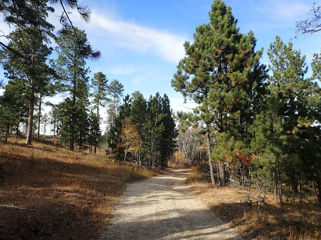
I'm finding roads like these. More to come. No hurries. No worries.

Black Water, Doobie Brothers Live (1979).

Thursday, August 25, 2022

Aint Worried 'Bout It Right Now

I don't know what you've been told,
But time is running out, no need to take it slow.
I'm stepping to you toe to toe,
I should be scared, honey, maybe so.

But I aint worried 'bout it right now, (right now)
Keeping dreams alive, 1999 heroes.
I aint worried 'bout it right now, (right now)
Swimming in the floods, dancing on the clouds below.

I aint worried 'bout it.

I Aint Worried, Ryan Tedder, Brent Kutzle, Tyler Spry, John Eriksson, Peter Moren & Bjorn Yttling (2022).

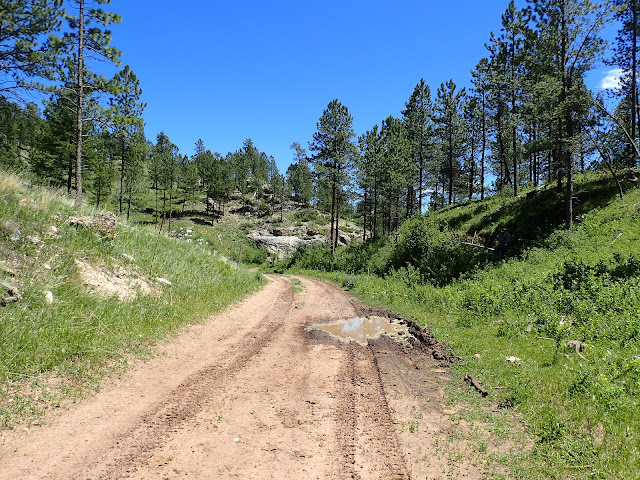
Just another Low Standard Road on the Black Hills Bounty.

The second annual Black Hills Bounty draws nigh. That's a 5 day, off-pavement bikepacking tour of the Black Hills of South Dakota that I created at the request of some out-of-state friends.

Last year, the Black Hills Bounty averaged almost 60 miles and 5,000 feet of elevation gain a day on a smattering of my favorite Forest Service roads in the Central Black Hills. It all came together, despite a seemingly steady stream of audibles that modified each day's ride. It worked out great, mainly because the guys who rode it were great. 2021 Black Hills Bounty Wrap.

Creating the route for this year, I scaled back the distance and elevation gain of each day by about a third to allow more time for navigation, water sourcing, re-supply, camp site selection, optional evening exploratory rides, and, mostly, hanging out at camp. Call it Bikepacking 202. With little more than a digital map and general description from me, each rider will be self-supported, self-navigated, and overall self-sufficient, at least within the context of a small group bikepacking ride. 

These friends are experienced endurance cyclists, so I suppose I should not be surprised at the very few questions from the group about this ride, even at this late date. Maybe I shortened the route so much it looks easy. Maybe the digital maps show all they need to know about the route and terrain. Maybe they've thoroughly prepared and tested bodies, bikes, and gear. Maybe they've researched weather. Maybe they're just flat out ready to ride.

Or maybe this group is like the Top Gun pilots playing Dog Fight Football before their improbable mission. Aint worried 'bout it, right now.

I Aint Worried, OneRepublic (2022).


Saturday, June 4, 2022

Paul's Great Divide Photo Gallery 2 (Clearwater Lake to Basin)

In 2021, cycling buddy Paul Brasby rode the Great Divide Mountain Bike Route with me from Roosville, Montana to Rawlins, Wyoming, where he ran out of vacation time. During those unforgettable 24 days, we rode 1,300 miles of back roads over every kind of surface and condition, repeatedly climbing high mountain passes and crossing endless prairie, skirting rampant forest fires and steaming grizzly scat, dodging thunderstorms and lightening, and meeting a stream of interesting people. 

Throughout this journey, Paul captured hundreds of remarkable images, some of which appear in my blog posts of ride together. Now, Paul has created a photo gallery of his favorite Great Divide images that he wishes to share. For the first installment, go to Roosville to Clearwater Lake. Here's the second. 

Hello All!

After a ten year dream, the first half of the GDMBR finally came true last year!

As Craig's blog posts of the GDMBR draw to an end, Craig was nice enough to let me share a few photo dumps showcasing the beautiful landscape, road conditions, people we met, and our POI along the way. I'll include some narrative with the pictures, as well. This is geared more to the first time touring riders of the GDMBR/Tour Divide adventures in the near future. I'll include distance and elevation gain of each day's ride as a helpful touring guide. For those that have already partaked in this amazing adventure, whether touring or racing, I hope these pictures bring back fond memories of a ride not soon forgotten.

Join along as Craig and I pedaled SOBO following the ACA's GDMBR from the Canadian border to Rawlins, Wyoming, at which point Craig pushed on solo to Antelope Wells, New Mexico. Enjoy!

One more footnote. A big shout out to all those planning and prepping for this year's Tour Divide and for all those touring riders giving it a go this year. Whether SOBO or NOBO, I wish you a safe and exciting adventure! Cheers!

Paul Brasby


Clearwater Lake to Ovando
Day 6, July 25, 2021 (51.7 miles/3,858 feet of elevation gain)

Craig riding on Road 4370 in the early morning hours.


Entrance to the well-known single track Trail 382,
around Richmond Peak in the Grizzly Basin.

FYI - This is one area that authorities
drop off problem bears.

Be bear aware.

Bear scat was everywhere on this trail.

Make your presence known as you ride!


Enjoy the views!

This trail was awesome!

Mark & Lisa on their 7 month tour
from their home in San Diego, CA.

Road 4353 north of Seeley Lake.


Road 477 between Seeley Lake and Ovando.

The little town of Ovando
is a must-stop!

We spent a night in the Jail House.


The Black Foot Merchantile Store has showers & laundry.


The locals are so friendly and helpful.


We ate dinner at Trixi's Bar & Grill,
located at the East end of town on Hwy 200.


Ovando to Lost Llama Ranch
Day 7, July 26, 2021 (74.2 miles/5,650 feet of elevation gain)

Owner/operator of the Stray Bullet Cafe, Colleen Stone
serves us coffee with our hearty breakfast.
Next door, the Black Foot Angler has a small selection
of cycling related items (tires, patch kits, food, floor pump).


Dry Gulch Road


Cooper Lake Road between Ovando & Lincoln.


Chainsaw sculpture in Lincoln, MT.


Lost Llama Ranch is an absolute gem!!

Hosts Barb & John make you feel so welcomed!


All camping amenities are available here.


Lost Llama Ranch to Helena
Day 8, July 27, 2021 (47.4 miles/3,812 feet of elevation gain)

As we left, most of the 21 riders that spent the night
rolled out with us, including the ACA guided tour group.


Empire Mine


We caught up to Jessica, ACA's tour guide,
as she sweeps the route behind her group on Road 1855.


Craig riding with one of the ACA riders on Road 1855.

A lone tree provides a cool, shady spot 
on Road 335 between Blossburg & Highway 12.
This was the hottest day of the trip.

Downtown Helena. If you're in need of a bike shop,
the Great Divide Cyclery is a good choice! 

MTB City is a great bicycle hostel 
one block off the route as you roll into town.

Conrad and his wife Eileen have created
a nice, relaxing oasis for cyclists.

All amenities, including a fully supplied kitchen,
washer & dryer combo, and showers.

The bike path that runs by their place
will take you downtown.


Helena to Basin
Day 9, July 28, 2021 (42.6 miles/5,321 feet of elevation gain)

This segment takes us up & over Lava Mountain.

We enjoyed the early miles on Grizzly Gulch Road
with Dave from Helena.

The climb up & over Lava Mountain
on Road 1878-D1.

If memory serves me right,
this is Trail 244.


Cataract Creek Road.


Great places to disperse camp along the creek on this stretch.


Silver Saddle Bar & Cafe in Basin.
If you want a good burger, the grill stays open until 8 pm.

If you want to spend the night in the Community Center next door,
let the bartender know & they'll unlock it for you for $5/night.

They have a full kitchen in the back and a half bath.

Had a great night's sleep on the benches!