Search This Blog

Tuesday, January 11, 2022

Black Hills BackBone & DoubleBackBone - With Map & Story Links

The Black Hills BackBone is simply a bicycle route that I created 7 years ago to ride myself. 

There is no Black Hills BackBone race, or organized public event, or "Grand Depart," or anything like that. It's just a route I created to ride myself. Then I created this blog to document my journey, in part as a digital scrapbook and in part to share my experience with family and friends.  

That's it.

The broad shoulders of Flag Mountain reveal the granite peaks of the Central Black Hills.

But, oh, what a route.

Inspired by the cross-country routes of the TransAmerican Trail and the Great Divide Mountain Bike Route of the Adventure Cycling Association, I wondered whether I could piece together a remote road ride on primarily gravel and dirt roads that spanned the height of the State of South Dakota along the spine of our beloved Black Hills. That whimsical daydream led to many days of scouring maps, scouting back roads and pedaling all over Western South Dakota. There seemed to be no end of options.

I struggled with this route, primarily because the Black Hills National Forest offers a staggering number of amazing roads to ride. Scouting a promising road invariably led to more. At some point, I simply had to stop, prioritize, and choose. The Black Hills BackBone is the resultBlack Hill BackBone - Cue Sheets & Other Links. Update - here's a link to a ridewithgps.com file that I created for the BackBone in 2021. Black Hills BackBone - 2021 Update.

Conceived as an unsupported, solo, continuous ride, the Black Hills BackBone readily lends itself to a multi-day bikepacking ride or even a multi-day supported tour. In 2017, a small group of friends rode the entire route over three days in the heat and winds of a Fourth of July weekend. For my reports on that ride, go to these posts. An Idea Takes ShapeGatheringCrossing The Northern PrairieUp And Into The Black HillsFocus On The FinishA Weekend To RememberFriends.

Over a cold, rainy Memorial Day weekend in 2019, an intrepid group of eight cycling enthusiasts from Colorado made a run at the Black Hills BackBone. On that particular weekend of difficult conditions, they rode about as much of the route as one reasonably could. They said they had a great time, particularly Day 3 from O'Neil Pass to Custer, and now make an annual road trip to the Black Hills to ride gravel. New Friends On The BackBone.

To my knowledge, the entire Black Hills BackBone has not been ridden on a bicycle as an unsupported, solo, continuous ride. In my first attempt in 2015, I stumbled into ferocious prairie winds with horizontal rain that eventually spit me out in Spearfish 135 miles later, barely able to stand.  A Rancher's Kindness.  In my second attempt in 2016, I flew across the 135 miles of Northern Prairie in ideal conditions before plowing into a freak ice blizzard climbing O'Neil Pass, dropping me into a trail head outhouse shaking like a frozen leaf.  A Sudden Turn.  My third attempt remains undocumented, as I still cannot wrap my mind around that ride.

Throughout this blog you will find details and pictures of the Black Hills BackBone route. To save a trip through the archives, here are links to some posts for the route. IntroductionOverviewFinal CutNew Cue Sheets & TweaksBackBone Photo Essay.


But wait, there's more.

Miles and miles of remote back roads on the Black Hills DoubleBackBone.
Self-sufficiency required.

Imagine riding along the Black Hills BackBone to the stop sign finish at the Nebraska border. Celebrate for a moment, but then head west onto Dakota Line Road to access the Wild, Wild Western reaches of the Black Hills. A serpentine network of barely used gravel and dirt roads wind generally north for a return trip back to the North Dakota border.

Now, that's one big, bad loop. Well over 600 miles, all told. 

It's the Black Hills DoubleBackBone. Black Hills DoubleBackBone Cue Sheets.

Sometimes, more is more. More rolling prairie patrolled by herds of cattle, buffalo, pronghorn and elk. More obscure canyons scoured by flash floods. More twisty ridge lines climbing to soaring views. More hills stuffed with pine and aspen. More dirt near-roads connecting with secondary Forest Service gravel. And even more remote than the easterly side of the loop, which is a bit hard to believe until you're out there.

The Black Hills DoubleBackBone, like the original BackBone, is just a route that I think is fun and challenging, however one chooses to experience it. Solo or group. One continuous ride, a series of days or in sections over time. Self-supported, shuttled or fully supported. Maybe some combination or even all of the above.

The Black Hills BackBone. Go big.
The Black Hills DoubleBackBone. Go bigger.
The Black Hills. Just go.


Tuesday, January 4, 2022

The Great Divide - Dreams (Reprise)

One year ago, I published the following post as I worked my dream of riding the Great Divide Mountain Bike route into a plan of action. After months of detailed preparation, I lived that dream over an unforgettable 2,651 miles. Whenever the topic comes up of riding the entire route in a continuous ride, I still cannot wrap my mind around the simple fact that I did it. But, my goodness, I did. The Great Divide - Living A Dream.

Dreams. 

Impossible to ignore. 

Impossible not to do.


Showing some age from 7 weeks of use on the Great Divide.
Great Divide Mountain Bike Route maps, Adventure Cycling Association
Cycling The Great Divide, Michael McCoy & Adventure Cycling Association
Spot X 2-way satellite messenger


And oh, my dreams, 
it's never quite as it seems, 
never quite as it seems.

I want more, 
impossible to ignore, 
impossible to ignore.

And they'll come true, 
impossible not to do, 
impossible not to do.

Dreams, Noel Hogan & Delores O'Riordan (1992)


Christmas gifts from an amazing wife.
Great Divide Mountain Bike Route Map Set #1-6, Adventure Cycling Association
Cycling The Great Divide, Michael McCoy & Adventure Cycling Association
Spot X 2-way Satellite Messenger

Dreams.

Impossible to ignore.

Impossible not to do.

Bikepacking The Great Divide Mountain Bike Route.

Dreams, Cranberries (1992)


Tuesday, December 28, 2021

The Great Divide - Old Friends

Guess who just got back today?
Them wild-eyed boys that had been away
Haven't changed, haven't much to say
But man, I still think them cats are great
The Boys Are Back In Town, Phil Lynott (1976)

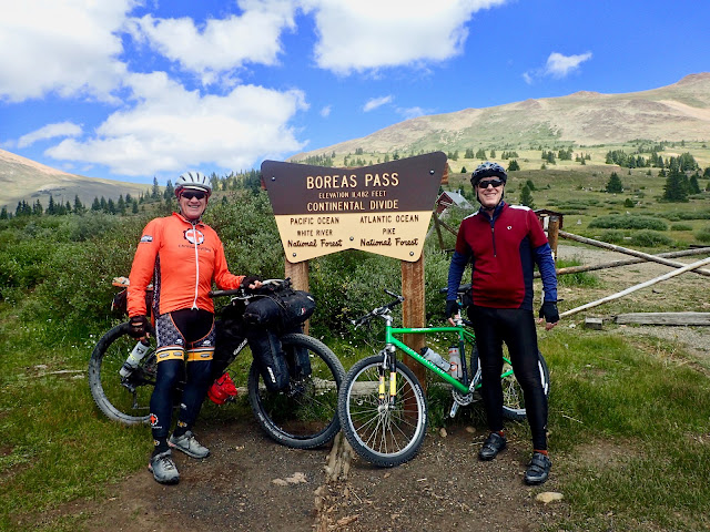
Atop 11,482 foot Boreas Pass with old cycling buddy Mark Almer.

In the fall of 1991, yes that's over 30 years ago, my friend Mark Almer chose the Colorado Trail from Kenosha Pass to Georgia Pass, and back, for my first mountain bike ride. That's 24 miles and about 4,000 feet of elevation gain on high altitude single track. With that initiation into mountain biking, I was hooked.

For more than a decade, Mark and I rode all sorts of trails and back roads on many memorable rides, commutes, events, and races. As our responsibilities with family, community, and careers expanded, we rode together less frequently, but no less enthusiastically. Mark truly is my first cycling buddy.

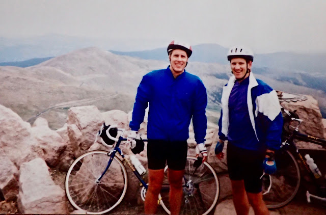
Mark and Craig atop Mt. Evans (elevation 14,271 feet) in the fall of 1992.

When Mark learns of my plans to ride the Great Divide Mountain Bike Route, he immediately wants to be a part of it. However, as a responsible adult still part of the productive workforce, Mark does not have a block of time to ride the entire route. Instead, he asks to join me for a day or two, maybe even a long weekend, as I ride across Colorado. Man, that would be great.

Mark follows my progress and massages his schedule, hoping to fit something in. Of course, his work takes a turn as I ride through northern Colorado, wiping out a potential three day weekend. However, with creative shuffling, Mark manages to open up a Thursday evening and most of a Friday to ride. His short time window fits.

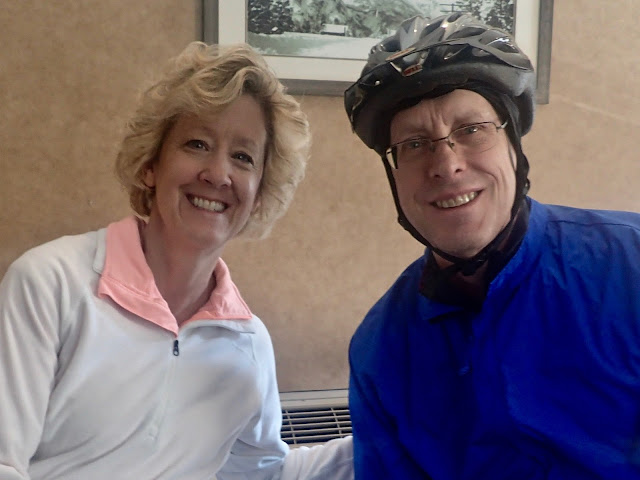
Kelly and Mark Almer, circa August 2021.

I roll into Frisco on a Thursday afternoon to meet my wife Colleen and daughter Cara, who are sightseeing Colorado together. Mark and his wife Kelly drive up from Littleton to join us for dinner. Just like that, I'm out of the Great Divide bubble and back into my world of family and friends. 

Naturally, Mark wants to know all about my Great Divide ride and, more importantly, wants to ride some. We look over maps of miles covered and miles to come. Mark says he can ride with me up Boreas Pass, and maybe beyond, after a couple of remote meetings in the morning. Cool.

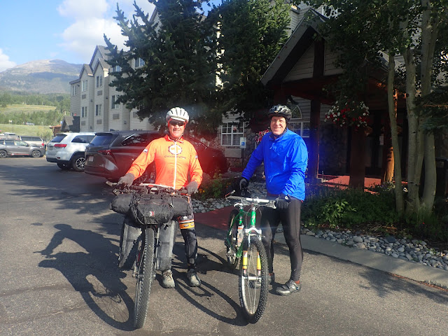
Craig and Mark ready to roll from Frisco.
My bike + gear weighs about 50 pounds more than his.

After a late night, at least for me, it's not a sacrifice to sleep in a bit in a nice hotel bed. I relax over breakfast with Colleen, and then Cara, as Mark conducts his meetings. The in-house hotel food isn't great, but the coffee is better than what I make on the trail. It's a nice change of morning routine.

Mark arrives, ready to roll. For this celebratory ride, he brings his 1997 Specialized StumpJumper Pro, a truly vintage racing hardtail mountain bike that belongs in a museum. Just seeing that bike makes me smile, as I remember many good times riding one just like it. I love that his is still rolling.

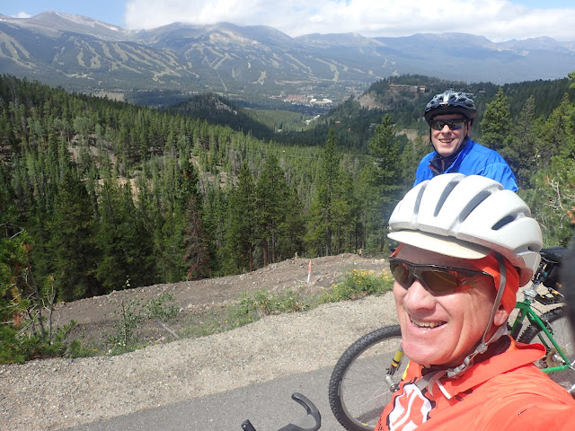
Spinning up an old railroad bed toward Boreas Pass, we look back toward Breckenridge.

With a late morning start, we ride south on a paved bike path that is full of locals and tourists walking, running, and cycling. The years melt away, and we're just out riding our bikes like always. This could be 1991, 2021, or 2051. After less than 10 miles, the sight of a coffee shop in the heart of Breckenridge stops us cold. Time for a break.

Absolutely, we stop. Today's ride is all about sharing some time together, after so many years. As great as it is to ride, it matters not whether that time is on the bike or in a coffee shop. We'll get back on the bikes in a bit.

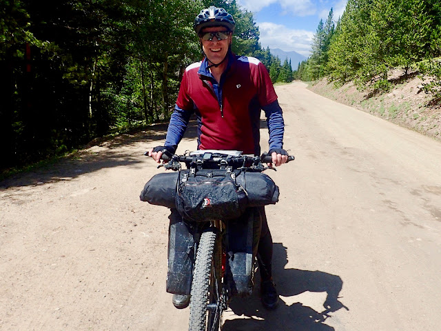
Mark checks out my loaded bike.

We eventually wind our way to Boreas Pass Road and start the gradual climb in earnest. This road carries a fair amount of vehicle and bicycle traffic, but at least we're out of town and headed for the backcountry. 

Once we finally hit gravel, I ask Mark if he'd like to try riding my loaded bike. He jumps at the chance and spins away, clicking through gears while weaving up and down the road. Mark marvels at how the Jones 29+ is so big and heavy, yet comfortable and balanced. He thinks he could ride a long way on this bike.

My time on his vintage StumpJumper initially brings a wide grin, with its crazy light weight, aggressive race geometry, and lightening quick handling. This is a thoroughbred 1990's race bike that goes all in. The front felt so narrow, so forward, and so low that I thought I must be holding onto pegs on the front hub. I don't know how I used to ride an even smaller version of this on long rides and races.

We switch back to our own bikes, but it takes more than a few inquiries from me before Mark agrees.

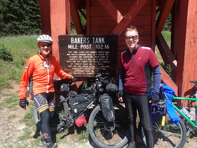
Taking a break at Baker's Tank, back on our own bikes.

The miles pass smoothly on the gentle climb. The higher elevations begin to reveal more and more of the surrounding country, triggering memories of many rides and hikes over the years. We stop frequently to take in the views.

Several times, Mark refers to the last time we rode up Boreas Pass from Breckenridge. For the life of me, I cannot remember ever riding this road. Ever. He insists, with some details I can't rebut. But I don't think so. I don't believe I've ever been here. 

One of us is having a serious senior moment.

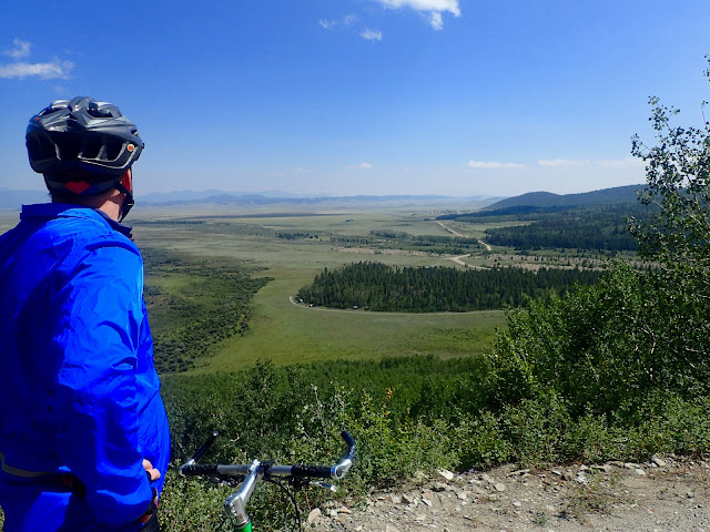
Mark surveys the descent off Boreas Pass toward Como and beyond to South Park.

Even with a late start, break at a coffee shop, pedestrian pace, and frequent stops, we summit Boreas Pass by early afternoon. Then it doesn't take long to drop down the other side of the pass to Como, where Mark meets his wife Kelly for their ride home. Just like that our ride is over.

We talk of riding again. Maybe a spin up Waterton Canyon next time I'm in Denver. Maybe even a bikepacking trip next summer in Colorado or the Black Hills of South Dakota. We'll ride again.

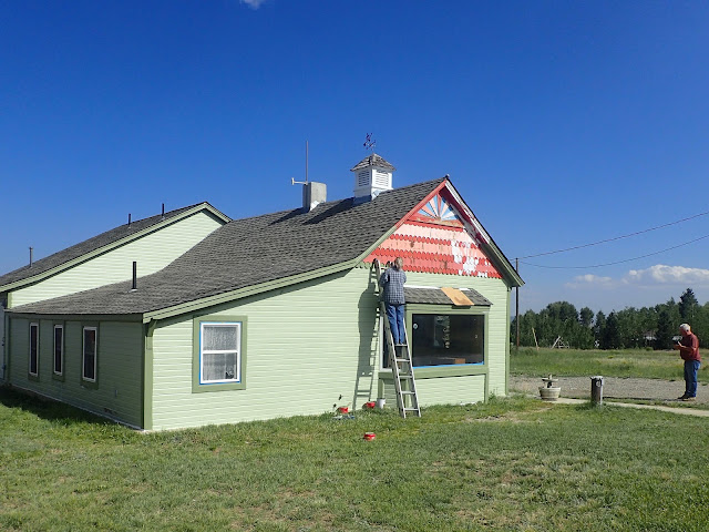
Colleen and Jeff hope to open their renovated cabin for business next year.

As Mark and Kelly drive away, I scan Como for the Community Center identified in the Adventure Cycling Association maps. Not seeing anything marked, I notice a man and a woman painting a building down the street and ask them. The man says, "Sure. You can camp by that Community Center over there and use that old outhouse. Or you can stay for free in our bunkhouse!"

Easy. Tell me about the bunkhouse. 

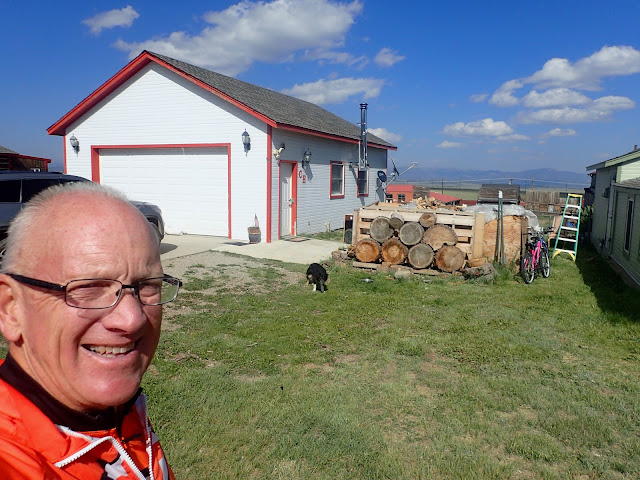
Jeff and Colleen are the couple painting the cabin. Next door is a nice garage that they repurposed into the fully furnished "Como Hospitality Bunkhouse" with bunk beds, sofas, lounge chairs, a full kitchen stocked with food and drinks, bathroom with shower, entertainment system, and more. Although fully operational, it's currently stuffed with many of the furnishings of the cabin next door that they are renovating. So, for now, they simply offer it for free to weary bikepackers.

The Bunkhouse, right next door to the cabin being renovated.
According to Jeff, the "CH" on the wall stands for "Como Hospitality."

At the start of the day, I thought I'd ride past Como another 30 miles to Hartsel, and maybe beyond. But the "Como Hospitality Bunkhouse" is just too much serendipity to pass up. So, at 3:00 pm and after just 34 miles, I call it another half day. But what a great half day.

A few hours later, the day gets even better. Rolling into Como is Great Divide rider Franz, whom I met way back in Montana at the Lost Llama Ranch on my Day 7. Not only does Franz stay at the bunkhouse, his daughter from Boulder drives out to visit him and brings pizza for dinner. Nice.

A day spent with an old friend ends with sharing some Trail Magic with a new friend. I love this journey. 


The Boys Are Back In Town, Thin Lizzy live (1976)


Tuesday, December 21, 2021

The Great Divide - Locals Brighten My Day

The sun is shining in the sky
There ain't a cloud in sight
It's stopped raining, everybody's in the play
And don't you know, it's a beautiful new day
Mr. Blue Sky, Jeff Lynne (1977)


Professional photographer Raymond Bleesz stops to chat and take a few pictures.
Oh, I mean portraits.

Wrapping up evening activities at my dispersed campsite just off a dirt road deep in the mountains of northern Colorado, I grab my journal to jot a few notes before turning in. It's another good, long day. The end of Day 29 on my ride of the Great Divide Mountain Bike Route. Time to rest.

Then a dark pickup, sporting a business decal of some sort on the door, rolls up, slows, and stops. Oh, man. I'm pretty sure I'm camped on National Forest land, but I rode past a large, active ranch not far back. Maybe this is the rancher stopping to tell me I'm on private land and have to move. I hope not.

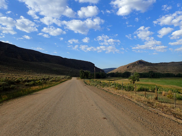
Leaving behind the bustle of town, CR 18 meanders alongside the Yampa River.

My choice of campsite is not by chance, but results from a chance encounter earlier in the day. Pedaling from the ranch/ski town of Steamboat Springs, I roll quiet miles through bucolic countryside populated with both working ranches and lavish vacation estates. Eventually turning to more primitive gravel and dirt, the route follows the Yampa River toward Stagecoach Reservoir and then up gentle Lynx Pass. What a pleasant start to the day.

Dropping off Lynx Pass onto a wide, high altitude meadow, I stop at the restored Rock Creek Stage Station. Built in 1880, this large, two story log building served as a stage stop, hotel, post office, election polling place, and the Gates family residence. It still stands as an imposing structure sitting alongside the old stage line, now a dirt road that is part of the Great Divide route.

Rock Creek Stage Station, circa 1888.

Just around the corner, I ride into Rock Creek, my first serious creek fording. Even in mid-August, the water reaches almost knee deep. I carefully cross amidst a cascade of animated chatter and laughter. A little upstream, two couples and five kids are splashing around in even deeper water. The kids barely notice me, but one of the dads, John, walks over to offer me water, soda, beer, and snacks. He says they're locals who came up here as kids and now bring their own kids for fun in this hidden swimming hole.

Eyeing my loaded bike, John asks where I'm headed. He seems not the least bit surprised to hear that I'm riding to the Mexican border, but doesn't think much of the developed campground in Radium for my destination tonight. Instead, he suggests camping at the top of a ridge right before leaving Medicine Bow-Routt National Forest. He says he camps there often for the big views of the surrounding mountains and canyons. Then, in the morning, it's only about 5 miles, mostly downhill, to Radium. Besides, he says the Radium campground is just a glorified parking lot.

Well, alrighty then. Thanks, John. I'm off to find this dreamy campsite.

Rock Creek, somewhere northwest of Radium.

It doesn't take long. In less than 10 miles, I top out a short climb, roll by a large ranch with several large construction projects, and see a big downhill just ahead. This is it.

The views are stunning in every direction. There's plant and rock cover enough to shelter a small campsite and more than enough downed trees for an impromptu table and chair. The only thing lacking is water nearby, but I filled up at Rock Creek and it's only 5 miles down to Radium in the morning. Local intel is awesome.

Seeking to pitch my tent to optimize sunset, moonlight, and sunrise views, I go here, then there, then over yonder. So many sites from which to choose. I finally pick one and take care of evening business. That's when the black pickup shows up.

This is it, just after the rain stops and the sky clears.
Pick a campsite amongst the aspen, before the road drops off.

A man steps out, but he's no rancher. It's Raymond Bleesz, a 71 year old somewhat retired professional photographer. Raymond says he's out driving around looking for inspiration, but not merely mountains, trees, or other scenery. "I like to meet interesting people and hear their stories." Looking at my loaded bike and pitched tent, he adds, "You look like you have a story to tell."

I introduce Raymond to the world of bikepacking and this little corner called the Great Divide Mountain Bike Route. Of course, all this is new to him. He starts by asking typical questions about my bike, gear, and logistics, but soon moves into a larger discussion of the journey itself. For him, I'm opening a door into an entirely different culture.

Similarly, I know little of his world. Raymond's passion is fine art photography and he is a co-founder of the Vail Valley Art Guild. He currently is working to host the annual Vail Valley Fine Art Show, a 3 month long show featuring local Colorado artists of many media, including photography. He's especially excited about presentations teaching the history of fine art photography in Colorado.

My little dispersed campsite in Medicine Bow-Routt National Forest, just off USFS 212.

Raymond asks to take some portraits of me. I hesitate, but quickly realize no harm is likely. So, I agree, as long as I can take a snap shot of him with my point-and-shoot Olympus TG-3. He laughs and asks to see my simple camera, with its cracked screen. Hearing my tales of camera abuse, including flying out of a pack at 40+ mph, he is amazed with the camera's ruggedness and durability.

We chat for an hour, or more, each eager to learn of the other's experiences and future endeavors. Two individuals from completely different worlds connecting around that little dispersed campsite off a dirt road deep in the northern Colorado mountains. It's a rare privilege.

As the sun descends, Raymond takes leave to return to pavement before dark. I retire into my tent for the night. 

Now we both have a new story to tell. 


Addendum. True to his word, Raymond sent me several portraits that he shot that evening. An 8x10 print of this black and white image hangs in my bicycle room as my primary memento of my Great Divide ride. Since then, we've kept in contact with occasional e-mails, which I hope to continue.

Raymond entitled this "Portrait of a Cyclist."
(photo by Raymond Breesz)

Second Addendum. I posted that black and white portrait on social media and received concerned comments about how I look old and tired. Well, they're right. Relative to many, I am old. And that was at the end of Day 29 of my Great Divide, after riding hard all day through intermittent rain showers, setting up camp, attending to bike and body, preparing dinner, and stowing things for the night. I was preparing to turn in when Raymond arrived.

For what it's worth, here's another portrait Raymond took at the same time. I'm still 63 years old and tired, but maybe look a little less weathered in color.

(photo by Raymond Breesz)


The overcast skies sputtering rain on and off all afternoon started to clear when John welcomes me at Rock Creek and recommends this area to camp. The blue skies broke through when Raymond stops. Both locals brighten my day, which was already pretty darn bright. I love this journey.


Mr. Blue Sky, Electric Light Orchestra (1977)

Tuesday, December 14, 2021

The Great Divide - Memorable Start To My Solo Second Half

When logic and proportion have fallen sloppy dead
And the white knight is talking backwards
And the red queen's off with her head
Remember what the dormouse said
Feed your head, feed your head.
White Rabbit, Grace Slick (1967)


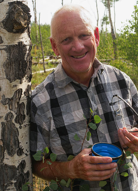
Brush Mountain Ranch, somewhat near Slater, Colorado, but with a Himalayan hippy vibe.

Relaxing in the shade within the comfortable confines of Brush Mountain Ranch, I study maps and notes for the northern Colorado section of the Great Divide Mountain Bike Route. It's only 10:00 on a bright, clear summer morning, but I call it a day, or more like a half day. This is too good to simply pass through.

Trail Angel cooler filled with water bottles along a lonely road 25 miles south of Rawlins.

I didn't really plan on such a short day today, but certainly left open the possibility. Just yesterday, I awoke in Rawlins, Wyoming considering how to approach this stretch of my ride of the Great Divide Mountain Bike Route. Cycling buddy Paul Brasby had left for home in Nebraska and I was about to start riding solo for the next 1,300 miles to Antelope Wells. My days are wide open.

I'm close to the Colorado border. The next town of any size is Steamboat Springs, which lies about 140 miles and two solid days of riding away. My wife Colleen and daughter Cara plan to be there, but not for another three days. Colleen dropped me off at the Canadian border 24 days ago and Cara just completed the Colorado bar exam. I'd love to see them.

Another tuna/ramen gourmet meal, here at my dispersed campsite near Aspen Alley.

So, I pedal south out of Rawlins early on a hot, windy summer morning, with three days to ride 140 miles to Steamboat Springs. As much as I enjoyed riding with Paul, and with others, there's a certain freedom that comes with riding alone. An empty road awaits.

The Adventure Cycling Association map shows 13 miles of pavement before turning to gravel that climbs into the mountains of Colorado. But times they are a changing. A mammoth wind farm is being built out there, resulting in pavement now stretching a full 46 miles. Fortunately, I see construction traffic only at one gravel road intersection after about 25 miles. Slowing to watch two big trucks cross, I spot a cooler with a taped note that simply says "GDMBR." Inside are dozens of bottles of water. Trail angels!

Aspen Alley in August 2021. 

Into the heat and head winds of central Wyoming, I steadily climb on shadeless pavement for many miles, with a few significantly steep pitches down into, and up out of, river bottoms. Ahead I see gravel, but immediately am reminded to be careful of what you wish for. Thick, heavily washboarded gravel punishes me for the next 10 miles. Effort increases. Speed dramatically decreases. Thankfully, the heavy vehicles capable of creating such conditions are not out on the road today.

Mid-afternoon, I fill water bottles at Little Sandstone Creek and finally climb out of the prairie into some higher elevation with trees offering occasional shade. I'm approaching the renowned Aspen Alley, where the narrow gravel road cuts straight through towering groves of old aspen trees. So old, in fact, that many of these giants are dying of age. 

Cruising through in amazement, I abruptly stop. I want to take this in, at a pace even slower than I'm pedaling. I realize that this forest will not ever look like this again, even if I did return someday. After a few moments, I decide to simply stay right here for the night.

The view out my front door in the midst of an aspen grove.

After a quiet night in the embrace of a peaceful aspen grove, I eat a hot breakfast by the pre-dawn twilight. It's my favorite time of day, watching the sky turn colors as the earth turns to greet the sun. And here I am, riding my bike through Aspen Alley on the Great Divide Mountain Bike Route. Heavenly.

Far too soon, the road turns away from the aspen and back onto pavement. I briskly roll along a ridge line, drop a bunch of elevation, cross into Colorado, and pass through the don't-blink town of Slater. It's time to start climbing gravel into the mountains of Colorado.

Climbing toward Colorado mountains along Slater Creek.

Miles flow smoothly climbing along Slater Creek on the fast gravel of Moffat County Road 1. Active beaver dams dot the creek and multiple public access corridors suggest a popular trout fishing destination. I ride in and out of sunlight along the westerly facing side of the valley, as the morning stirs. I could ride a long way on a day like this.

Then I round a corner to practically ride into Brush Mountain Ranch, an iconic stop for everyone on the Great Divide. This I must experience.

Early morning sun reaches into the valley of Slater Creek.

As I soft pedal into Brush Mountain Ranch, proprietor Kirsten Hendricksen bursts out of the lodge shouting enthusiastic greetings. After a trademarked hug, she rapid fires a quick run-down of things, invites me to everything, apologizes for leaving to run a few errands but promises to return in an hour, and dashes off. Just like that, I have Brush Mountain Ranch all to myself.

I grab some cold water and trail mix, my map and guide book, and some shade under one of the colorful tarps outside. Looking across the scrubby valley to the forested mountains, I see why this is an ideal location for a stop along the Great Divide route. It's almost 90 miles from Rawlins, but still 50 miles to Steamboat Springs. Just ahead starts a steady, exposed 10 mile climb that works away from the creek to a steep 3 mile pitch over a watershed divide. What a great spot to reload before all that.

Soon, Kirsten returns, full of energetic hospitality. She eagerly shows me around the Ranch, which offers free camping, showers, water, and more. Rooms in the lodge and cabins are available to cyclists at half the price to motorized travelers. Cold drinks, snacks, and other supplies are in the kitchen. She even makes breakfast in the morning and pizza in the afternoon/evening. She merely asks you to keep track of what you take and make an appropriate donation.

Time to stop for an early lunch at Brush Mountain Ranch.

It's all simply amazing. After about an hour of buzzing around, Kirsten finally sits still for a moment and talks about the transformation of Brush Mountain Ranch into this iconic Great Divide haven. Many years ago, her father built this as a hunting lodge, adding and improving infrastructure over time. The family still operates the Ranch as a hunting lodge during those seasons, but the force of nature that is Kirsten turns this into a bike packer's paradise over the summer.

Starting about the third week of June, Tour Divide racers start to roll in. Practically all stop for at least awhile to refuel, rehydrate, and re-energize. In the 2008 documentary "Ride The Divide," racers congregated there to wait out a spring snow storm, some staying for days. But whether racing or riding, I've read several accounts describing Brush Mountain Ranch as a vortex, drawing you in and holding you there. Kirsten just makes it such a great spot to take a break from a difficult ride.

Kirsten Hendricksen, proprietor and hostess extraordinaire at Brush Mountain Ranch.

Even though I stopped before 10:00 am after only riding about 30 miles from Aspen Alley, I decide to just stay. I'll call it a half day and be part of the Brush Mountain Ranch experience for myself and others. And I can comfortably ride the remaining 50 miles into Steamboat Springs tomorrow to meet Colleen and Cara. I eat an early lunch, shower, wash clothes, dry out gear, and talk with Colleen, thanks to Kirsten's cell phone boost device in the Lodge. I even catch up texting with a few friends. This place really is a vortex in the space/time continuum.

It's now August 14, nearing the end of the bikepacking season here and I'm the only cyclist for awhile. Early afternoon, a trio of day riders from Steamboat Springs ride in for pizza and beer, relishing the good vibes for an hour or more. A local friend of Kirsten's stops by for lunch. Late afternoon, a group of three south bound bikepackers swing in for the night. Then a solo north bounder refuels briefly, before riding on. As the sun sets, more trickle in, including solo rider Franz, who I met way back at the Lost Llama Ranch in Montana and last saw near Grand Teton National Park.

As each cyclist rolls in, Kirsten rushes out to greet them with a smile and a big hug, offering water, other refreshments, and food. No one wants for care or attention, first by Kirsten and then with everyone else gathered. A small community forms. What a cool scene.

My first two days riding solo on the Great Divide Mountain Bike Route only cover about 90 miles, but create two memorable days and nights. I can't wait to see what's ahead.


White Rabbit, Jefferson Airplane live at Woodstock (1969)

Tuesday, December 7, 2021

The Great Divide - There & Back Again

Roads go ever, ever on,
Under cloud and under star,
Yet feet that wandering have gone,
Turn at last to home afar.
The Lord Of The Rings, J.R.R. Tolkein (1949)


We're ready to leave Rapid City, SD for our ride of the Great Divide Mountain Bike Route.
(photo by Paul Brasby)

The Great Divide Mountain Bike Route presents many logistical challenges, some of which are known in advance. A significant known obstacle is simply getting to the start line at Roosville, Montana and getting from the finish line at Antelope Wells, New Mexico, neither one of which are populations centers with readily available public transportation options.

Here's how we got there and back again on the Great Divide.

Paul Brasby and his pilot Lawrence about to unload after their flight from North Platte, NE.

1. North Platte, Nebraska to Rapid City, South Dakota (Paul)

Cycling buddy Paul Brasby will start his ride of the Great Divide at the Montana border with me, ride as far as his vacation time allows, find his way home, and then return next year to continue his quest of riding the entire route. To do so, he first travels from his home in North Platte, Nebraska to mine in Rapid City, South Dakota.

Paul doesn't mess around. He enlists his pilot friend Lawrence to fly him and his loaded Salsa CutThroat. By removing the front wheel and a few packs, Paul squeezes the big bike into the cabin of a single engine Cessna and they're off to a flying start on his grand adventure. As a bonus, Lawrence's flight plan takes them directly over Badlands National Park, just east of Rapid City.

Paul flies over Badlands National Park en route to Rapid City.
(photo by Paul Brasby)

2. Rapid City, South Dakota to Roosville, Montana (Paul and Craig)

After picking up Paul from the Rapid City airport, we spend the afternoon and evening scurrying about, re-checking bikes and gear. Through the combined efforts of Lucas Haan, Christopher Grady and Two Wheeler Dealer of Spearfish, Paul snags a last minute replacement for shoes that suddenly look to fall apart. Not confident that the older shoes will hold up, but not really wanting to start such a big ride with new shoes, Paul takes both along and will decide by our start. Thanks, Lucas, Chris & Two Wheeler for scrambling for those shoes!

Early in the morning, we pile into my loaded Jeep for the 906 mile drive to Eureka, Montana, just 8 paved miles from the USA/Canadian border. We arrive 14 hours later to check into the weathered Ksanka Motel, which is more than a bit dated and rough around the edges, but clean. As a bonus, I meet George, who is walking across the country on trails and self-shuttling with two vehicles. He turns out to be just the first of many interesting people I meet on this trip.

The next morning, Colleen shuttles us the final 8 miles to the border and starts her long drive home. 

Meanwhile, Paul and I pedal south on the Great Divide.

At the USA/Canadian border, Paul starts to unload.

3. Rawlins, Wyoming to North Platte, Nebraska (Paul)

After 24 days and over 1,200 miles, we ride into Rawlins, Wyoming. Although Paul's just warming up, he's plumb out of vacation time. He suspends his Great Divide ride for now and will return next year to continue from here.

Paul's brother Matt meets us in Rawlins to start Paul's shuttle home. After fueling up on chicken fried steak and all the fixings, they drive to Fort Morgan, Colorado, where Paul visits his mother. The next day, Matt drives Paul all the way back to North Platte, Nebraska. By going many extra miles for his brother, Matt makes simple a shuttle that could have been much more complicated for Paul.

Meanwhile, I pedal solo toward Antelope Wells, New Mexico.

Paul Brasby and his brother Matt, who drives almost 600 miles to take Paul home.

4. Antelope Wells, New Mexico to Rapid City, South Dakota (Craig)

Colleen originally plans to road trip to Antelope Wells to be there for my big finish. However, a few weeks into my ride, other family issues arise that keep her in Rapid City. I decide to just leave that issue open until I close in on the border. After all, I'm focused on one day at a time and not even thinking about the  finish. And I won't need a ride from Antelope Wells until I get there.

When I emerge from Polvadera Mesa near Cuba, New Mexico on Day 43, Colleen encourages me to at least contact my brother Cyler who lives in Phoenix, Arizona. I learn that he checks my Spot Tracker regularly, knows that I'm in New Mexico, and wonders how I plan to get home. After first suggesting that I ride my bike back to Rapid City, Cyler offers to drive 400+ miles one way to pick me up at Antelope Wells and take me to Phoenix. 

There you go. When you need a ride, call your brother. 

From Phoenix, I fly commercial directly to Rapid City. I leave my bike and gear in my parent's winter home in Sun City Grand and plan to pick those up when we drive there for Christmas. But then in October, Cyler road trips to Loveland, Colorado to visit his daughter and throws my bike and gear in his car. That's an easy pickup for me, as we regularly visit family and friends in the Denver area.

Cyler checks out my bike at Antelope Wells before loading it into his minivan.

5. Antelope Wells to Anywhere

Getting home from Antelope Wells seems to be the most problematic for Great Divide cyclists. It's hard to predict when you'll get there until you get close and it's a long way from anywhere. It's also just a closed U.S. Border Station, with nothing there for anyone waiting.

Many of the southbound GDMBR cyclists I meet along the way do not know how they will get home. Like me, they reason that they have plenty of time to figure it out. Several end up using one of the shuttle services identified in the Adventure Cycling Association maps, at least to get to a larger town for a ride from family or friends, car rental, or commercial flight home.

Although the idea of riding home from Antelope Wells may sound loopy from the outside, I find it tempting while waiting for Cyler to arrive. I certainly have the bike, gear, conditioning, and experience to ride a few more remote miles. And I'm not altogether sure that I want this ride to end.


There And Back Again, The Hobbit (2012)

Tuesday, November 30, 2021

The Great Divide - Goodbye, Hello

You say yes, I say no
You say stop, and I say go, go, go
Ooh, no
You say goodbye and I say hello
Hello, Goodbye, John Lennon & Paul McCartney (1967)


Paul says goodbye to the Great Divide, at least until next year.
I say hello to my solo ride to Antelope Wells.
(photo by Matt Brasby)

Like many endurance cyclists, Paul Brasby holds a long time dream of riding the entire length of the Great Divide Mountain Bike Route. Also like many others, Paul has a full time job, a busy slate of family commitments, and a long list of community activities. He simply does not have the block of time required to ride the Great Divide in a single shot.

However, Paul recognizes that it doesn't have to be all at once or nothing. He sets out to ride the Great Divide in sections, as his time off allows. Paul initially decides to ride the northern half in 2020, but then learns of my plans to ride the Cloud Peak 500 bikepacking route in August 2020 as a big shakedown ride for riding the Great Divide in 2021. He joins me at Cloud Peak, where he rocks the entire route to become the first, and still only, official finisher of the Cloud Peak 500. See Cloud Peak 500 Wrap & Links.

The northern terminus of the Great Divide Mountain Bike Route at Roosville, Montana.
(photo by Colleen Groseth)

Atop our first pass on Day 1 in Montana.

After the Cloud Peak 500, Paul continues to prepare for his Great Divide by riding the Pony Express 120 Bikepacking Adventure (Pony Express Bikepack), the Buffalo Bill Rough Rider Bikepacking Event (Buffalo Bill Rough Rider Bikepack), and the Black Hills Bounty (Black Hills Bounty). Those rides shape his thoughts on his bike, gear, and ambitions. Also, in addition to all the typical bikepacking stuff to sort through, Paul figures out how to carry and charge a C-PAP machine and batteries for multi-day rides. see Paul's Set Up & Gear List. He's ready.

Not all miles are full of smiles.
(photo by Paul Brasby)

Sweet single track through an old forest fire area.
(photo by Paul Brasby)

Paul cobbles together enough time off to ride for 24 days and we start our Great Divide ride together at the U.S. Border Station in Roosville, Montana on July 20, 2021. For Tour Divide racer-types, 24 days may be plenty of time to ride the entire route. That may be enough time for Paul, as well, except that he wants to ride it with me. And I'm not racing it. See my 2019 post Bikepacking The GDMBR.

Instead, we plan to ride 8-10 hour days, much like our Cloud Peak 500 and Black Hills Bounty. If we actually keep our trip going for 24 days, we think we may be able to cover the 1,200 miles or so to Rawlins, Wyoming. Maybe farther. It's hard to tell sitting at home looking at maps and a computer screen.

Topping a pass brings out the smiles.
(photo by Paul Brasby)

Staring down Fleecer Ridge. It drops. It just drops.

Right from the start and throughout the entire ride, Paul is a straight-forward, problem-solving, git 'er done guy utterly devoid of pretense or drama. Just ride, man. He's a great companion on a multi-day ride filled with long, difficult, unpredictable days.

We both are determined to ride the main route created by the Adventure Cycling Association, unless roads are closed or absolutely impassable. Early on, the biggest potential problem are wildfires in Montana. Fortunately, timely evening showers knock down enough of those fires and we slip through those areas without any road closures or breathing issues. Those same showers create some soft roads on occasion, but no serious detours.

We simply work through the fires, the weather, and whatever else comes up. Go, team.

Celebrating the top of Union Pass in Wyoming, the last big climb before the Great Basin.

Enjoying the Strawberry Creek Safety Shelter in big grizzly country near Union Pass, Wyoming.

Paul also takes exceptional pictures, even though he only uses a cell phone and adamantly refuses to edit or alter the images. His father was an amateur photographer who hauled his small legion of kids, including young Paul, up and down the mountains of Colorado on countless camping and hiking excursions. For a visual treat, just take a look at his images sprinkled throughout my Great Divide and Cloud Peak blog posts and on his FaceBook page.

Paul shares on social media a collection of images nightly, or whenever we have cell coverage. He often works into the night, well after I go to sleep, selecting images and drafting daily reports. He also tags me on his posts, so that my family and friends can follow along our trip. Many noted how much they enjoyed Paul's posts and missed them when I rode on solo.

An example of Paul's cell phone picture taking wizardry.
(photo by Paul Brasby)

After 24 days on roads and trails, we roll into Rawlins, where Paul's brother Matt shuttles him home to Nebraska. He'll be back next year to pick up where he left off on the Great Divide Mountain Bike Route. 

And know that he will git 'er done.

After 700+ miles, Paul and I celebrate reaching the Montana/Idaho border.


Hello, Goodbye, The Beatles (1967)