The BackBone Grande is a 400 mile bikepacking route running south to north across the State of South Dakota along the spine of the Black Hills. It's a highlight reel showcasing the best of the Black Hills and surrounding prairie, connected by a unique mix of remote gravel and dirt roads. It's a Great Divide type of bikepacking experience right here in my backyard. See, Introducing The BackBone Grande.
At Mile 203 of the BackBone Grande, Cheyenne Crossing sits high in the Northern Black Hills, a long time mining area and now popular year round recreational area for both human and machine powered activities. Over the years, countless mining claims and all kinds of residential properties created a byzantine patchwork of private and public land. The route weaves down Forest Service roads through these lands, passing Roughlock Falls, Forest Service campgrounds, and hiking/mountain biking trailheads. Further downhill lies the college/mountain bike town of Spearfish and then the Belle Fouche National Wildlife Refuge. The Northern Black Hills are a fitting finish to the Black Hills portion of the ride.
 |
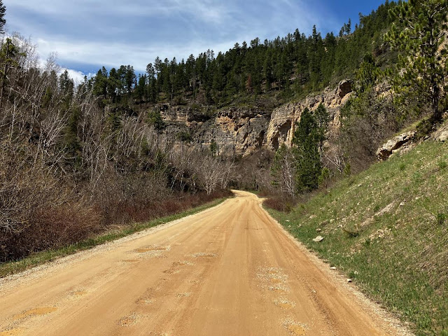
| Entering Spearfish Canyon shortly after Cheyenne Crossing. |
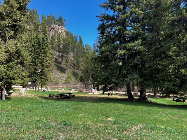
From Cheyenne Crossing, the BackBone Grande winds along Spearfish Creek down to Savoy, another ghost town survived by a cafe and resort. The route then gently climbs up Roughlock Falls Road (USFS Secondary 222) to, yes, Roughlock Falls, a popular tourist and picnicking area. That's a nice spot for a break to stretch legs a bit with a stroll to the falls. Further up the well-traveled gravel road is USFS Rod and Gun Campground and then USFS Timon Campground for those looking for a developed campground with potable water, picnic tables, and bathrooms.
Then it's on to Schoolhouse Gulch Road and Beaver Creek Road for a meandering 9 miles. It's easy to fly down these roads, but know that a hilly mile off route is Iron Creek Lake, yet another mountain resort area with some re-supply opportunities. Shortly thereafter, the route turns onto less traveled Higgins Gulch Road (USFS Secondary 214) for a long, gradual descent past Crow Peak Trailhead into Spearfish.
 |
| Scenic, though chronically pot-holed, Roughlock Falls Road (USFS 222). |
The BackBone Grande enters Spearfish from the NorthWest, traverses much of the retail parts of town, and finally exits from the SouthEast. As the largest town on this entire route, Spearfish offers grocery stores, C-stores, fast food, restaurants, bars, micro-breweries, and two full service bike shops.
To more easily access all these re-supply opportunities, the BackBone Grande takes a route directly on the town's commercial strips, intentionally riding by both bike shops: Rushmore Bikes at 3105 West Fairground Loop and Two Wheeler Dealer at 305 North Main Street. That sounds like a lot of traffic, but it's Spearfish, a town of about 12,000 people. It's just not that busy. And there are bike paths and sidewalks, if the road is too much.
(For just one comparison, the Great Divide Mountain Bike Route takes a similar, much longer NW to SE route through most of Butte, Montana, population 34,500).
 |
| USFS Timon Campground, on Roughlock Falls Road (USFS 222). |
A bit south of downtown, the City of Spearfish operates a campground along Spearfish Creek next to Spearfish City Park descriptively named The Spearfish City Campground. Notwithstanding the vanilla name, the City Campground is popular with campers of all kinds and a great spot for a Zero Day. It's also near the start of the Dakota Five-O mountain bike race, a Labor Day fixture for the mountain bikers around here.
The route continues past more retail and crosses Interstate 90. But this is still a small town. Pavement turns to gravel less a half mile past a Wal-Mart parking lot. Soon, the route turns onto Lookout Mountain Road, a Minimum Maintenance Road that is regularly deeply rutted. Hope that it's not muddy. It's time to roll some county gravel out into the country.
 |
| Lookout Mountain Road. Believe the sign. |
Now, we're bumping along some rolling hills through residential acreages and out into ranch land. At Mile 258, the BackBone Grande spins through St. Onge, a town best known for its cattle auctions and bar. Then it's out on Sale Barn Road, a short Minimum Maintenance Road that is chronically muddy.
A twisty spin through scrub oak on Crooked Oaks Road rolls past historic Snoma Finnish Cemetery and then the town of Fruitdale (no commercial establishment). A bit of pavement tops out at the Belle Fouche Reservoir, home of the Bell Fouche National Wildlife Refuge. Developed campsites are available there at the Rocky Point Recreational Area.
 |
| Unnumbered, unnamed, sometimes-two-tracks-are-visible connector to Old Baldy Road. |
That's it? No Low Standard Roads? No nameless two track? For an entire 70 mile stretch of the BackBone Grande? Well, I may have skipped one or two.
Back on about Mile 217, the BackBone Grande turns north off Schoolhouse Gulch Road (USFS 222) onto a solid Secondary Road for about a half mile. The route then turns sharply left onto a rough, unnumbered two track. Pay attention here. The two track follows an old road bed, but occasionally disappears to one track, or even no track in spots. But I've ridden it. It connects with Old Baldy Road (USFS Low Standard 633.1) in a couple of miles and then back to Schoolhouse Gulch Road near Beaver Crossing. This little shortcut spices up this section, adds a couple of cascading streams through a small canyon, and offers some primo disperse camping opportunities.
Another Low Standard Road/nameless two track combo takes off Higgins Gulch Road just after Iron Creek Lake at about Mile 222. More specifically, USFS Low Standard Road 130.1 winds for a delightful 5 miles along a high ridge through aspen groves before turning onto another unnumbered, unnamed two track connector for a couple of miles, mostly downhill back to Higgins Gulch Road. This deeper dive into the Black Hills promises to add splashes of amazing colors in the summer and autumn.
Other Low Standard/nameless two track connectors are always possible, with our virtually unlimited roads and near roads throughout the Black Hills. I regularly stumble across new finds, so always check the RideWithGPS file to ensure you have the latest update before heading out there.
Navigation never sleeps. Not if you want to ride the BackBone Grande.
 |
| Unnumbered, unnamed two track off USFS 130.1. |
Next up. Across the big, rolling Northern Prairie to the Geographic Center of the United States, a Bureau of Land Management Wetlands Area, historic stage coach stop of Harding, and the one bar/one cafe town of Buffalo. Just as the North Dakota border approaches, the BackBone Grande takes one last Low Standard Road to climb to Picnic Springs Campground, a forested, rocky oasis in the midst of the prairie. It's not over, until it's over.
For earlier, related posts, see Introducing A Bikepacking Route - The BackBone Grande; (Miles 0-46) - Buffalo Gap National Grasslands; (Miles 46-114) - Open Range Buffalo; (Miles 114-203) - Heart of the Hills. For a digital map, see BackBone Grande Digital Map.

This is a great looking route that we need to put on our list. Lovely.
ReplyDelete