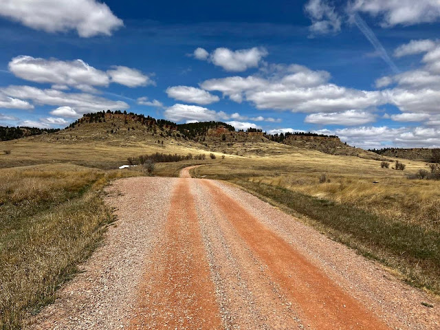
The BackBone Grande is a 400 mile bikepacking route running south to north across the State of South Dakota along the spine of the Black Hills. It's a highlight reel showcasing the best of the Black Hills and surrounding prairie, connected by a unique mix of remote gravel and dirt roads. It's a Great Divide type of bikepacking experience right here in my backyard. See, Introducing The BackBone Grande.
Now clearly out of the Black Hills, the BackBone Grande streaks into the Northern Prairie on solid county gravel. The next 128 miles roll through wide open ranch country, but it's not homogenous and it's not flat. Then, with the North Dakota border practically within sight, a fun Low Standard Road climbs to a forested oasis in the midst of millions of acres of grassland. The BackBone Grande. It's not over, until it's over.
 |
| Custer Gallatin National Forest, North Cave Unit, USFS Picnic Springs Campground. Just 12 miles to the North Dakota border, this view is right by a campsite. |
From the Belle Fouche National Wildlife Refuge at Mile 272, the BackBone Grande rolls over county roads along pastures and irrigated cropland by the town of Arpan (no services). At Mud Buttes, the route turns onto graveled Old U.S. Highway 85 into the wide open, exposed Northern Prairie streaming toward the North Dakota border.
Just 8 miles later, a small turn-off to the east reveals a truly unique piece of Americana (Mile 300). Next to a hand stacked stone marker, a handprinted sign proudly proclaims this to be the "TRUE Center of the Nation." A beaten path leads into the pasture with an American flag marking a survey medallion set in a concrete base. Although perhaps appreciated best by geography and math geeks, this is the one and only "Geographic Center of the United States." See, Geographic Center of the United States.
 |
| Local rancher marks the "True Center of the Nation" with a homespun, heartfelt marker. |
Just 9 miles later, keep an eye to the west for a simple wooden sign by a cattle gate (Mile 309). It's easy to miss, as I have done numerous times while riding and driving on this road. This marks the Battle Creek Wetlands Project, a cooperative effort between the Bureau of Land Management and Ducks Unlimited. In big ranch land, it's a rare patch of marked public land for disperse camping.
One could camp just on the other side of the gate and barbed wire fence. For a little wind break in the exposed prairie and a bit more seclusion from the occasionally traveled gravel road, ride about 3/4 mile into Battle Creek Wetlands Project to a large trailer sitting at an intersection. (That's the light, small dot on the horizon just right of center in the picture below). At that point, taking the south (left) fork in the road for another 3/4 mile reveals a good sized reservoir for possible water re-supply.
 |
| A simple sign identifies Battle Creek Wetland Project, a patch of public land in ranch country. Bureau of Land Management and Ducks Unlimited. |
Next up is Harding (Mile 332), a collection of a few homes and abandoned buildings. Back in 1884-1885, Harding was a stage coach stop on the Medora-Deadwood Stage Line. A local resident, Gayle Penn, once showed me glass bottles from that era that she found while working on her property. Gayle herself is another gem hidden in plain sight in the Northern Prairie. See, A Rancher's Kindness.
The BackBone Grande cruises out of Harding north and eventually east toward Buffalo (Mile 360), a town with a cafe, bar, a couple of C-stores, a grocery store, a motel, and a bare bones campground. Like many small towns, the days and hours that a business is open may be limited. For what it's worth, I happened to stop there in May of 2023 shortly after noon during the week and enjoyed the Daily Special (meatloaf, mashed potatoes, gravy, corn, bread) at the Blossom Cafe. It was busy with locals, always a good sign.
 |
| Dropping into the mound speckled prairie on Gilbert Road en route to Buffalo. |
Since dropping out of the Black Hills about 120 miles ago, the BackBone Grande has been crossing the vast, exposed Northern Prairie. Now, an unexpected, lumpy mass of rocks covered with pine trees juts up from the horizon north of Buffalo. It's a small, isolated piece of Custer Gallatin National Forest called the North Cave Hills Unit, only about 10 miles long, north-to-south, and less than half that wide. There's nothing like it anywhere around here.
From Buffalo, the route picks up some local gravel, but eventually follows paved U.S. Highway 85 for about 5 miles to access graveled Brown-Johnson Road. This nice, rolling county gravel road passes a few ranches and turns onto Tuft Road to enter a unique patch of national forest. You may wish to stop at the USFS welcome sign to pick up a Motor Vehicle Use Map, as this area is not well marked or well mapped.
 |
| Winding toward the North Cave Unit of Custer Gallatin National Forest. |
Now into the National Forest, Tuft Road (USFS 3120) winds up a valley supporting some trees along drainages and reveals more pine trees higher up. After about 6 miles, the route turns onto unnamed USFS Low Standard Road 3123 (Mile 381) to climb a shorter, steeper pitch to a ridge line. If you've ridden through Riley Pass and started downhill, you missed the turn onto Road 3123.
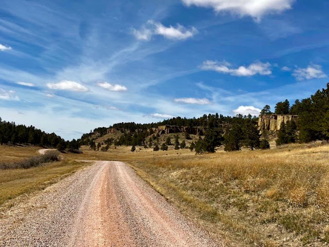
After rolling along this ridge for about 4 miles, the route runs by idyllic USFS Picnic Springs Campground (Mile 385). Take a look at that picture below. If you didn't know better, you'd think you were back in the middle of the Black Hills, over 150 miles of prairie away.
 |
| USFS Picnic Springs Campground. |
But, no. Picnic Springs Campground sits just 12 route miles from the North Dakota border. This shaded, quiet oasis offers an ideal spot to relax as you finish the BackBone Grande route. Or, as a South Bound rider, an ideal spot to launch a ride from the North Dakota border. See, e.g., Three Days Of The BackBone (2017).
This delightful, no fee, no reservation campground offers 9 camp sites, plus 2 group camp sites, vault toilets, picnic tables, and "non-potable" spring water. It's scenic, quiet, secluded, and practically at the border. I've camped there several times without seeing anyone else. However, in view of those sturdy, extra long picnic tables, I expect it may be used more often during fall hunting season.
 |
| Fuller Pass Road (USFS Secondary 3114). |
Dropping down a short pitch to Fuller Pass Road (USFS 4113), the BackBone Grande winds along a final canyon to abruptly pop back out onto the prairie. A final few miles delivers you to the North Dakota border, unmarked as such. The signs shown below state that you're entering South Dakota as well as anything.
The BackBone Grande. That's a ride.
 |
| North Dakota border looking south into South Dakota. |
For earlier, related posts, see Introducing A Bikepacking Route - The BackBone Grande; (Miles 0-46) - Buffalo Gap National Grasslands; (Miles 46-114) - Open Range Buffalo; (Miles 114-203) - Heart of the Hills; (Miles 203-272) - Northern Black Hills and Beyond. For a digital map, see BackBone Grande Digital Map.
No comments:
Post a Comment